Area Overview for SE11 4SD
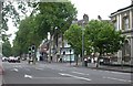
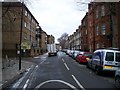
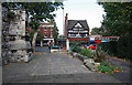
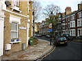
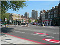
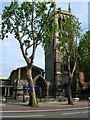
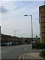
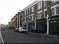
Photos of SE11 4SD


Area Information
SE11 4SD is a specific postcode area covering a small residential cluster with a total land size of 2646 square metres. The local population stands at 1554 people, creating a relatively compact community within the wider greater London landscape. This area represents a focused neighbourhood where residents live in close proximity to major city infrastructure. It is situated in a context where high population density is a defining characteristic, with the area supporting a significant number of inhabitants within its boundaries. Living in SE11 4SD means you are part of a densely populated environment that sits near key transport hubs and commercial districts. The character of this postcode is defined by its status as a distinct residential pocket rather than a sprawling suburb. You should consider how the high population concentration affects your daily life, from noise levels to access to local services. This location offers a specific slice of urban living where individual street life contributes to the overall community feel. The area presents a straightforward demographic profile without the broader variety found in larger districts. Your experience here will be shaped by the immediate surroundings and the practical reality of shared urban space.
- Area Type
- Postcode
- Area Size
- 2646 m²
- Population
- 1554
- Population Density
- 19376 people/km²
The housing stock in SE11 4SD is defined by its composition of flats rather than detached or terraced houses. With only 21% of residents owning their homes, the market here operates largely on a rental basis. This high percentage of renting means that buying properties in SE11 4SD or its immediate surroundings may be driven by investors or landlords rather than owner-occupiers. When you look at homes in this postcode, you will find a concentration of multi-unit buildings designed for density. The prevalence of flat accommodation means buyers should familiarise themselves with the specific rules and fees associated with leasehold properties. You might find fewer opportunities for ground-floor ownership compared to family-heavy estates. The market dynamics reflect a location where capital is often tied up in rental yields rather than long-term personal residency. If you are considering a purchase, understand that you are entering a segment where tenancy changes are common. This reality influences everything from local upkeep velocities to the composition of your immediate neighbours.
House Prices in SE11 4SD
Showing 8 properties
| Address | Type | Beds | Baths | Last Sale Price | Last Sale Date | |
|---|---|---|---|---|---|---|
| 8, Brutus Court, Kennington Lane, London, SE11 4SD | Maisonette | - | - | £300,000 | Oct 2022 | |
| 4, Brutus Court, Kennington Lane, London, SE11 4SD | Flat | 1 | - | - | - | |
| 6, Brutus Court, Kennington Lane, London, SE11 4SD | Maisonette | - | - | - | - | |
| 2, Brutus Court, Kennington Lane, London, SE11 4SD | Maisonette | - | - | - | - | |
| 3, Brutus Court, Kennington Lane, London, SE11 4SD | Maisonette | - | - | - | - | |
| 7, Brutus Court, Kennington Lane, London, SE11 4SD | Flat | - | - | - | - | |
| 1, Brutus Court, Kennington Lane, London, SE11 4SD | Maisonette | - | - | - | - | |
| 5, Brutus Court, Kennington Lane, London, SE11 4SD | Maisonette | - | - | - | - |
Energy Efficiency in SE11 4SD
Your daily life in SE11 4SD benefits from immediate access to a wide variety of retail, transport, and leisure facilities. You are within practical reach of five Tesco locations, including specific branches at Kennington and Lambeth, as well as a Sainsburys at Elephant and Castle. Retail options are substantial without needing to travel far for groceries or general shopping. For commuting, you have access to five metro stations nearby, including Kenddington Station, Oval, and Borough Station, which facilitates rapid citywide movement. Rail connections extend further with access to Elephant and Castle Railway Station, Vauxhall Railway Station, and London Waterloo Railway Station. Public transport diversity is high with five ferry points such as Lambeth Pier, Millbank Pier, and Vauxhall St George Wharf Pier available along the Thames. Bus options include three major coach stations like the Green Line Coach Station and London Victoria Coach Station Arrivals. You can walk to or take short trips to these amenities, making car ownership less essential. The sheer volume of transport nodes ensures you can choose the most convenient route for every journey.
Amenities
Schools
| Rank | School | Type | Entry gender | Ages |
|---|
Explore more schools in this area
Go to Schools tabDemographics
The community in SE11 4SD is dominated by adults aged between 30 and 64 years, reflecting an established population rather than a family-oriented demographic. The median age for residents is 47, which suggests a neighbourhood with many long-term residents and professionals who have settled in the area. Accommodation preferences align heavily with flat living, which suits single occupants, couples, or small households seeking convenience in an urban setting. Only 21% of residents own their homes, while the majority of people reside in rental properties. This low ownership rate indicates that the area functions primarily as a letting market where tenants change more frequently than traditional owner-occupied estates. The predominant ethnic group is White, matching the broader national average for many parts of London. You should expect a mature community where everyday interactions often involve neighbours who have known each other for many years. The absence of significant youth or elderly outliers suggests a stable social network built around working-age adults. This demographic profile creates a specific atmosphere where lifestyle choices tend towards the practical and established.
Household Size
Accommodation Type
Tenure
Ethnic Group
Religion
Household Composition
Age
Household Deprivation
NS-SEC
Explore more demographic insights in this area
Go to Demographics tabPlanning
Planning Constraints
- Flood RiskPremium
- Ramsar Wetland SitesPremium
- Area of Outstanding Natural BeautyPremium
- Protected Nature ReservePremium
- Protected WoodlandPremium