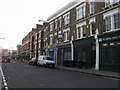
Area Overview for SE11 4RU
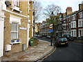
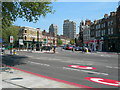
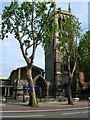
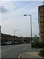
Photos of SE11 4RU


Area Information
Living in SE11 4RU means residing within a compact residential cluster defined by a specific postcode covering just 4575 square metres. This tight-knit location holds a population of 2050 residents, creating a high density of 448,089 people per square kilometre. Such density characterises a vibrant yet confined urban environment where daily life happens in close proximity to neighbours. The area functions as a micro-community embedded within the broader residential fabric of South London. You will find that this postcode represents a specific slice of urban living where space is at a premium. The small geographical footprint suggests a neighbourhood designed for footfall and immediate access rather than sprawling suburbs. Residents here experience living in SE11 4RU as a high-intensity urban lifestyle, blending the convenience of city living with the confines of a smaller district. The sheer concentration of people in this 4,575 square metre zone ensures that amenities are never far away, yet personal space remains limited. Every street corner in this area connects you to a larger network of London life. The area functions as a distinct residential pocket, offering a unique position within the transport-laden landscape of the capital.
- Area Type
- Postcode
- Area Size
- 4575 m²
- Population
- 2050
- Population Density
- 13603 people/km²
Buying or renting within SE11 4RU involves navigating a market defined by specific structural characteristics. Only 41 per cent of residents own their homes, suggesting that a majority of households live in rental properties. This imbalance indicates a dynamic market where tenancy plays a larger role than ownership in this tiny 4,575 square metre pocket. Flats remain the predominant accommodation type, consistent with the high population density of 448,089 people per square kilometre. Prospective buyers looking for freehold properties may find fewer options than those seeking to rent an existing flat. The high density and flat-heavy stock are typical features of this specific postcode cluster. You will likely encounter a housing stock designed to maximise occupancy within a small residential footprint. This market structure affects the nature of transactions, favouring those content with renting or purchasing a flat over those seeking large detached houses. Understanding the 41 per cent ownership rate helps you gauge the competitive landscape for both buying and letting within SE11 4RU. The data confirms that this area functions as a hub for rental living within this compact geographic space.
House Prices in SE11 4RU
Showing 38 properties
| Address | Type | Beds | Baths | Last Sale Price | Last Sale Date | |
|---|---|---|---|---|---|---|
| 8 George Mathers Road, London, SE11 4RU | house | - | - | £940,000 | May 2021 | |
| 7 George Mathers Road, London, SE11 4RU | house | - | - | £670,000 | May 2011 | |
| 6 George Mathers Road, London, SE11 4RU | Retail | 1 | 1 | - | - | |
| Flat 19, Limelight House, 4 George Mathers Road, London, SE11 4RU | Flat | - | - | - | - | |
| Flat 7, Limelight House, 4 George Mathers Road, London, SE11 4RU | Flat | - | - | - | - | |
| Flat 26, Limelight House, 4 George Mathers Road, London, SE11 4RU | Flat | - | - | - | - | |
| Flat 23, Limelight House, 4 George Mathers Road, London, SE11 4RU | Flat | - | - | - | - | |
| Flat 25, Limelight House, 4 George Mathers Road, London, SE11 4RU | Flat | - | - | - | - | |
| Flat 30, Limelight House, 4 George Mathers Road, London, SE11 4RU | Flat | - | - | - | - | |
| Flat 29, Limelight House, 4 George Mathers Road, London, SE11 4RU | Flat | - | - | - | - |
Energy Efficiency in SE11 4RU
Daily life in SE11 4RU benefits from a dense network of transport and retail hubs within practical reach. You are steps from Sainsburys Elephant and Castle, Tesco Kennington, and Sainsburys Elephant and Castle, ensuring ample shopping options. Rail travel is anchored by Elephant and Castle Railway Station, London Waterloo Railway Station, and Vauxhall Railway Station, offering direct links across London. Metro access includes Kennington Station, Borough Station, and Southwark Station, while ferry services like Lambeth Pier and Millbank Pier add variety. Bus routes connect you to Green Line Coach Station and Victoria Coach Station for national travel. This extensive network means you rarely need a car to navigate your surroundings. Residents can walk to key destinations or take a short journey to reach wider London. The convenience of having multiple rail and tube stations so close by enhances the livability of this small area. Dining, leisure, and office spaces are accessible through these well-connected transport links. Living in SE11 4RU offers a lifestyle defined by instant mobility and immediate access to the city centre.
Amenities
Schools
Families considering homes in SE11 4RU have access to specific educational institutions nearby. The closest primary education option is Archbishop Sumner Church of England Primary School, which holds an outstanding Ofsted rating. This classification guarantees a high standard of education for children attending this school. Shelley School also serves the area, categorised as a special school for specific educational needs. The proximity of these institutions supports families seeking schooling for their children. The presence of an outstanding-rated primary school is a significant factor for parents evaluating this postcode. While most residents are adults aged thirty to sixty-four, these schools cater to the needs of younger children in the vicinity. The mix of a standard primary school and a special school indicates a diverse approach to local education provision. You will not find comprehensive schools or high schools listed in the immediate data for this cluster, meaning higher education requires travel beyond the local zone. The robust rating of Archbishop Sumner Primary School provides a strong educational anchor for those living nearby.
| Rank | School | Type | Entry gender | Ages |
|---|
Explore more schools in this area
Go to Schools tabDemographics
The community in SE11 4RU reflects the maturity of a South London neighbourhood where half the population consists of adults aged thirty to sixty-four years. The median age stands at forty-seven, indicating that the residents here are predominantly middle-aged and older adults. This age profile shapes a stable demographic where long-term settlement is common. Home ownership accounts for 41 per cent of households, meaning a significant portion of residents rent their accommodation. Flats dominate the accommodation type, aligning with the high-density nature of the postcode. This housing preference suits the limited land area available in this 4,575 square metre zone. While White residents form the predominant ethnic group, the data highlights a community with a specific demographic focus. The combination of older residents, a mixture of owner-occupiers and tenants, and a flat-heavy stock creates a residential picture suited to established living. This demographic makeup suggests a neighbourhood where you might expect quieter evenings compared to younger, transient areas. The statistics paint a clear portrait of an area occupied by those seeking stability within a dense urban setting.
Household Size
Accommodation Type
Tenure
Ethnic Group
Religion
Household Composition
Age
Household Deprivation
NS-SEC
Explore more demographic insights in this area
Go to Demographics tabPlanning
Planning Constraints
- Flood RiskPremium
- Ramsar Wetland SitesPremium
- Area of Outstanding Natural BeautyPremium
- Protected Nature ReservePremium
- Protected WoodlandPremium