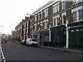
Area Overview for SE11 4NZ
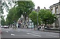
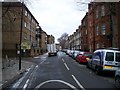
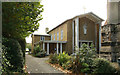
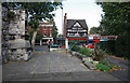
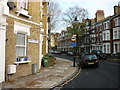
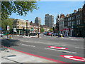
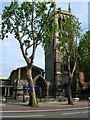
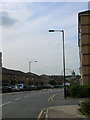
Photos of SE11 4NZ


Area Information
This small residential cluster within SE11 4NZ covers just over 2,300 square metres and supports a population of 2,050 people. The area accommodates approximately 888,000 people per square kilometre, creating an exceptionally dense urban environment typical of central south London. Living in SE11 4NZ means navigating a tightly packed neighbourhood where every square metre counts. Residents here enjoy the benefits of a high-density location while dealing with the inherent congestion of such a compact footprint. You will find this postcode serves as a microcosm of the wider Elephant and Castle district, offering immediate access to the city's infrastructural network. The area's scale suggests a focus on efficient living rather than sprawling housing. Daily life revolves around proximity to major transport hubs and commercial centres, making it suitable for those who prioritise convenience over space. The sheer volume of residents per square metre indicates that streets and local facilities experience significant footfall throughout the day. You should expect a lively atmosphere driven by the close quarters of the housing stock. This environment suits professionals and families who value being steps away from London's core amenities. The location positions you centrally between key rail termini and main shopping districts, ensuring short commutes and easy access to services.
- Area Type
- Postcode
- Area Size
- 2306 m²
- Population
- 2050
- Population Density
- 13603 people/km²
You will find that the housing stock in SE11 4NZ is dominated by flats, catering to the high-density nature of this 2,306 square metre cluster. With only 41 per cent of residents owning their homes, the area operates heavily within the private rental market. This high proportion of tenancy suggests a desirable location where demand consistently outstrips supply. Flats here often represent compact, efficient living spaces designed maximise occupancy within limited square footage. Homes in SE11 4NZ are typically accessed via shared stairwells or lift shafts, common in London's dense urban fabric. You are unlikely to find detached or semi-detached properties in this specific postcode. Instead, expect vertical living arrangements with internal residents of 2,050 people sharing nearby resources. The prevalence of rental properties frequently attracts commuters and young professionals seeking central living without the burden of long-term ownership. This market dynamic can create a transient but vibrant local culture. Buyers looking at this area should prioritise leasehold flats over freehold houses, as the latter are virtually absent from this specific location. The high population density naturally drives property values and rental yields, making investment attractive despite the smaller unit sizes.
House Prices in SE11 4NZ
Showing 9 properties
| Address | Type | Beds | Baths | Last Sale Price | Last Sale Date | |
|---|---|---|---|---|---|---|
| 1 Gilbert Road, London, SE11 4NZ | house | - | - | £1,075,000 | Feb 2022 | |
| 13 Gilbert Road, London, SE11 4NZ | house | - | - | £1,035,000 | Dec 2020 | |
| 5 Gilbert Road, London, SE11 4NZ | house | - | - | £965,000 | Dec 2017 | |
| 15 Gilbert Road, London, SE11 4NZ | house | 3 | - | £850,000 | Jan 2014 | |
| 7 Gilbert Road, London, SE11 4NZ | house | 3 | - | £600,000 | Apr 2011 | |
| 17 Gilbert Road, London, SE11 4NZ | Terraced | - | - | £493,000 | May 2006 | |
| 11 Gilbert Road, London, SE11 4NZ | Terraced | - | - | £175,000 | Jan 1997 | |
| 19 Gilbert Road, London, SE11 4NZ | Terraced | 3 | 1 | £184,000 | Jan 1997 | |
| 3 Gilbert Road, London, SE11 4NZ | Terraced | - | - | £174,000 | Dec 1996 |
Energy Efficiency in SE11 4NZ
Your daily life in SE11 4NZ centres on immediate access to extensive retail and leisure networks. Essential shopping is available at Tesco Lambeth and Tesco Kennington, with Sainsburys Elephant & Castle within practical reach. Five major retail outlets ensure you can stock your home without leaving the district. You also have five metro stations on your doorstep, including Kennington and Southwark Station, simplifying your commute. Rail travel is equally convenient with Elephant & Castle, London Waterloo, and Vauxhall stations all nearby. This transport density supports a lifestyle that rarely requires a car. For leisure, five ferry terminals at Lameth and Vauxhall piers allow easy river access. Local transport hubs include Green Line and Victoria Coach Stations, linking you to national destinations. You live within walking distance of five bus services and three major coach stations. This amenity-rich environment means housing costs absorb less of your budget due to lower transport expenses. The concentration of shops and stations creates a self-sufficient urban heartbeat. Residents enjoy the convenience of having supermarkets, transit hubs, and ferry links all clustered in a small geographic area.
Amenities
Schools
Families living in SE11 4NZ benefit from access to two key educational institutions within their immediate vicinity. Archbishop Sumner Church of England Primary School serves young children with an outstanding Ofsted rating, providing a premium foundation for early education. This primary school offers a curriculum environment that has met the highest national standards. For special educational needs, Shelley School is located nearby, providing specialist support for children requiring additional assistance. You will find a mix of mainstream and special education options close to your home. The presence of an outstanding-rated primary school adds significant value to properties in this postcode. This educational provision supports the local demographic of adults aged 30 to 64 years, many of whom are parents actively seeking reliable schooling for their children. The availability of a special school indicates that the area can accommodate diverse learning needs within the community. Local parents will appreciate the quality of Archbishop Sumner and have alternatives available through Shelley School if required. Both institutions represent important community anchors for households in this small residential cluster.
| Rank | School | Type | Entry gender | Ages |
|---|
Explore more schools in this area
Go to Schools tabDemographics
The community living in SE11 4NZ consists of 2,050 residents with a median age of 47 years. Most commonly, the population comprises adults aged between 30 and 64 years, indicating a mature demographic profile. This age distribution suggests the area attracts families with older children, downwards mobility professionals, or established single individuals. Home ownership stands at 41 per cent, meaning the majority of households in SE11 4NZ are in the private rental sector. The predominant accommodation type here consists of flats, which aligns with the high population density of 888,932 people per square kilometre. White residents form the predominant ethnic group within this small postcodes, reflecting the broader demographic trends of Southwark and Lambeth. You will find that the housing stock is designed for shared building environments rather than standalone houses. The lower rate of home ownership implies that many residents may be tenants looking for stability in a dynamic London market. This demographic mix often fosters a community based on lifestyle compatibility rather than generational lineage. Services here cater effectively to an adult population, from healthcare access to leisure facilities. The concentration of adults in productive age brackets supports local businesses reliant on consistent customer traffic.
Household Size
Accommodation Type
Tenure
Ethnic Group
Religion
Household Composition
Age
Household Deprivation
NS-SEC
Explore more demographic insights in this area
Go to Demographics tabPlanning
Planning Constraints
- Flood RiskPremium
- Ramsar Wetland SitesPremium
- Area of Outstanding Natural BeautyPremium
- Protected Nature ReservePremium
- Protected WoodlandPremium