Area Overview for SE11 4LD
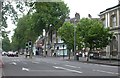
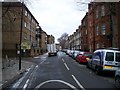
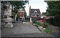
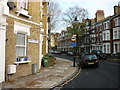
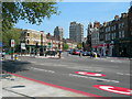
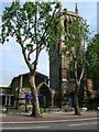
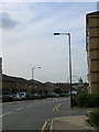
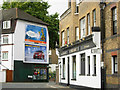
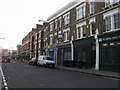
Photos of SE11 4LD


Area Information
Living in SE11 4LD means residing in a compact residential cluster measuring 1.2 hectares. This specific postcode area forms a tightly knit neighbourhood where 1,432 people call it home. The population density reaches 120,710 people per square kilometre, creating an intense urban environment typical of central south London. Residents experience a very close proximity to neighbours due to the small geographical footprint. Daily life centres around high accessibility rather than spacious gardens or quiet country lanes. The area functions as a hub for those who prioritise quick commutes over local seclusion. You will find yourself steps away from major transport links that connect you to the wider city. The context of this location is defined by its density and immediate connectivity to key London districts. Prospective buyers should view this space as an efficient base for urban living rather than a retreat from the city buzz. The sheer number of residents packed into such a small area dictates the pace of daily routines.
- Area Type
- Postcode
- Area Size
- 1.2 hectares
- Population
- 1432
- Population Density
- 12356 people/km²
House Prices in SE11 4LD
Showing 49 properties
| Address | Type | Beds | Baths | Last Sale Price | Last Sale Date | |
|---|---|---|---|---|---|---|
| 328 Kennington Road, London, SE11 4LD | Terraced | - | - | £523,000 | Dec 2006 | |
| 326A Kennington Road, London, SE11 4LD | Flat | 3 | 2 | £280,000 | Dec 2003 | |
| 352 Kennington Road, London, SE11 4LD | Terraced | - | - | £1,000,000 | Sep 2002 | |
| 320 Kennington Road, London, SE11 4LD | Terraced | - | - | £435,000 | Jun 2002 | |
| 324 Kennington Road, London, SE11 4LD | Terraced | 5 | 3 | £250,000 | May 1999 | |
| Etna House, 350 Kennington Road, London, SE11 4LD | Land | - | - | £300,000 | Jul 1995 | |
| Flat, 356 Kennington Road, London, SE11 4LD | Flat | 3 | 1 | - | - | |
| Lower Ground Floor Flat, 346-348 Kennington Road, London, SE11 4LD | Flat | 3 | 2 | - | - | |
| 324A Kennington Road, London, SE11 4LD | Terraced | 5 | 3 | - | - | |
| 326 Kennington Road, London, SE11 4LD | Flat | 6 | 2 | - | - |
Energy Efficiency in SE11 4LD
Amenities
Schools
| Rank | School | Type | Entry gender | Ages |
|---|
Explore more schools in this area
Go to Schools tabDemographics
The community within SE11 4LD leans heavily towards established households. The median age stands at 47 years, indicating that residents are generally mature individuals rather than young families or students. Adults aged between 30 and 64 years represent the most common age range in the population. Home ownership remains low at just 19%, signaling that the majority of residents likely rely on rented accommodation. This high rental rate contrasts with the typical expectation of family-oriented suburbs in London. Accommodation types are predominantly flats, aligning with the limited space available within the small hectare footprint. The predominant ethnic group is White, reflecting the broader demographic profile of this specific postcode. Deprivation metrics are not provided for this area, but the housing stock suggests a market focused on rental investment rather than long-term owner-occupation. You should prepare to live in a dense, rental-heavy environment where families move frequently. The age profile means you are buying into a stable population of older professionals and retirees who value location stability.
Household Size
Accommodation Type
Tenure
Ethnic Group
Religion
Household Composition
Age
Household Deprivation
NS-SEC
Explore more demographic insights in this area
Go to Demographics tabPlanning
Planning Constraints
- Flood RiskPremium
- Ramsar Wetland SitesPremium
- Area of Outstanding Natural BeautyPremium
- Protected Nature ReservePremium
- Protected WoodlandPremium