Area Overview for SE11 4EL
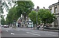
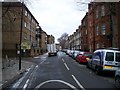
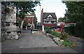
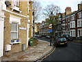
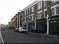
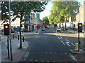
Photos of SE11 4EL


Area Information
Living in SE11 4EL means residing within a very compact residential cluster measuring just 947 square metres. This specific postcode serves a small population of 2,135 people, creating an intimate but densely populated environment. The area is entirely dedicated to flat accommodation, which defines the physical character of this neighbourhood. With an extreme population density, daily life here involves close proximity to neighbours and immediate access to surrounding London infrastructure. You will find yourself in a space where every square metre is optimised for housing, reflecting its role as a dedicated residential hub rather than a mixed-use business district. The location benefits from strong links to major transport nodes, including Kennington Station and several railway hubs. This connectivity allows residents to move quickly across the capital despite the restricted local footprint. The distinct lack of green space protections like AONB designation or protected woodlands indicates an urban setting focused on built environment rather than expansive nature. For those considering homes in SE11 4EL, the defining feature is the sheer concentration of people within a tiny geographical area. This setup suits individuals who prioritise walkability and transport links over private gardens or extensive local parks. The area functions as a tight-knit cluster where the boundaries with adjacent zones are thin, making it a quintessential piece of the wider South London mosaic.
- Area Type
- Postcode
- Area Size
- 947 m²
- Population
- 2135
- Population Density
- 17941 people/km²
The property market in SE11 4EL is heavily skewed towards flat living, as this is the only listed accommodation type for the postcode. With home ownership at 35%, the area operates as a mixed economy of owner-occupied flats and rented units. This division means you will encounter both prospective buyers looking to purchase their first home in a flat and investors managing rental properties. The total area of just 947 square metres implies a limited stock available for sale, necessitating quick decision-making when viewing a home nearby. Given that the entire area consists of flats, buyers should anticipate buildings that prioritise vertical space over ground footprint. This definition of the housing stock makes SE11 4EL an ideal location for those who value low-maintenance living over traditional houses with gardens. The low ownership rate suggests a competitive rental sector, which often correlates with high demand from young professionals or students seeking convenience. As a specific postcode cluster, the scarcity of properties means that viewing availability fluctuates rapidly. Potential residents seeking homes in SE11 4EL must act decisively, as the small supply limits the time available to compare options. The market here rewards flexibility and speed, particularly given the high density of 2,255,250 people per square kilometre which drives up competition for limited units.
House Prices in SE11 4EL
Showing 18 properties
| Address | Type | Beds | Baths | Last Sale Price | Last Sale Date | |
|---|---|---|---|---|---|---|
| 9, Helston House, Kennings Way, London, SE11 4EL | Flat | - | - | - | - | |
| 12, Helston House, Kennings Way, London, SE11 4EL | Flat | - | - | - | - | |
| 1, Helston House, Kennings Way, London, SE11 4EL | Flat | - | - | - | - | |
| 18, Helston House, Kennings Way, London, SE11 4EL | Flat | - | - | - | - | |
| 10, Helston House, Kennings Way, London, SE11 4EL | Flat | - | - | - | - | |
| 16, Helston House, Kennings Way, London, SE11 4EL | Flat | - | - | - | - | |
| 15, Helston House, Kennings Way, London, SE11 4EL | Flat | - | - | - | - | |
| 13, Helston House, Kennings Way, London, SE11 4EL | Flat | - | - | - | - | |
| 8, Helston House, Kennings Way, London, SE11 4EL | Flat | - | - | - | - | |
| 11, Helston House, Kennings Way, London, SE11 4EL | Flat | - | - | - | - |
Energy Efficiency in SE11 4EL
Living in SE11 4EL places you moments away from a wealth of amenities, all within practical reach. Retail options include five nearby supermarkets, notably Tesco Lambeth, Tesco Kennington, and two other Tesco locations, ensuring daily shopping needs are met without leaving the local vicinity. Dining and leisure possibilities extend further, yet the immediate shelter provides a convenient self-sufficient hub. You can easily access five metro stations and five railway stations, including London Waterloo, which anchors your weekend trips or daily commutes. Transport hubs like Victoria Coach Station and London Victoria Coach Station Arrivals are just a short distance away, offering nationwide connections. If water travel suits your schedule, five ferry piers are available, ranging from Lambeth Pier to Vauxhall St George Wharf Pier. These connections transform the area into a bowl of convenience where life happens on your doorstep. The proximity to these facilities means you spend less time commuting and more time enjoying local life. Whether you need fresh groceries from a nearby Tesco or a train ticket from Vauxhall Railway Station, the logistics of daily life remain simple. The dense network of transport and retail points converts the small area size into a logistical advantage, ensuring nothing essential is ever far away.
Amenities
Schools
| Rank | School | Type | Entry gender | Ages |
|---|
Explore more schools in this area
Go to Schools tabDemographics
The community in SE11 4EL is dominated by adults between the ages of 30 and 64 years, with a median age of 47. This age profile suggests the area attracts professionals and families who have moved beyond their twenties and are establishing long-term roots. Ownership of a property stands at 35%, meaning the majority of households operate as renters within a landscape defined primarily by flats. This high concentration of rental units aligns with the predominant ethnic group being White, reflecting a diverse yet largely established demographic mix. You will not find significant data on deprivation in the provided records, so avoid assumptions about local economic hardship. Instead, focus on the clear picture of an adult-centric zone where stability is common. The presence of multiple households in a small 947-square-metre space indicates a high demand for efficient living arrangements. With home ownership sitting at exactly 35%, buyers must consider whether they intend to purchase an existing flat or invest in the rental market. The age range ensures that schools near SE11 4EL remain relevant for the majority of families, while older residents enjoy amenities designed for later life. This demographic structure creates a stable environment where the needs of working-age adults and retirees overlap significantly, shaping local demand for services and public transport.
Household Size
Accommodation Type
Tenure
Ethnic Group
Religion
Household Composition
Age
Household Deprivation
NS-SEC
Explore more demographic insights in this area
Go to Demographics tabPlanning
Planning Constraints
- Flood RiskPremium
- Ramsar Wetland SitesPremium
- Area of Outstanding Natural BeautyPremium
- Protected Nature ReservePremium
- Protected WoodlandPremium