Area Overview for SE11 4AS
Photos of SE11 4AS


Area Information
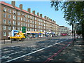
Living in SE11 4AS means residing within a compact residential cluster covering just 5.4 hectares. This specific postcode area accommodates a population of 1,701 people, creating a dense environment with a high density of 31,679 people per square kilometre. You are likely to encounter neighbours on every side, as this small footprint concentrates housing across South London. The location sits in close proximity to significant landmarks, yet the area maintains its identity as a distinct residential zone. Daily life here involves navigating a high-density setting where the boundaries between your home and the wider neighbourhood are thin. The sheer concentration of residents within such a limited space defines the character of SE11 4AS, setting it apart from broader borough districts. For someone seeking a very specific pocket of South London, this area offers a focused environment where every plot counts. The proximity to major transport hubs allows for quick transitions between this tight-knit cluster and the wider city without leaving the borough limits. Understanding the physical dimensions of SE11 4AS is key to appreciating the intensity of local interaction and the efficiency of local services delivery.
- Area Type
- Postcode
- Area Size
- 5.4 hectares
- Population
- 1701
- Population Density
- 5590 people/km²
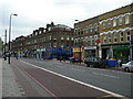
The housing stock in SE11 4AS is defined by a high density of flats, which dominates the local property market. With home ownership at just 22 per cent, this area leans heavily towards a rental market rather than an owner-occupied community. You will find few large terraced or semi-detached houses; instead, the architecture consists primarily of apartment blocks suited to the high population density of 31,679 people per square kilometre. This configuration means that private gardens are rare, and outside spaces are controlled. The prevalence of flats influences both the value proposition and the maintenance responsibilities for residents. If you are looking to buy a home in SE11 4AS, you must adapt your expectations to a flat-based inventory. The low ownership rate signals strong demand for long-term leases or buy-to-let investments, but it creates barriers for families seeking mortgages for freehold properties. Security, sound insulation, and communal agreements become more critical factors than land size or driveway access. The urban layout of this post code forces a reliance on indoor facilities and precise planning for any renovations. Your choice of home here prioritises efficient use of vertical space over horizontal expansion.
House Prices in SE11 4AS
Showing 35 properties
| Address | Type | Beds | Baths | Last Sale Price | Last Sale Date | |
|---|---|---|---|---|---|---|
| 15 KENNINGTON PARK PLACE, London, SE11 4AS | Flat | 2 | - | £623,000 | Mar 2017 | |
| 11 Kennington Park Place, London, SE11 4AS | Semi-detached | 2 | 1 | £1,575,000 | Aug 2013 | |
| 12 Kennington Park Place, London, SE11 4AS | house | 4 | - | £1,375,000 | May 2013 | |
| Flat B, 1 Kennington Park Place, London, SE11 4AS | Flat | 1 | 1 | - | - | |
| Flat 2, 14 Kennington Park Place, London, SE11 4AS | Flat | 2 | 1 | - | - | |
| Flat C, 1 Kennington Park Place, London, SE11 4AS | Flat | 2 | 2 | - | - | |
| Flat A, 1 Kennington Park Place, London, SE11 4AS | Flat | 4 | 1 | - | - | |
| Flat 4, 14 Kennington Park Place, London, SE11 4AS | Flat | 2 | - | - | - | |
| Kennington Park Lodge, Kennington Park, Kennington Park Road, London, SE11 4AS | Flat | 3 | 1 | - | - | |
| Ground Floor Flat, 13 Kennington Park Place, London, SE11 4AS | Flat | - | - | - | - |
Energy Efficiency in SE11 4AS
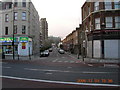
Residents of SE11 4AS benefit from an extensive network of amenities located just beyond the postcode boundary. Shopping needs are met at Tesco Kennington and Tesco Lambeth, ensuring daily grocery runs are convenient. Five rail stations within reach include Vauxhall Railway Station, which links to several national lines, and Loughborough Junction Station for local travel. Transport diversity extends to the waterfront with Vauxhall St George Wharf Pier and Millbank Pier, connecting to attractions in central London. The Green Line Coach Station and Victoria Coach Station provide links across the UK, though they are slightly further away. Five metro stations, including Three Elms Underground Station, offer frequent tube access. Dining and leisure options cluster around these transport hubs rather than deep within the 5.4 hectares of the postcode itself. This arrangement means your lifestyle relies on walking a short distance to access a broader commercial centre. You will find that daily leisure, work, and shopping activities are clustered efficiently around the transport nodes. The presence of multiple Tesco stores indicates a supply-rich environment for household essentials. For a homebuyer seeking convenience, the proximity to Kennington and Nine Elms ensures that a quiet postcode does not mean isolation from the city's pulse.
Amenities
Schools
Families residing or looking at homes in SE11 4AS will find several educational institutions within easy reach. Kennington Park Bridge To School operates as an alternative provision for students requiring specialised support. The Lighthouse Group (TLG) Centre offers independent education for those seeking alternative curricula. Kennington Park Academy serves the mainstream educational needs of the local population as a comprehensive school. Additionally, Evolve Academy provides further education and vocational training options for older students. This mix means that if you are a parent in SE11 4AS, you have access to conventional academies alongside specialist establishments for specific learning needs. The presence of The Lighthouse Group (TLG) Centre indicates a provision for independent schooling, which often attracts families with specific educational preferences. For prospective homebuyers, the diversity of nearby schools offers flexibility, though capacity remains strictly limited by the small size of the postcode area. All four institutions are located close enough to be practical choices for residents of SE11 4AS. Understanding the specific type of each school helps you match your child's needs with the available provision. No data is available on current Ofsted ratings for these specific locations, so independent research remains part of the due diligence process for any family.
| Rank | School | Type | Entry gender | Ages |
|---|
Explore more schools in this area
Go to Schools tabDemographics
The community in SE11 4AS reflects a mature demographic profile with a median age of 47 years. Most residents fall into the adult bracket spanning 30 to 64 years, suggesting a population dominated by established households rather than young families or retirement-only zones. Home ownership stands at 22 per cent, indicating that the majority of residents are renting properties within this postcode cluster. This high rental penetration shapes the social dynamics and investment outlook for anyone considering moving to SE11 4AS. Your potential neighbours are predominantly white, according to ethnic group data, which influences the cultural makeup of the estate. The overwhelming accommodation type is flats, a consideration that affects noise levels, communal spaces, and long-term property modification options. The median age of 47 combined with the prevalence of flats points to a market serving professionals, couples, or empty-nesters who prioritise location over detached living. As a renter-focused community with an older population, SE11 4AS offers stability but limited ownership pathways for first-time buyers. You should expect a neighbourly atmosphere typical of high-density urban blocks where shared walls define daily routine.
Household Size
Accommodation Type
Tenure
Ethnic Group
Religion
Household Composition
Age
Household Deprivation
NS-SEC
Explore more demographic insights in this area
Go to Demographics tabPlanning
Planning Constraints
- Flood RiskPremium
- Ramsar Wetland SitesPremium
- Area of Outstanding Natural BeautyPremium
- Protected Nature ReservePremium
- Protected WoodlandPremium