Area Overview for SE10 9XR
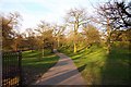
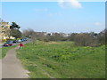
Photos of SE10 9XR


Area Information
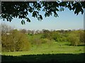
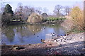
Living in SE10 9XR means residing within a specific residential cluster in southeast London. The area covers a total land mass of 9,434 square metres and supports a population of 2,076 people. This high density results in 220,055 people per square kilometre, indicating a tightly packed urban environment rather than a sprawling suburb. You will find that daily life here is defined by proximity. Every resident needs to navigate an area where homes sit close together, creating a neighbourhood that functions as a contained community. The location offers immediate access to key transport hubs, including Maze Hill Railway Station, Westcombe Park, and Greenwich Station, which lie just beyond the immediate cluster. For shoppers, Tesco Greenwich, Co-op Greenwich, and M&S Trafalgar Greenwich BP are all within practical reach, ensuring you can run errands without significant travel time. The presence of multiple piers, such as Greenwich Pier and Cutty Sark for Maritime Greenwich, suggests that river access and scenic views are integral to the local character. You are also positioned near London City Airport, adding a layer of global connectivity to your commute options. This postcode is not a vast district but a focused living space where convenience and density define the experience of home ownership.
- Area Type
- Postcode
- Area Size
- 9434 m²
- Population
- 2076
- Population Density
- 13325 people/km²
Homes in SE10 9XR are primarily houses, which distinguishes this postcode from areas dominated by purpose-built flats. However, the low home ownership rate of 39% indicates that the market operates as much on a rental basis as it does on ownership. Prospective buyers should understand that while you might find a house to purchase, competition will be fierce given the small physical size of the area, which spans just 9,434 square metres. The high population density of 220,055 people per square kilometre means that demand outstrips supply, often driving prices upward for available stock. You are looking at a market where every property represents a significant portion of the local housing stock. The mix of house styles is consistent with the broader area description, but the scarcity of space limits development potential. When searching for homes here, expect to find properties that serve a mature demographic, as the median age sits at forty-seven. The 39% ownership stat means you may need to consider both purchase and rental listings, and negotiation will be key given the constrained availability of land for new builds.
House Prices in SE10 9XR
Showing 39 properties
| Address | Type | Beds | Baths | Last Sale Price | Last Sale Date | |
|---|---|---|---|---|---|---|
| 8 Lemmon Road, Greenwich, SE10 9XR | Terraced | 3 | 1 | £585,000 | Aug 2023 | |
| 9 Lemmon Road, Greenwich, SE10 9XR | Terraced | 2 | 1 | £585,000 | Jul 2023 | |
| 19 Lemmon Road, Greenwich, SE10 9XR | house | - | - | £610,000 | Nov 2021 | |
| 11 Lemmon Road, Greenwich, SE10 9XR | house | 2 | - | £510,000 | Jul 2016 | |
| 31 Lemmon Road, Greenwich, SE10 9XR | Terraced | 4 | 2 | £590,000 | Jul 2016 | |
| 22 Lemmon Road, Greenwich, SE10 9XR | house | - | - | £365,000 | Apr 2014 | |
| 32 Lemmon Road, Greenwich, SE10 9XR | house | - | - | £267,000 | Oct 2006 | |
| 29 Lemmon Road, Greenwich, SE10 9XR | house | 4 | - | £135,000 | Aug 1999 | |
| 28 Lemmon Road, Greenwich, SE10 9XR | Semi-detached | - | - | £73,000 | Jul 1997 | |
| Flat 1, Purser Court, 1A Lemmon Road, Greenwich, SE10 9XR | Flat | - | - | - | - |
Energy Efficiency in SE10 9XR
Living in SE10 9XR offers immediate access to a wide array of amenities that cater to daily needs and leisure. You are surrounded by five notable retail outlets, including Tesco Greenwich, Co-op Greenwich, and M&S Trafalgar Greenwich BP, ensuring that groceries and household essentials are never far away. Transport connectivity is a key feature of your weekly routine, with five railway stations, five ferry points, and five metro stations all within practical reach. Greenwich Pier and Cutty Sark DLR Station stand out as major landmarks you can utilise for both commuting and tourism. The presence of five nearby airports, including London City Airport, highlights the area's strategic location for both business and travel. Residents can enjoy cultural and historical sites through access to Island Gardens and the Cutty Sark for Maritime Greenwich. Five local ferry terminals provide regular crossings, linking you to the wider network of south-east London. The combination of these facilities means your daily life revolves around convenience, with shops, parks, and transport hubs available without the need for extensive planning.
Amenities
Schools
Maze Hill School stands as the only institution listed within the immediate vicinity of SE10 9XR. This facility is designated as a special school, which provides education specifically tailored to students with additional needs. Because no other schools are recorded in the direct neighbourhood, families in this postcode must look beyond the immediate limits to find comprehensive education options. The presence of a special school indicates that the area is sensitive to the specific educational requirements of certain residents, rather than offering a broad range of primary, secondary, or academic institutions. You should account for travel time when planning for children, as the nearest general education facilities will likely lie outside the 9,434-square-metre boundary of this specific cluster. The reliance on a single named institution suggests that the daily life of families involves careful planning regarding transport to wider educational networks. While you cannot access a typical local academy or comprehensive school nearby, the school does serve the community's specific needs effectively within the immediate area.
| Rank | School | Type | Entry gender | Ages |
|---|
Explore more schools in this area
Go to Schools tabDemographics
The community in SE10 9XR is dominated by adults, with the most common age range falling between 30 and 64 years. The median age for residents is forty-seven, which points toward a mature demographic likely seeking stability rather than raising young children in this specific micro-locale. Only 39% of households in this area own their homes, suggesting a significant portion of the population rents or lives in shared accommodation. Houses remain the predominant form of accommodation, indicating that despite the high density, the built environment consists primarily of standalone properties rather than flats or terraced houses. The area is predominantly white, reflecting a homogenous community profile. With a population of 2,076 people living across such a small footprint, the social fabric is tightly woven. You will encounter a neighbourhood where the average resident is middle-aged, and property ownership is less common than in some other parts of London. The high population density of over 220,000 people per square kilometre creates a lively atmosphere where noise and activity levels are naturally higher than in rural settings.
Household Size
Accommodation Type
Tenure
Ethnic Group
Religion
Household Composition
Age
Household Deprivation
NS-SEC
Explore more demographic insights in this area
Go to Demographics tabPlanning
Planning Constraints
- Flood RiskPremium
- Ramsar Wetland SitesPremium
- Area of Outstanding Natural BeautyPremium
- Protected Nature ReservePremium
- Protected WoodlandPremium