Area Overview for SE10 9UP
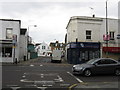
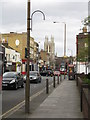
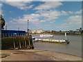
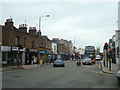
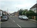
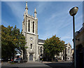
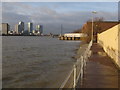
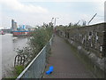
Photos of SE10 9UP

Area Information
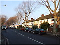
Living in SE10 9UP places you within a specific postcode area covering a small residential cluster just south of the Greenwich Peninsula. This neighbourhood spans 658 square metres and supports a population of 2076 residents. You will find yourself in a tightly knit environment where daily life revolves around proximity to key transport hubs and local services. The area's identity is defined by its close connection to the broader Greenwich postcode cluster and its reliance on nearby rail and ferry links for daily commuting. Residents here navigate a landscape that prioritises access over expansive space, given the compact footprint of this specific postcode. The population density suggests a built-up environment where houses are the dominant accommodation type. You are minutes away from Maze Hill Railway Station, which offers critical access to central London and beyond. Those living in SE10 9UP also benefit from the immediate proximity of Green Line bus routes and the Cutty Sark for Maritime Greenwich DLR station. Daily routines involve utilising practical transport links rather than relying on open space, making this area ideal for commuters who value connectivity above all else.
- Area Type
- Postcode
- Area Size
- 658 m²
- Population
- 2076
- Population Density
- 13325 people/km²
You are looking at a property market defined by a significant rental component alongside a solid base of owner-occupied homes. With home ownership at 39%, nearly four properties out of every ten have had their owners tide over the costs of maintenance and mortgages. Houses remain the primary accommodation type for buyers considering SE10 9UP. This skew suggests that the housing stock caters more towards standing living rather than high-rise flats common in denser urban centres. The market here reflects a mature reality where buyers must compete with determined landlords. The small geographical scope of this 658 square metre postcode means inventory is limited. Every available house represents a significant opportunity for a buyer willing to accept the price tag. The low equity population percentage indicates that many current owners may be reluctant to sell quickly, potentially lengthening time-on-market for willing sellers. For investors, the mix suggests steady long-term demand rather than rapid speculative turnover. The dominance of house ownership over other dwelling types provides a sense of security that often translates to more rigorous price resistance among sellers.
House Prices in SE10 9UP
Showing 3 properties
| Address | Type | Beds | Baths | Last Sale Price | Last Sale Date | |
|---|---|---|---|---|---|---|
| 3A Mell Street, Greenwich, SE10 9UP | Flat | - | - | - | - | |
| 3B Mell Street, Greenwich, SE10 9UP | Flat | - | - | - | - | |
| 1A Woodland Crescent, Greenwich, SE10 9UP | Flat | 1 | - | - | - |
Energy Efficiency in SE10 9UP
Living in SE10 9UP grants you access to a wide array of retail and transport amenities within practical reach. Five key retail options operate near your home, including Tesco Greenwich, M&S Trafalgar Greenwich BP, and Co-op Greenwich. These shops provide essential daily necessities without the need for long journeys into central London. You can stock up on groceries, pick up clothing, and handle bill payments with ease. Transport connectivity reaches peak levels in this neighbourhood. Five railway stations, including Maze Hill Railway Station, Westcombe Park, and Greenwich Station, serve the local population. Additionally, five ferry terminals such as Greenwich Pier and Masthouse Terrace Pier offer scenic travel options. You also have access to five metro stations including Cutty Sark for Maritime Greenwich and Cutty Sark DLR Station. One airport, London City Airport, sits nearby, providing rapid links to business hubs in the east end of the capital. This dense concentration of mobility options means you rarely need a car for daily commutes. Dining, banking, and leisure activities are all within a short walk or bike ride from your doorstep in SE10 9UP.
Amenities
Schools
The educational landscape immediately surrounding SE10 9UP is focused on specialist provision. Maze Hill School stands as the primary educational facility listed for residents of this postcode. It operates as a special school, catering to students with specific learning needs or disabilities. This concentration of specialist education indicates that the immediate neighbourhood serves a specific demographic requiring tailored learning environments. Families looking for mainstream primary or secondary academies will need to look beyond the immediate vicinity of this specific postcode. The presence of Maze Hill School means that parents with very young children or those requiring special educational support have a local option without needing to commute long distances. However, it also suggests a lack of conventional comprehensive schools directly within the boundary. Residents of SE10 9UP must plan carefully regarding school run logistics, knowing that the only officially listed institution nearby is dedicated to special needs education. This mix limits the options significantly compared to more diverse neighbourhoods with multiple state and private institutions listed for each family.
| Rank | School | Type | Entry gender | Ages |
|---|
Explore more schools in this area
Go to Schools tabDemographics
The community in SE10 9UP is characterised by a mature population with a median age of 47 years. Most residents fall into the 30 to 64 years age range, indicating a household composition that often includes families with older children or empty nesters. Home ownership stands at 39%, meaning just over a third of residents own their properties outright. The remaining majority likely rent or share ownership through some other arrangement, creating a mixed ownership landscape rather than an exclusively owner-occupied one. Houses are the predominant accommodation type in this postcode, distinguishing it from areas dominated by flats or terraced blocks. The predominant ethnic group is White, reflecting the traditional demographic makeup of the broader Greenwich and Woolwich regions. You are living in an area where stability appears to be a priority, given the age profile and the significant presence of homeowners. This demographic profile often correlates with lower turnover rates compared to student-heavy districts. The 47-year median age suggests you are moving into an area with established neighbours rather than a transient population of young professionals constantly cycling through.
Household Size
Accommodation Type
Tenure
Ethnic Group
Religion
Household Composition
Age
Household Deprivation
NS-SEC
Explore more demographic insights in this area
Go to Demographics tabPlanning
Planning Constraints
- Flood RiskPremium
- Ramsar Wetland SitesPremium
- Area of Outstanding Natural BeautyPremium
- Protected Nature ReservePremium
- Protected WoodlandPremium