Area Overview for SE10 9UG
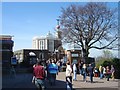
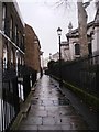
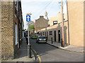
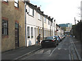
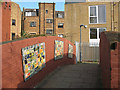
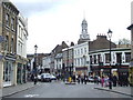
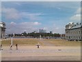
Photos of SE10 9UG


Area Information
Living in SE10 9UG offers a specific residential experience within a defined cluster measuring 1,094 square metres. This postcode serves 2,076 residents, creating a distinct community where daily life revolves around practical proximity to key services. The area is not a sprawling suburb but a concentrated settlement where neighbours are likely to know each other well. You will find yourself in a setting where the built environment is dense, meaning you can reach essential locations without significant travel times. The population density figures indicate a well-utilised space, ensuring that streets are active during the day and weekend evenings. Homebuyers considering this location should note the precise boundaries of this postcode, which function as a small residential unit within the larger Greenwich constituency. Life here moves at a pace dictated by access to nearby rail and ferry links rather than open countryside. The mix of accommodation types suggests a mature neighbourhood where established homes are common. You will appreciate the balance between being part of a busy city infrastructure and having sufficient space around your immediate street. The area feels established, with a population profile that suggests long-term residents rather than short-term tenants. Your commute to central London or Kent begins from a well-connected base, making SE10 9UG a logical choice for those balancing work and family commitments.
- Area Type
- Postcode
- Area Size
- 1094 m²
- Population
- 2076
- Population Density
- 13325 people/km²
The property market in SE10 9UG is characterised by a housing stock consisting almost entirely of houses. This stands in contrast to the flat-heavy landscape of much of central south-east London, offering a different lifestyle for potential buyers. With home ownership at 39%, the market includes a significant number of rental properties alongside owner-occupied dwellings. This split suggests that while many residents aspire to buy or have already done so, a large portion of the population of 2,076 rents its home. For a buyer looking at homes in SE10 9UG, the availability of houses is the primary advantage. You will find detached, semi-detached, and terraced options within this small 1,094-square-metre cluster and its immediate surroundings. The 39% ownership rate indicates that competition for purchase could be high when good properties come up for sale, as many homeowners are motivated to move upwards. Conversely, the rental sector is robust, meaning you might find opportunities to purchase a property from a landlord looking to downsize or recycle capital. The area does not contain large estates or major commercial hubs, so the property values reflect a specific residential niche rather than broad market fluctuations.
House Prices in SE10 9UG
Showing 10 properties
Energy Efficiency in SE10 9UG
Residents of SE10 9UG enjoy immediate access to a diverse range of amenities, ensuring convenience for daily errands and leisure activities. Retail options are well-provided, with five notable outlets including M&S Trafalgar Greenwich BP, Tesco Greenwich, and Co-op Greenwich within practical reach. You will find all essentials for the household stocked at these locations, reducing the need for long trips to other boroughs. Transport hubs are equally accessible, with five railway stations and five ferry piers nearby. Maze Hill Railway Station provides local rail access, while Greenwich Station offers a broader network connection. For road users, London City Airport sits just one stop away, providing rapid access to the continent. Cultural and leisure visitors can utilise the Cutty Sark for Maritime Greenwich and Cutty Sark DLR Station to explore the historic maritime village. Island Gardens offers a local transport node close to green spaces. This density of services means your commute begins from a vibrant environment where shopping, commuting, and dining are all steps away from your doorstep.
Amenities
Schools
Maze Hill School serves as the nearest educational institution to SE10 9UG. The school is designated as a special school, catering to students with special educational needs and disabilities. This specific provision means that families with children requiring additional support have a local facility within the postcode area. There are no other primary, secondary, or academies listed in the immediate vicinity of this specific cluster, so Maze Hill School is the primary specialist option for residents. For families without children requiring special education, parents would likely look towards standard schools in the wider Greenwich area, as no comprehensive schools are directly attached to this data set. The presence of a special school reflects the inclusive nature of the local education landscape. The mix of school types is limited in this immediate zone, focusing on specialist provision rather than a broad spectrum of general education institutions. You must plan carefully when moving to SE10 9UG, as the nearest general schools may be located a short distance away in neighbouring postcodes. The data confirms that Maze Hill School is the key educational landmark for this community, supporting a targeted segment of the local population.
| Rank | School | Type | Entry gender | Ages |
|---|
Explore more schools in this area
Go to Schools tabDemographics
The community in SE10 9UG reflects a mature demographic with a median age of 47 years. Adults aged between 30 and 64 years form the most common age range within this 2,076-strong population. This age profile indicates a neighbourhood dominated by families with children or empty-nesters, rather than young professionals just entering the housing market. Houses form the predominant accommodation type, confirming that this postcode consists largely of traditional family homes rather than modern flats or purpose-built rental blocks. Home ownership stands at 39%, meaning roughly 61% of households rent their property. This high proportion of renters suggests a dynamic market where ownership is possible but not guaranteed for every resident. The predominant ethnic group is White, though the specific percentage breakdown is not detailed in the available records. You are buying into a community where the majority of neighbours have lived here for some time, creating stability in the local schools and shops. Deprivation data is not provided, rendering a full socio-economic analysis impossible without external updates. However, the age structure and home ownership rates provide a clear picture of a stable, middle-aged populace. This demographic composition explains the demand for gardens and driveway parking, which are naturally associated with houses in this postal sector.
Household Size
Accommodation Type
Tenure
Ethnic Group
Religion
Household Composition
Age
Household Deprivation
NS-SEC
Explore more demographic insights in this area
Go to Demographics tabPlanning
Planning Constraints
- Flood RiskPremium
- Ramsar Wetland SitesPremium
- Area of Outstanding Natural BeautyPremium
- Protected Nature ReservePremium
- Protected WoodlandPremium