Area Overview for SE10 9RN
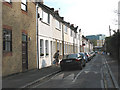
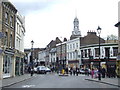
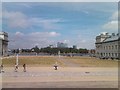
Photos of SE10 9RN


Area Information
Living in SE10 9RN means residing within a specific postcode area that covers a small residential cluster in England. This location encompasses just 1,796 square metres and holds a population of 1,866 people. You will find that the space is extremely dense, with a calculated population density of 1,039,176 people per square kilometre. Despite the high density figure, the area functions as a focused residential spot defined by its proximity to key London landmarks. The environment is structured around immediate access to transport hubs and commercial zones rather than expansive green spaces. For a homebuyer, understanding the tight confines of this postcode is essential. The high number of residents relative to the physical land area suggests a built-up district where every square metre of land is utilised. You do not anticipate large gardens or isolated plots in this specific cluster. Instead, daily life revolves around the efficient use of shared urban infrastructure. This small footprint places you in close proximity to the Cutty Sark area and the broader Greenwich district. You are positioned within a functional zone where residential living intersects directly with commercial activity and major transit routes. The area is best understood as a compact settlement integrated into a larger metropolitan network.
- Area Type
- Postcode
- Area Size
- 1796 m²
- Population
- 1866
- Population Density
- 5024 people/km²
The property market in SE10 9RN is characterised by a high proportion of rental living, with home ownership standing at only 40 per cent. Across the 1,796 square metres designated by the SE10 9RN postcode, flats constitute the predominant accommodation type. This skew towards flats and a lower rate of ownership suggests the area functions more as a rental hub than an owner-occupier estate. Buyers looking at this specific residential cluster should expect a stock comprised largely of smaller, high-density units rather than detached or semi-detached houses. The 40 per cent ownership figure is significantly lower than the national average, indicating that many current residents are tenants. If you are seeking to purchase a freehold home here, availability will be limited compared to owner-dominated suburbs. The market landscape reflects the physical reality of a small residential cluster where land value is maximised through multi-unit developments. You should factor in competitive pressures typical of dense urban flats where multiple buyers may vie for the same properties. The high population density of 1,039,176 people per square kilometre reinforces the expectation that new investments will favour apartment buildings over single-family dwellings. Understanding this balance of rentals and limited ownership is critical for anyone planning financial commitments in this postcode.
House Prices in SE10 9RN
Showing 18 properties
| Address | Type | Beds | Baths | Last Sale Price | Last Sale Date | |
|---|---|---|---|---|---|---|
| 4 Haddo Street, Greenwich, SE10 9RN | Flat | - | - | £175,000 | Dec 2001 | |
| 10A Haddo Street, Greenwich, SE10 9RN | Flat | 2 | 2 | - | - | |
| 6 Haddo Street, Greenwich, SE10 9RN | Flat | 2 | 1 | - | - | |
| Flat B, 8 Haddo Street, Greenwich, SE10 9RN | Flat | 1 | 1 | - | - | |
| Flat C, 8 Haddo Street, Greenwich, SE10 9RN | Flat | - | - | - | - | |
| Flat D, 8 Haddo Street, Greenwich, SE10 9RN | Flat | - | - | - | - | |
| Flat A, 8 Haddo Street, Greenwich, SE10 9RN | Flat | - | - | - | - | |
| 18B Haddo Street, Greenwich, SE10 9RN | Flat | - | - | - | - | |
| Flat 2, 2A Haddo Street, Greenwich, SE10 9RN | Flat | 1 | 1 | - | - | |
| Flat 3, 2A Haddo Street, Greenwich, SE10 9RN | Flat | - | - | - | - |
Energy Efficiency in SE10 9RN
Daily life for residents of SE10 9RN is defined by immediate access to a wide array of amenities despite the small size of the postcode cluster. Within practical reach, you will find five retail outlets, including Tesco Cutty, Aldi Greenwich, and Waitrose Greenwich. Dining and shopping needs are met without significant travel or reliance on delivery services. Transport links are exceptionally convenient with five metro options nearby, prominent among them being Cutty Sark DLR Station and Cutty Sark for Maritime Greenwich. Five railway stations, including Greenwich Station and Maze Hill Railway Station, are situated within easy reach to facilitate travel across London. Ferry services connect you to five locations such as Greenwich Pier and Greenland Surrey Quays Pier, adding flexibility to your commute or leisure trips. One airport, London City Airport, is also in close proximity, offering quick access for business travelers. Three major coach stations, including the Green Line Coach Station and London Victoria Coach Station, provide national and international travel options. This density of options ensures you can walk to work, shop, or explore without needing a car. The lifestyle offered is one of urban convenience where professional, recreational, and social needs are all satisfiable locally.
Amenities
Schools
Families considering SE10 9RN will find two primary educational institutions in the immediate vicinity. Both James Wolfe Infant School and James Wolfe Junior School are listed as the nearest options for education. These two facilities function as an integrated unit within the broader James Wolfe School complex, serving children from early years through to lower secondary levels. Both institutions operate as primary schools catering to different age brackets within the infant and junior school system. There is no data provided regarding Ofsted ratings, so parents cannot assess performance metrics based on official inspector grades for these specific locations. The presence of these two schools within the postcode suggests a designated catchment area for the local cluster of 1,866 residents. You must verify exact catchment boundaries with the schools or the local authority to ensure your property qualifies for admission. The pairing of infant and junior sections on the name indicates a long-established establishment rather than a collection of disparate facilities. For families moving into this small residential cluster, relying solely on these two primary options means you may need to look further afield for comprehensive secondary education or specialist colleges.
| Rank | School | Type | Entry gender | Ages |
|---|
Explore more schools in this area
Go to Schools tabDemographics
The community in SE10 9RN consists of 1,866 residents with a median age of 47 years. Most commonly, the population falls within the adult age range of 30 to 64 years. This demographic profile indicates a neighbourhood populated by established individuals rather than young families or elderly residents alone. Home ownership levels in this postcode are at 40 per cent, meaning a significant portion of households rent their properties. The predominant accommodation type listed for this area is flats, which aligns with the high-density nature of the 1,796 square metre cluster. White residents form the predominant ethnic group within this small residential population. There is no data presented regarding deprivation indices, so qualitative assessments of living standards rely solely on the housing mix and age distribution. The concentration of adults in their prime working years suggests an area suited to those who already own property or are secure in the rental market. With 60 per cent of households likely renting, you should expect a dynamic tenant turnover alongside the long-term challenges of securing ownership. The heavy weighting towards middle-aged adults shapes local demand for amenities that cater to established lifestyles.
Household Size
Accommodation Type
Tenure
Ethnic Group
Religion
Household Composition
Age
Household Deprivation
NS-SEC
Explore more demographic insights in this area
Go to Demographics tabPlanning
Planning Constraints
- Flood RiskPremium
- Ramsar Wetland SitesPremium
- Area of Outstanding Natural BeautyPremium
- Protected Nature ReservePremium
- Protected WoodlandPremium