Area Overview for SE10 9PT
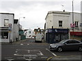
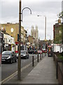
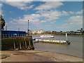
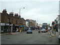
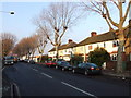
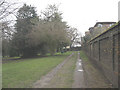
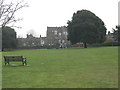
Photos of SE10 9PT

Area Information
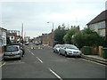
SE10 9PT represents a specific residential cluster within the SE10 postcode area, serving a population of 1,289 people. This compact community functions as a quiet residential enclave, offering a distinct alternative to the broader tourist-heavy zones of nearby Greenwich. Residents here experience a day-to-day rhythm defined by proximity to major transport hubs rather than secluded countryside. The area benefits from immediate access to five railway stations, five ferry terminals, and four DLR stations, ensuring connectivity without requiring a dedicated journey into central London. London City Airport sits within practical reach for those working in the financial district or travelling abroad frequently. The environment avoids planning constraints, with no coverage of protected wetlands, woods, or Areas of Outstanding Natural Beauty. This absence of restrictions allows for standard residential development while maintaining a straightforward regulatory status. Living in SE10 9PT means choosing a location that prioritises efficiency and access. You will find a setting that balances convenience with a sense of scale, avoiding the congestion of larger urban blocks while remaining close to historic maritime landmarks like Cutty Sark. The area caters to individuals and families who value logistical convenience and a straightforward living environment.
- Area Type
- Postcode
- Area Size
- Not available
- Population
- 1289
- Population Density
- 33568 people/km²
The housing market in SE10 9PT is characterised by a mix of ownership models within a constrained geographical space. With exactly 1,289 residents, the area maintains a relatively low population density compared to other parts of Southeast London. The most striking feature of the local inventory is the dominance of flats, which makes up the primary accommodation type. This housing style suits the limited land available in this specific postcode cluster. Half of the residents, representing 53 per cent of the population, are homeowners, indicating a significant portion of the market consists of people with a stake in the long-term value of the property. The remaining households are likely tenants, a common arrangement in inner London flats. While no specific price data is provided, the high proportion of flat living suggests a market skewed towards apartments rather than detached houses. Buyers considering homes in SE10 9PT should look for vertical living solutions that offer easy maintenance and proximity to shared amenities. The 53 per cent ownership rate provides a stable backdrop, suggesting a community less likely to experience the churn of a volatile rental market.
House Prices in SE10 9PT
No properties found in this postcode.
Energy Efficiency in SE10 9PT
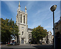
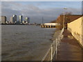
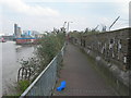
Daily life in SE10 9PT revolves around a dense network of amenities reachable without significant travel time. Residents have immediate access to five retailers, including Sainsburys Greenwich, Iceland Trafalgar, and Co-op Greenwich. These stores provide everything from groceries to household essentials, ensuring you rarely need to travel far for daily supplies. leisure and cultural options are equally prominent, with five ferry terminals and four DLR stations offering views of the Thames and access to Greenwich Park. Notable venues include the Royal Wharf Pier and Cutty Sark for Maritime Greenwich, which are within practical reach. For aviation needs, London City Airport is just one station away, a unique advantage for business travellers. Dining and shopping can be accessed at the five identified retail points, which serve the local population of 1,289 residents. The area also benefits from five railway stations, making weekend trips to the countryside or central London straightforward. You will find that living in SE10 9PT offers a high degree of convenience, with supermarkets, boats, and trains all integrated into a short walk or a few minutes' drive.
Amenities
Schools
| Rank | School | Type | Entry gender | Ages |
|---|
Explore more schools in this area
Go to Schools tabDemographics
The community in SE10 9PT is defined by a mature demographic profile. The median age is 47 years, indicating that the most common residents are adults aged between 30 and 64. This age distribution suggests a neighbourhood populated by established families or professionals rather than students or retirees alone. Fifty-three per cent of households own their homes, meaning just over half the residents operate on a mortgage while the remainder rents or lives rent-free. This balance creates a stable local presence without the rapid turnover typical of pure student villages or transient rental zones. Flats form the predominant accommodation type, reflecting the compact nature of this postcode cluster and the surrounding urban density. The population is overwhelmingly White, which aligns with typical demographics for this specific part of Greenwich. Housing quality in the area is supported by a solid infrastructure; digital connectivity scores are high, with fixed broadband rated at an excellent 96 out of 100 and mobile coverage at 85. These figures ensure that connectivity never disrupts daily life. You can expect a neighbourhood where long-term residents maintain their properties, supported by reliable internet speeds and a stable social fabric.
Household Size
Accommodation Type
Tenure
Ethnic Group
Religion
Household Composition
Age
Household Deprivation
NS-SEC
Explore more demographic insights in this area
Go to Demographics tabPlanning
Planning Constraints
- Flood RiskPremium
- Ramsar Wetland SitesPremium
- Area of Outstanding Natural BeautyPremium
- Protected Nature ReservePremium
- Protected WoodlandPremium