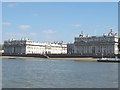
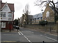
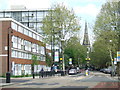
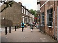
Area Overview for SE10 9PB
Photos of SE10 9PB
Area Information
SE10 9PB represents a compact residential cluster within England, covering a total area of 1.7 hectares. This small postcode supports a population of 2235 residents, creating a relatively high-density environment compared to wider suburban standards with a population density of 133141 people per square kilometre. The area functions as a distinct neighbourhood where daily life revolves around close proximity to major transport hubs and amenities. Living in SE10 9PB means navigating a space that balances residential needs with significant connectivity to the rest of London. The high density suggests an urban or inner-suburban feel where services are within walking distance for many. You will find yourself in an environment where neighbours are close and local infrastructure, such as railway stations and piers, plays a central role in the rhythm of the day. The area is not vast, so the character of the locality is defined by its efficiency and access rather than sprawling landscape. This concentration of people in a limited space creates a dynamic setting for those seeking a location with immediate access to the city.
- Area Type
- Postcode
- Area Size
- 1.7 hectares
- Population
- 2235
- Population Density
- 12486 people/km²
The property market in SE10 9PB is characterised by a high proportion of rental housing, with home ownership standing at only 39%. Flats are the predominant accommodation type, reflecting the high population density within this 1.7 hectare space. This housing stock suggests that buying a standalone home in this specific postcode is less common than renting or purchasing a flat. The area consists of a small residential cluster where space is at a premium. For buyers looking at this area and its immediate surroundings, expectations should align with apartment living rather than detached houses. The shortage of owner-occupied properties indicates strong tenant demand for the district. When viewing homes in SE10 9PB, you will largely encounter flats suited to urban lifestyles. This structure supports a lively community where different households share the same small footprint. Your search here will focus on quality and location rather than garden space.
House Prices in SE10 9PB
Showing 5 properties
| Address | Type | Beds | Baths | Last Sale Price | Last Sale Date | |
|---|---|---|---|---|---|---|
| 59 Hoskins Street, Greenwich, SE10 9PB | Semi-detached | 3 | 1 | £642,000 | Mar 2015 | |
| Paul Rhodes Bakery, Warehouse 1, Hoskins Street, Greenwich, SE10 9PB | general_industrial | - | - | - | - | |
| Tfl, London Transport Generating Station, Hoskins Street, Greenwich, SE10 9PB | Industrial | - | - | - | - | |
| The Cottage, Hoskins Street, Greenwich, SE10 9PB | Semi-detached | - | - | - | - | |
| 61 Hoskins Street, Greenwich, SE10 9PB | Semi-detached | 3 | 1 | - | - |
Energy Efficiency in SE10 9PB
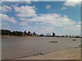
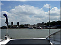
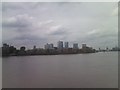
Residents of SE10 9PB enjoy excellent access to retail, rail, and ferry services within practical reach. You can shop at M&S Trafalgar Greenwich BP, Tesco Greenwich, and Co-op Greenwich for your grocery and general retail needs. Transport links are exceptionally dense, with Maze Hill Railway Station, Greenwich Station, and Westcombe Park railway station nearby. Ferry options include Greenwich Pier, Masthouse Terrace Pier, and North Greenwich Pier, providing river access. Metro connectivity is served through Island Gardens, Cutty Sark for Maritime Greenwich, and Cutty Sark DLR Station. London City Airport is also accessible, offering direct UK and European flight connections. This variety of amenities ensures that daily errands and commutes are convenient. The presence of multiple transport modes allows you to choose rail, river, or metro based on your destination. Shopping and leisure are integrated into your routine without requiring a long drive.
Amenities
Schools
Education facilities nearby cater to different stages of learning. Meridian Primary School is a primary institution located close to the area and holds a good Ofsted rating. This school provides a regulated and satisfactory education for younger children living in SE10 9PB. The University of Greenwich is another key educational neighbour, classified as an other type of institution. It serves older students and professionals within the community. Families with school-aged children will find Meridian Primary School a registered option for their education needs. The University adds a higher education presence, contributing to the adult-oriented demographic profile. These two institutions define the educational landscape accessible to residents without needing to travel further afield. The mix of primary education and university presence supports the age profile of the neighbourhood.
| Rank | School | Type | Entry gender | Ages |
|---|
Explore more schools in this area
Go to Schools tabDemographics
The community in SE10 9PB has a clear demographic profile with a median age of 47 years. Adults aged between 30 and 64 years represent the most common age range within the population. This middle-aged predominance suggests a neighbourhood often suited to families or established professionals rather than young singles or retirees. Home ownership rates stand at 39%, indicating that a majority of households are likely renting or living in shared ownership arrangements. Flats form the predominant type of accommodation in this postcode. While the predominant ethnic group is White, the area hosts a diverse cross-section of the local population. The concentration of flats aligns with the high population density and the typical housing stock of this part of Greenwich. You can expect a community where mature residents make up the bulk of the demographic makeup. The lower home ownership percentage reflects the nature of the stock, which often appeals to tenants looking for central locations near transport links.
Household Size
Accommodation Type
Tenure
Ethnic Group
Religion
Household Composition
Age
Household Deprivation
NS-SEC
Explore more demographic insights in this area
Go to Demographics tabPlanning
Planning Constraints
- Flood RiskPremium
- Ramsar Wetland SitesPremium
- Area of Outstanding Natural BeautyPremium
- Protected Nature ReservePremium
- Protected WoodlandPremium