Area Overview for SE10 9LJ
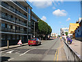
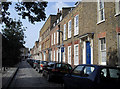
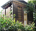
Photos of SE10 9LJ


Area Information
Living in SE10 9LJ offers a residential experience defined by a compact, clustered layout within South East London. This postcode covers a small population of 1,399 people, creating a tightly knit environment where neighbours often know one another. The area sits in a transitional zone that balances proximity to major metropolitan hubs with a distinct local character. For buyers, the scale of SE10 9LJ suggests a neighbourhood rather than a sprawling district, which can influence the pace of daily life and the availability of green spaces. The location provides direct access to key transport nodes including Greenwich Station, Deptford, and St Johns, ensuring that travel times to central London remain manageable. Despite being urban, the area lacks specific planning constraints such as Ramsar wetland sites or Areas of Outstanding Natural Beauty. This absence of protected status allows for straightforward development planning while maintaining current residential structures. With a medium age profile and significant reliance on flat living, the area caters to those seeking convenient city access without the footprint of large detached homes.
- Area Type
- Postcode
- Area Size
- Not available
- Population
- 1399
- Population Density
- 13962 people/km²
The housing stock in SE10 9LJ is defined by a high proportion of flats and a significant tenant presence. With only 37% of homes owned, the market is heavily weighted towards rental properties. This structure often appeals to professionals relocating to London who require flexibility rather than long-term stability. Buyers looking for flats should expect a competitive market where leasehold specifics and service charges become central to any financial modelling. The dominance of flat dwellings limits the availability of terraced or detached homes, which influences the overall architectural character of SE10 9LJ. Future development could theoretically alter this mix given the lack of protected nature reserves or woodlands in the immediate vicinity. However, the current landscape remains static with an established pattern of multi-unit living. Investors and landlords will find substantial opportunity within this slice of the postcode, particularly if they can tailor properties to the needs of the working-age adult demographic that forms the bulk of the resident population.
House Prices in SE10 9LJ
Showing 50 properties
Energy Efficiency in SE10 9LJ
Daily life in SE10 9LJ benefits from a dense concentration of amenities within practical walking or short driving distance. Residents have access to five rail stations including Greenwich Station and Deptford for local and national travel. Shopping needs are met by five retail outlets, specifically Co-op London, Tesco Deptford and Sainsburys Greenwich, which handle everyday grocery and household requirements. Public transport extends beyond rail with five metro stations like Cutty Sark for Maritime Greenwich and five ferry terminals including Masthouse Terrace Pier. For longer travel, one airport, London City Airport, and three bus connections featuring Victoria Coach Station provide extensive regional links. These five distinct amenity categories ensure that nothing is far from reach. The presence of these specific named venues means that buying in SE10 9LJ grants immediate access to the wider commercial and leisure network of Greenwich and Deptford without the need for extensive journeys.
Amenities
Schools
| Rank | School | Type | Entry gender | Ages |
|---|
Explore more schools in this area
Go to Schools tabDemographics
The community profile of SE10 9LJ reflects a mature and established demographic. The median age here is 47 years old, with adults aged between 30 and 64 representing the most common age range. This suggests a household composition dominated by middle-aged families or individuals settling down in the south-east. House ownership stands at exactly 37%, indicating that this postcode operates largely within the private rental sector. Over two-thirds of residents do not own their homes outright, which impacts the stability of the local tenant base. Accommodation types are predominantly flats, aligning with the density of the residential cluster. The predominant ethnic group is White, reflecting the traditional demographic makeup of many London postcode districts. Safety scores indicate a critical level, with a crime risk score of 17 out of 100, meaning crime rates are above average. Residents must consider enhanced security measures when evaluating this specific property market segment compared to neighbouring areas with lower risk profiles.
Household Size
Accommodation Type
Tenure
Ethnic Group
Religion
Household Composition
Age
Household Deprivation
NS-SEC
Explore more demographic insights in this area
Go to Demographics tabPlanning
Planning Constraints
- Flood RiskPremium
- Ramsar Wetland SitesPremium
- Area of Outstanding Natural BeautyPremium
- Protected Nature ReservePremium
- Protected WoodlandPremium