Area Overview for SE10 9GD
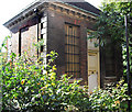
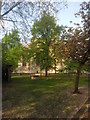
Photos of SE10 9GD


Area Information
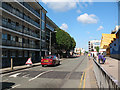
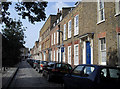
Living in SE10 9GD offers a defined residential experience within the Greenwich postcode sector. This specific cluster serves a population of 1,692 people, creating a close-knit environment where neighbours are likely to know one another. You will find yourself in a setting characterised by flats rather than detached houses, which shapes the daily rhythm of the community. The area functions as a practical base for residents who need easy access to both London's historic quarter and modern business hubs. Your daily life revolves around proximity to key transport links. Cutty Sark DLR Station, Greenwich Pier, and Greenwich Station are all within practical reach. You can walk to retail giants like Waitrose Greenwich or Sainsburys Greenwich without relying on a car. The presence of London City Airport is a significant local asset for short-haul travel. This postcode cluster balances urban convenience with a contained residential feel, making it suitable for those who prioritise location over large detached gardens.
- Area Type
- Postcode
- Area Size
- Not available
- Population
- 1692
- Population Density
- 71392 people/km²
The property market in SE10 9GD is defined by a distinct shift towards renting. With only 24% of homes owned outright, you are entering a rental-heavy landscape. This statistic reveals that three-quarters of the 1.7k residents pay rent, suggesting a strong demand for secure, long-term tenancies in local buildings. Flats dominate the housing stock, confirming that this postcode is not built for the traditional family home or the luxury detached property enthusiast. If you are considering buying, you must look beyond the immediate 169-person cluster to the wider SE10 sector for owner-occupied stock. For buyers seeking flats, this area offers the chance to live centrally without the premium of prime central London. However, the high rental ratio means that management and maintenance responsibilities often fall to a landlady or an external agency. You should expect to compete with landlords seeking yield. The predominance of flat living also implies shared walls and communal spaces, which affects noise levels and privacy. Those buying here prioritise location efficiency and transport access over square footage or garden space. The market reflects a pragmatic approach to housing where convenience supersedes space.
House Prices in SE10 9GD
Showing 50 properties
Energy Efficiency in SE10 9GD
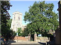
Your lifestyle in SE10 9GD centres around immediate access to high-quality amenities. Five local retail options serve your shopping needs, featuring Waitrose Greenwich, Sainsburys Greenwich, and Tesco Cutty. These supermarkets ensure you can stock your home without a significant weekly trip. For leisure, you are close to five metro-related attractions, notably Cutty Sark DLR Station and Island Gardens, which provide walking routes with historic views. Transport as a lifestyle feature includes five ferry terminals like Greenwich Pier and Masthouse Terrace Pier, allowing weekend getaways across the Thames. Five rail stations nearby offer fast commuter links. London City Airport is just one away for business travellers. You can also reach the Green Line Coach Station and London Victoria Coach Station easily. Dining and fresh produce are covered by the rich variety of supermarkets mentioned. This concentration of services means you can run your domestic life locally while retaining easy access to national leisure destinations. The area functions as a hub where daily errands and weekend adventures overlap.
Amenities
Schools
| Rank | School | Type | Entry gender | Ages |
|---|
Explore more schools in this area
Go to Schools tabDemographics
The community in SE10 9GD reflects a mature demographic profile with a median age of 47. Adults aged between 30 and 64 years form the most common age range, indicating a population in their career-building and family-raising years. You will notice a higher proportion of families and professionals compared to the wider London average. House ownership stands at a measured 24%, meaning the majority of residents rent their homes. This dynamic creates a fluid community where housing stock changes hands frequently on the rental market. Flats constitute the predominant accommodation type, defining the physical fabric of SE10 9GD. This layout supports both single professionals and couples who prefer low-maintenance living. The predominant ethnic group is White, aligning with broader national trends but existing within a diverse national context. The area does not suffer from high deprivation markers based on the available safety and infrastructure scores. Residents benefit from a stable neighbourhood probability without the complications associated with high-octane property turnover or significant social fragmentation.
Household Size
Accommodation Type
Tenure
Ethnic Group
Religion
Household Composition
Age
Household Deprivation
NS-SEC
Explore more demographic insights in this area
Go to Demographics tabPlanning
Planning Constraints
- Flood RiskPremium
- Ramsar Wetland SitesPremium
- Area of Outstanding Natural BeautyPremium
- Protected Nature ReservePremium
- Protected WoodlandPremium