Area Overview for SE10 9EF
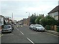
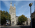
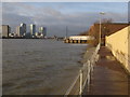
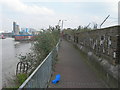
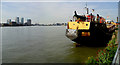
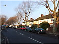
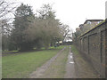
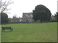
Photos of SE10 9EF
Area Information
Living in SE10 9EF means residing within a compact residential cluster defined by its specific postcode. This small area covers just 3,875 square metres and is home to 1,289 residents. The population density is exceptionally high at 332,653 people per square kilometre, creating a tightly packed urban environment where neighbours are often close by. Despite the small geographic footprint, the location provides access to the wider Greenwich peninsula. You are situated in a zone where space is limited but connectivity is high. Daily life here revolves around proximity to key landmarks. The area is surrounded by significant transport hubs, including Maze Hill Railway Station and Charlton Station. Nearby piers like Greenwich Pier and Royal Wharf Pier offer river access, while the DLR station at Cutty Sark serves the Maritime Greenwich area. This concentration of transport links makes SE10 9EF a practical choice for commuters. The community is established and stable. Over half of the residents own their homes, indicating long-term settlement patterns. The area attracts adults between the ages of 30 and 64, suggesting families and professionals seeking stability. While the postcode represents a very small slice of the local landscape, it functions as a distinct node within the South London network. Living in SE10 9EF places you in a high-density setting that prioritises convenience and access over open space.
- Area Type
- Postcode
- Area Size
- 3875 m²
- Population
- 1289
- Population Density
- 33568 people/km²
The property market in SE10 9EF is characterised by a specific type of housing stock dominated by flats. This accommodation type reflects the small size of the postcode, which covers only 3,875 square metres. With 53% of residents owning their homes, the market shows a strong preference for ownership over renting. This ownership rate suggests that the flats in this area attract buyers looking for stability rather than landlords seeking rental yields. Because the area is so small and densely populated, detached or semi-detached houses are virtually non-existent. You will find tiered living environments where neighbours share walls and balconies. The high population density of 332,653 people per square kilometre dictates that space is at a premium. Consequently, buyers seeking single-family homes will look beyond SE10 9EF itself. The housing here caters to those comfortable with urban living. This ownership structure supports a stable community. The fact that more than half the residents own their homes means the area likely has fewer transient occupants. Buyers considering homes in SE10 9EF should focus on the condition of the flats and the building management. The market values location over square footage. Access to amenities and transport links often outweighs the size of the individual unit. Understanding this dynamic is crucial when evaluating properties in this specific cluster.
House Prices in SE10 9EF
Showing 22 properties
| Address | Type | Beds | Baths | Last Sale Price | Last Sale Date | |
|---|---|---|---|---|---|---|
| 3 Rodmere Street, Greenwich, SE10 9EF | Terraced | 3 | 2 | £710,000 | Nov 2025 | |
| 9 Rodmere Street, Greenwich, SE10 9EF | house | 3 | - | £711,000 | Dec 2020 | |
| 1 Rodmere Street, Greenwich, SE10 9EF | Terraced | 3 | 3 | £710,500 | Oct 2018 | |
| 8 Rodmere Street, Greenwich, SE10 9EF | Terraced | 3 | 2 | £625,000 | Sep 2017 | |
| 10 Rodmere Street, Greenwich, SE10 9EF | house | 3 | 2 | £691,000 | Aug 2016 | |
| 2 Rodmere Street, Greenwich, SE10 9EF | Retail | 3 | 2 | £437,500 | Jun 2014 | |
| 7 Rodmere Street, Greenwich, SE10 9EF | Terraced | 3 | 2 | £420,000 | Apr 2007 | |
| 4 Rodmere Street, Greenwich, SE10 9EF | Terraced | 3 | - | £310,000 | Jun 2004 | |
| 6 Rodmere Street, Greenwich, SE10 9EF | Terraced | - | - | £275,000 | Jul 2002 | |
| 5 Rodmere Street, Greenwich, SE10 9EF | house | 3 | 2 | £280,000 | May 2002 |
Energy Efficiency in SE10 9EF
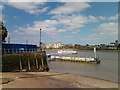
Your access to amenities in SE10 9EF is extensive despite the small size of the postcode. Five retail options serve daily shopping needs directly from Iceland Trafalgar, Co-op Greenwich, and Sainsburys Greenwich. These supermarkets provide everything from fresh groceries to household essentials within a short walk or cycle. You do not need to travel far to stock your pantry or find daily necessities. Transport connectivity forms the backbone of daily life. Five railway stations including Maze Hill Railway Station, Westcombe Park, and Charlton Station offer frequent rail services. Five ferry piers such as Greenwich Pier, Royal Wharf Pier, and North Greenwich Pier provide river crossings to central London and across the Thames. Additionally, five metro stations like Island Gardens, Cutty Sark for Maritime Greenwich, and Cutty Sark DLR Station integrate seamlessly with the rail network. This variety of transport choices means you can choose how you reach your destination. London City Airport is also within practical reach, making SE10 9EF convenient for travel. The area offers a balance between urban convenience and local charm. You can enjoy a quick trip to the shops while relying on efficient public transport for longer journeys. Life here is defined by choice and ease of movement.
Amenities
Schools
| Rank | School | Type | Entry gender | Ages |
|---|
Explore more schools in this area
Go to Schools tabDemographics
The community profile of SE10 9EF is dominated by adults aged between 30 and 64 years. This age range constitutes the most common demographic, reflecting a population of residents who are likely establishing careers or raising families. The median age of 47 years confirms a mature neighbourhood where long-term residents have remained in the locality for many years. Home ownership stands at 53%, placing this area slightly above the national average for outright ownership. This figure indicates that more than half of the households own their dwellings outright or have a mortgage, reducing the proportion of short-term renters. The prevalence of flats as the primary accommodation type aligns with the high density of the postcode area. With a population density that exceeds 332,000 people per square kilometre, multi-unit living is inevitable. Accessibility is the core feature of life here. All residents have central residential units rather than detached houses, which limits privacy but maximises efficiency. The predominant ethnic group is White, which aligns with the broader London demographic trends. The high density and flat-based housing stock create a community dynamic where street life and shared spaces are vital. Living in SE10 9EF requires adapting to a vertical environment where personal space is managed carefully.
Household Size
Accommodation Type
Tenure
Ethnic Group
Religion
Household Composition
Age
Household Deprivation
NS-SEC
Explore more demographic insights in this area
Go to Demographics tabPlanning
Planning Constraints
- Flood RiskPremium
- Ramsar Wetland SitesPremium
- Area of Outstanding Natural BeautyPremium
- Protected Nature ReservePremium
- Protected WoodlandPremium