Area Overview for SE10 9DT
Photos of SE10 9DT


Area Information
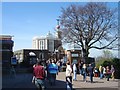
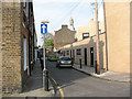
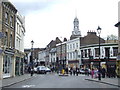
Living in SE10 9DT means residing within a small residential cluster that forms part of the wider Greenwich peninsula. The postcode covers a specific population of 1,423 people, creating a tight-knit environment where neighbours are often neighbours for a reason. This area sits near the historic Cutty Sark and operates within the shadow of Greater London's cultural hubs, yet it maintains a distinctively local character. Daily life here revolves around proximity to significant transport links, including Greenwich Station and the Cutty Sark DLR Station, which place you moments away from the heart of the city and the waterfront. You will find yourself surrounded by practical amenities rather than expansive suburban streets. The setting offers direct access to the Cutty Sark for Maritime Greenwich and Island Gardens, providing immediate leisure options without the need for lengthy commutes. Because the area is defined by its postcode rather than a broad estate, you experience the convenience of urban living without the anonymity of larger districts. Your routine involves easy walks to retail outlets like M&S Greenwich SF or trips to the nearby Greenwich Pier. The location appeals to those who prioritise transport connectivity and local convenience over traditional leafy suburban sprawl.
- Area Type
- Postcode
- Area Size
- Not available
- Population
- 1423
- Population Density
- 20329 people/km²
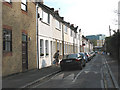
The housing market in SE10 9DT is heavily skewed towards rental living rather than outright home ownership. With only 31% of the population owning their homes, the majority of the market operates on a monthly tenancy basis. This statistic paints a clear picture of the residential landscape: you are looking at an area where leased accommodation dominates the available stock. The predominant accommodation type is flats, which reinforces the rental-heavy nature of the postcode. Flats are naturally suited to single occupants or couples who value flexibility over investment stability. For buyers considering homes in SE10 9DT, this implies a competitive rental market where demand likely outstrips supply due to the high proportion of young adults. It also suggests that purchasing freehold property here may involve navigating a market accustomed to transient residents. The small population size of 1,423 limits the sheer volume of transactions, but the concentration of flats indicates that investors focus on blocks of apartments rather than detached family homes. You will find that the property portfolio is tailored to those seeking convenient urban living, potentially including purpose-built blocks alongside converted residential spaces. This makes the area particularly relevant for landlords or investors targeting young professionals rather than traditional family buyers looking for gardens or garages.
House Prices in SE10 9DT
Showing 24 properties
Energy Efficiency in SE10 9DT
Your daily lifestyle in SE10 9DT is shaped by a dense collection of amenities within practical reach. You have immediate access to major retailers including M&S Greenwich SF, Tesco Cutty, and Aldi Greenwich, ensuring your weekly shopping needs are met without long trips. Transport convenience is central to the area, with five metro options nearby, including the Cutty Sark DLR Station and the Cutty Sark for Maritime Greenwich. Ferry services are also prominent, offering connections to Greenwich Pier, Masthouse Terrace Pier, and Greenland Surrey Quays Pier. If you require train travel, Greenwich Station and Maze Hill Railway Station are close by, alongside connections to Deptford. For air travel, London City Airport is a nearby option, making business trips or holidays accessible. Bus links, including routes to the Green Line Coach Station and Victoria Coach Station, further expand your mobility. You can walk to Island Gardens for a break from the urban street. This concentration of five retail outlets, five metro stops, and five ferry points means you rarely need your car. The amenities create a self-contained environment where food, travel, and leisure are all moments away from your flat.
Amenities
Schools
Families considering schools near SE10 9DT have access to specific local options immediately adjacent to the postcode. The primary education provision is anchored by St Alfege with St Peter's Church of England Primary School, which holds a Good Ofsted rating. This single named institution provides early years education for the local cluster, offering a reliable and inspected standard for young children. Because the area is a small residential cluster with a median age of 22, the school composition reflects a mix of local families and potentially younger students from wider London regions. The Good rating from Ofsted confirms that the school meets required standards for curriculum and student support. While primary education is well-represented with this named provider, secondary education options are not explicitly detailed in the immediate data for this specific small postcode. The presence of St Alfege with St Peter's suggests that the immediate vicinity supports the needs of younger children effectively. Parents in the area will need to look further afield for secondary schooling, though St Alfege serves as a key local asset for the younger demographics who make up a significant portion of the 1,423 residents. The school type is primary, which fits the demographic profile of young families moving into the flat-heavy environment.
| Rank | School | Type | Entry gender | Ages |
|---|
Explore more schools in this area
Go to Schools tabDemographics
The community in SE10 9DT is defined by a surprisingly young population profile. Data shows a median age of just 22 years, which indicates a high concentration of younger residents compared to the national average. Despite the median figure, the most common age range consists of adults between 30 and 64 years, suggesting a diverse mix of young professionals and established families sharing the space. Ownership levels reflect this dynamic demographic; only 31% of residents own their homes, meaning the majority live in the rental sector. This low ownership rate aligns with the predominant accommodation type, which consists almost entirely of flats. Such housing stock naturally attracts renters, including students and young career starters who prefer the flexibility of shared living or short-term leases. The predominant ethnic group is White, contributing to a generally homogenous yet youthful social fabric. You should expect a vibrant, energetic atmosphere driven by this younger demographic. The low homeownership percentage suggests that while the area is dense with activity, long-term established families may be fewer in number than in other parts of South East London. This creates a neighbourhood where life moves quickly and social circles form around work locations and universities rather than multi-generational local roots.
Household Size
Accommodation Type
Tenure
Ethnic Group
Religion
Household Composition
Age
Household Deprivation
NS-SEC
Explore more demographic insights in this area
Go to Demographics tabPlanning
Planning Constraints
- Flood RiskPremium
- Ramsar Wetland SitesPremium
- Area of Outstanding Natural BeautyPremium
- Protected Nature ReservePremium
- Protected WoodlandPremium