Area Overview for SE10 8QW
Photos of SE10 8QW
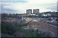
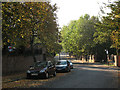
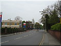
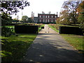

100 photos from this area
Area Information
Key information about the SE10 8QW including its size, population, and administrative classification.
- Area Type
- Postcode
- Area Size
- 1.1 hectares
- Population
- 1732
- Population Density
- 1448 people/km²
House Prices in SE10 8QW
32
Properties
£661,688
Average Sold Price
£126,500
Lowest Price
£2,225,000
Highest Price
Showing 32 properties
| Address | Type | Beds | Baths | Last Sale Price | Last Sale Date | |
|---|---|---|---|---|---|---|
| 84 Point Hill, Greenwich, SE10 8QW | Terraced | 2 | 1 | £605,000 | Dec 2024 | |
| 90 Point Hill, Greenwich, SE10 8QW | Terraced | 2 | 1 | £720,000 | Jun 2024 | |
| 80 Point Hill, Greenwich, SE10 8QW | Terraced | 3 | 1 | £668,000 | Nov 2023 | |
| 88 Point Hill, Greenwich, SE10 8QW | Terraced | 2 | 1 | £630,000 | Nov 2023 | |
| 27 Point Hill, Greenwich, SE10 8QW | house | - | - | £2,225,000 | Sep 2022 | |
| 62 Point Hill, Greenwich, SE10 8QW | Terraced | 2 | 1 | £709,000 | Aug 2022 | |
| 74 Point Hill, Greenwich, SE10 8QW | Terraced | 2 | 1 | £615,000 | Nov 2021 | |
| 17 Point Hill, Greenwich, SE10 8QW | Terraced | 2 | 1 | £970,000 | Jun 2018 | |
| 64 Point Hill, Greenwich, SE10 8QW | house | 2 | - | £630,000 | May 2018 | |
| 60 Point Hill, Greenwich, SE10 8QW | Terraced | 2 | 2 | £605,000 | Apr 2017 |
Page 1 of 4
Energy Efficiency in SE10 8QW
Amenities
Schools
| Rank | School | Type | Entry gender | Ages |
|---|
Explore more schools in this area
Go to Schools tabDemographics
Household Size
Two person
most common
Accommodation Type
Houses
most common
Tenure
65
majority
Ethnic Group
White
most common
Religion
N/A
most common
Household Composition
N/A
most common
Age
47
median
Adults (30-64 years)
most common
Household Deprivation
N/A
with no deprivation
NS-SEC
65
in Lower managerial occupations
Explore more demographic insights in this area
Go to Demographics tabPlanning
Planning Constraints
- Flood RiskPremium
- Ramsar Wetland SitesPremium
- Area of Outstanding Natural BeautyPremium
- Protected Nature ReservePremium
- Protected WoodlandPremium