Area Overview for SE10 8PB
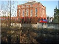
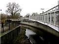
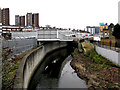
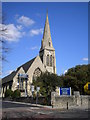
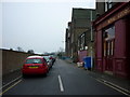
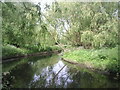
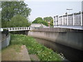
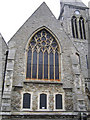
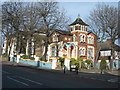
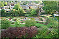
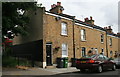
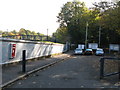
Photos of SE10 8PB
Area Information
Living in SE10 8PB means occupying a specific residential cluster on the south bank of the Thames. This postcode covers a population of 2,629 people spread across an area of 1,162 square metres. The density here is exceptionally high, reflecting a flat, urban neighbourhood rather than spacious suburban surroundings. Daily life involves close proximity to major transport hubs, with five metro stations including Elverson Road and Deptford Bridge accessible for fast travel. You also have five rail options nearby, such as Greenwich Station and Lewisham Railway Station, alongside Greenwich Pier and other ferry terminals. London City Airport is just one kilometre away, making business travel straightforward. The area is defined by its practicality and direct links to Greenwich and central London. You will find retail options like Tesco Deptford and Sainsburys Greenwich within easy reach. While the character is distinctly urban, the absence of planning constraints means local development faces fewer restrictions than in protected zones. This postcode offers a grounded experience where access to infrastructure outweighs the presence of green spaces or rural constraints. It is a place built for connectivity, where your morning commute or evening walk is dictated by the效率 of the transport network surrounding you.
- Area Type
- Postcode
- Area Size
- 1162 m²
- Population
- 2629
- Population Density
- 13764 people/km²
The property market in SE10 8PB is characterised by a shift towards rental living. Only 45% of residents own their homes, meaning a majority rely on the private or social rental sector. Flats are the primary accommodation type, confirming that terraced houses or semi-detached properties are rare in this specific cluster. You are likely to encounter a mix of purpose-built apartments and converted residential units designed for the high-density urban lifestyle. This market dynamic means that buying a freehold home here is more uncommon than finding a leasehold flat. The high population density within 1,162 square metres further cements the flat as the standard offering. For buyers seeking ground-floor property with garden access, options will be extremely limited. Instead, the market prioritises efficient use of space and proximity to amenities. The presence of major transport links influences property values, with units closer to Elverson Road or Deptford Bridge potentially commanding higher premiums. Competition for flats will be intense given the popularity of the location for commuters. When viewing properties, you should expect modern interiors that maximise light and vertical storage, typical of developments in this postcode. The 45% ownership figure indicates that you may also find opportunities to purchase a flat from an individual owner rather than a large housing association.
House Prices in SE10 8PB
Showing 14 properties
| Address | Type | Beds | Baths | Last Sale Price | Last Sale Date | |
|---|---|---|---|---|---|---|
| 7A Blackheath Hill, Greenwich, SE10 8PB | Flat | 3 | 1 | £270,000 | Mar 2025 | |
| 5A Blackheath Hill, Greenwich, SE10 8PB | Flat | - | - | £375,000 | Jun 2023 | |
| 11A Blackheath Hill, Greenwich, SE10 8PB | Flat | - | - | £162,000 | Sep 1999 | |
| First Floor And Second Floor Flat, 11A Blackheath Hill, Greenwich, SE10 8PB | Flat | - | - | - | - | |
| 1A Blackheath Hill, Greenwich, SE10 8PB | Flat | - | - | - | - | |
| 3A Blackheath Hill, Greenwich, SE10 8PB | Maisonette | - | - | - | - | |
| 1B Blackheath Hill, Greenwich, SE10 8PB | Flat | - | - | - | - | |
| 1A Blackheath Hill, Greenwich, SE10 8PB | Flat | - | - | - | - | |
| Kelly Permanent Beauty, Beauty Treatment Room, 5 Blackheath Hill, Greenwich, SE10 8PB | Retail | - | - | - | - | |
| Room 2, 11A Blackheath Hill, Greenwich, SE10 8PB | Unknown | - | - | - | - |
Energy Efficiency in SE10 8PB
Your daily lifestyle in SE10 8PB is defined by immediate access to major retail and leisure venues. You can walk or take a short bus ride to Tesco Deptford, Co-op London, and Sainsburys Greenwich for all your grocery and shopping needs. Five metro stations, five rail stations, and five ferry terminals mean you never feel isolated, even in a small residential cluster. London City Airport is just one away, making you connected to the business world if you travel frequently. The area offers five bus and coach connections including routes to Green Line Coach Station and London Victoria Coach Station. While there are no AONBs or protected woodlands listed, the urban setting provides a walkable environment surrounded by commercial hubs. You will find convenience stores and supermarkets on your doorstep, eliminating the need for long trips for daily essentials. The density of 226 kilograms per square metre, converted from the population data, implies a very tight-knit, vertical living experience. However, the presence of multiple transport modes ensures you can easily escape the city centre for a Thames walk or visit Greenwich Park. Your routine is structured by the rhythm of the trains and ferries that pass nearby. This connectivity brings a cosmopolitan feel to your doorstep, allowing you to access Canary Wharf or South London with minimal effort.
Amenities
Schools
Families living near SE10 8PB have access to the Mayflower Independent School, located within practical reach of the postcode. This institution is an independent school and caters to families seeking alternative education options to the state sector. While specific Ofsted ratings and age ranges for the school are not included in the current records, its presence as an independent provider signals a option for private education close by. The area does not list any state-maintained primary or secondary schools in the immediate data, so parents should look beyond this specific postcode for broader educational choices. The reliance on one named independent school suggests that residents either travel further for state education or choose private schooling for their children. This limited school listing within the data highlights that SE10 8PB serves as a residential hub rather than a dedicated educational district with multiple local establishments. You may need to consider schools in adjacent areas like Greenwich or Lewisham for a wider selection. The lack of comprehensive school data in this specific snapshot means you cannot assess the academic performance of nearest children's centres based on these figures alone. Families must rely on the single available option, the Mayflower Independent School, or expand their search radius significantly to find additional provision.
| Rank | School | Type | Entry gender | Ages |
|---|
Explore more schools in this area
Go to Schools tabDemographics
The community in SE10 8PB reflects a mature neighbourhood with a median age of 47 years. Most residents fall into the adult bracket between 30 and 64 years old, indicating a stable population likely focused on established careers and family life. Home ownership stands at 45%, meaning less than half of households own their property outright. This suggests a significant portion of the population rents their homes, creating a dynamic mix of long-term tenants and owners. The dominant accommodation type is flats, which aligns with the high density and urban nature of the postcode. Predominantly, the area is home to White residents, though diverse living arrangements are common in such high-density zones. There is no data provided regarding deprivation levels or income statistics, so specific socioeconomic profiles remain undefined. However, the age profile suggests a demand for local services tailored to adults, such as healthcare and leisure facilities. The housing stock is predominantly rental or part-shared ownership given the lower ownership rate compared to national averages for similar eras. This demographic mix creates a vibrant, transient-friendly environment where neighbours often interact through shared building spaces rather than extensive gardens. The population density per square kilometre suggests limited private outdoor space for each household.
Household Size
Accommodation Type
Tenure
Ethnic Group
Religion
Household Composition
Age
Household Deprivation
NS-SEC
Explore more demographic insights in this area
Go to Demographics tabPlanning
Planning Constraints
- Flood RiskPremium
- Ramsar Wetland SitesPremium
- Area of Outstanding Natural BeautyPremium
- Protected Nature ReservePremium
- Protected WoodlandPremium