Area Overview for SE10 8HL
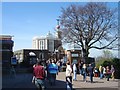
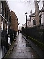
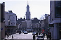
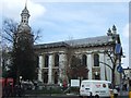
Photos of SE10 8HL

Area Information
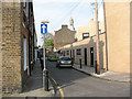
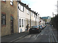
SE10 8HL is a small, tightly knit residential cluster located in England with a total footprint of 6,385 square metres. This compact area houses a population of 1,732 people, creating a density of 1,448 people per square kilometre. Life in this postcode feels intimate due to the limited land area and concentrated community size. You will find yourself walking to local shops within minutes rather than driving lengthy distances. The proximity of transport hubs like Greenwich Station and Maze Hill Railway Station means you can reach central London quickly while remaining grounded in a quieter neighbourhood. Unlike sprawling districts, SE10 8HL functions as a self-contained pocket of daily life where residents know their immediate surroundings. The mix of housing leans heavily towards houses, giving the location a suburban character despite its proximity to significant transport infrastructure. You get the convenience of a major UK city with the manageable feel of a small neighbourhood. Practicality defines this area; every facility you need is within reach. Whether you commute to Canary Wharf or work from home, the layout of SE10 8HL supports an efficient routine. The area serves as a solid base for those who prioritise accessibility over space or exclusivity.
- Area Type
- Postcode
- Area Size
- 6385 m²
- Population
- 1732
- Population Density
- 1448 people/km²
The property market in SE10 8HL differs significantly from the high-rise rental blocks common in central London. You will find that 65% of homes in this postcode are owner-occupied, creating a market driven by existing residents rather than short-term landlords. The accommodation type is exclusively houses, which is unusual for such a densely populated cluster near major transit links. This scarcity of properties and dominance of owner-occupiers means competition can be fierce for available stocks. Because the total population is only 1,732 within 6,385 square metres, new construction is unlikely to expand the supply of homes in the immediate future. Buyers looking here should expect to find period properties or older family homes that have evolved over time. The area does not cater to the modern flat-hunting demographic; instead, it appeals to those seeking traditional domestic spaces. If you require a rental property, options will be much harder to find compared to nearby areas dominated by council estates or private towers. The high concentration of house ownership suggests that sellers here often stay put for many years. When a sale does occur, it attracts serious buyers who can appreciate the unique nature of living in a house within this specific transit corridor.
House Prices in SE10 8HL
Showing 24 properties
| Address | Type | Beds | Baths | Last Sale Price | Last Sale Date | |
|---|---|---|---|---|---|---|
| 7, Chesterfield Gardens, Crooms Hill, Greenwich, SE10 8HL | Flat | - | - | - | - | |
| 3, Chesterfield Gardens, Crooms Hill, Greenwich, SE10 8HL | Flat | - | - | - | - | |
| 13, Chesterfield Gardens, Crooms Hill, Greenwich, SE10 8HL | Flat | - | - | - | - | |
| 9, Chesterfield Gardens, Crooms Hill, Greenwich, SE10 8HL | Flat | - | - | - | - | |
| 19, Chesterfield Gardens, Crooms Hill, Greenwich, SE10 8HL | Maisonette | - | - | - | - | |
| 16, Chesterfield Gardens, Crooms Hill, Greenwich, SE10 8HL | Maisonette | - | - | - | - | |
| 20, Chesterfield Gardens, Crooms Hill, Greenwich, SE10 8HL | Flat | - | - | - | - | |
| 21, Chesterfield Gardens, Crooms Hill, Greenwich, SE10 8HL | Maisonette | - | - | - | - | |
| 2, Chesterfield Gardens, Crooms Hill, Greenwich, SE10 8HL | Flat | - | - | - | - | |
| 5, Chesterfield Gardens, Crooms Hill, Greenwich, SE10 8HL | Flat | - | - | - | - |
Energy Efficiency in SE10 8HL
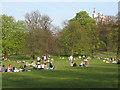
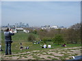
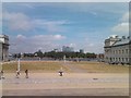
Residents of SE10 8HL enjoy a lifestyle anchored by a cluster of major retail and transport hubs. Within practical reach, you can visit Sainsburys Greenwich, Aldi Greenwich, and Tesco Cutty for all your shopping needs. These three supermarkets ensure you never have to travel far for groceries or household essentials. Transport options extend beyond rail to include five stations across different modes. Greenwich Station and Maze Hill Railway Station handle train services, while Cutty Sark DLR Station and Elverson Road serve the metro. For a change of pace, Cutty Sark for Maritime Greenwich offers a historic departure point. Ferries connect you to Greenwich Pier, Masthouse Terrace Pier, and Greenland Surrey Quays Pier. The diversity of amenities means SE10 8HL functions as a central node for the wider borough. You can catch a train, dive deeper into Greenwich Park, or sail across the river without leaving the neighbourhood's immediate vicinity. This density of facilities supports a walkable life where convenience is the primary driver of daily choices.
Amenities
Schools
Families living in SE10 8HL have access to two distinct primary education options nearby. St Ursula's Convent School operates at a satisfactory Ofsted rating and serves the local community. This school offers a Catholic educational environment which some parents may specifically seek. Alternatively, James Wolfe Primary School and Centre for the Deaf holds a good Ofsted rating. The presence of a centre for the deaf alongside general primary education highlights the inclusive approach of the local schooling network. You will not find secondary institutions directly listed for this specific postcode, meaning children likely transition to comprehensive schools further afield after age eleven. The mix of school types allows you to choose between a faith-based curriculum at St Ursula's Convent School or a specialist educational environment at James Wolfe. Both schools fall within the primary category, serving children from ages four to eleven. The data confirms these are the only two schools associated with this immediate location. Parents should consider transport routes to these specific schools when evaluating their move to SE10 8HL. The satisfactory rating of St Ursula's contrasts with the good rating of James Wolfe, requiring careful consideration based on your educational preferences.
| Rank | School | Type | Entry gender | Ages |
|---|
Explore more schools in this area
Go to Schools tabDemographics
The community in SE10 8HL is defined by stability and maturity. The median age stands at 47 years, reflecting a population dominated by adults aged between 30 and 64 years. This age profile suggests a neighbourhood suited to families with older children or downshifting professionals rather than young students. A significant 65% of households own their homes, indicating a deep-rooted sense of permanence among residents. The majority of the housing stock consists of houses, which aligns with the preference of this demographic for family-sized properties. Predominantly White residents form the core of the community, contributing to a relatively homogeneous social fabric. There is no evidence of significant demographic volatility typical of student hubs or transient rental zones. The high home ownership rate combined with the age data points to a quiet, established environment where long-term planning is the norm. You are likely to encounter neighbours who have lived in their current homes for decades. This stability often translates to better-maintained properties and a more predictable social atmosphere. The area does not experience the rapid turnover found in parts of Greenwich known for new developments. Instead, SE10 8HL offers a settled pace of life where community bonds have had time to strengthen.
Household Size
Accommodation Type
Tenure
Ethnic Group
Religion
Household Composition
Age
Household Deprivation
NS-SEC
Explore more demographic insights in this area
Go to Demographics tabPlanning
Planning Constraints
- Flood RiskPremium
- Ramsar Wetland SitesPremium
- Area of Outstanding Natural BeautyPremium
- Protected Nature ReservePremium
- Protected WoodlandPremium