Area Overview for SE10 8HB
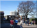
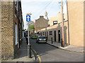
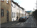
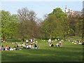
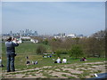
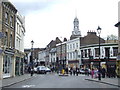
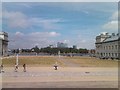
Photos of SE10 8HB

Area Information
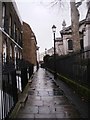
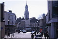
SE10 8HB is a small, residential postcode covering an area of 3944 square metres with a population of 1732 people. You will find this cluster situated within the broader Greenwich and Deptford landscape, offering a quiet residence close to major transport hubs. The density here reaches 1448 people per square kilometre, creating a compact environment where neighbours are within easy reach without the chaos of larger urban commuter zones. Daily life involves navigating a tight-knit community where the majority of residents have lived for a considerable time, evidenced by the high rate of home ownership. This specific area avoids significant planning constraints such as protected wetlands, nature reserves, or Areas of Outstanding Natural Beauty. Instead, the focus remains on providing stable residential space near cultural sites like Cutty Sark and localized retail zones. Living in SE10 8HB means accessing a functional piece of London that balances close proximity to rail and DLR links with a lower, more residential intensity. The locality is defined by its practicality and its position as a home base for adults rather than a transient student village. You can expect a setting that prioritises established housing stock over rapid development, making it suitable for those seeking a settled domestic address.
- Area Type
- Postcode
- Area Size
- 3944 m²
- Population
- 1732
- Population Density
- 1448 people/km²
The housing market in SE10 8HB reflects a clear preference for established ownership rather than short-term renting or student accommodation. With 65% of households owning their homes, this area is fundamentally an owner-occupied community. Houses are the main accommodation type, meaning you will encounter detached, semi-detached, or terraced family properties rather than high-rise flats or mansion blocks. This housing stock naturally appeals to adults seeking stability, aligning with the local median age of 47 years. Buyers looking for homes in SE10 8HB should expect traditional domestic settings rather than modern developments or purpose-built rental schemes. The small size of the postcode, covering only 3944 square metres, limits the total volume of stock, meaning competition comes from a smaller pool of available properties. The high ownership rate suggests properties here have been sorted and kept by families who do not intend to move frequently. This stability is a practical advantage for eventual buyers who wish to avoid the turnover associated with rental-heavy zones. The accommodation type data confirms that the area lacks the density of large estates or sites common in other London boroughs.
House Prices in SE10 8HB
Showing 17 properties
| Address | Type | Beds | Baths | Last Sale Price | Last Sale Date | |
|---|---|---|---|---|---|---|
| 7 Crooms Hill Grove, Greenwich, SE10 8HB | Retail | 3 | 1 | £1,186,000 | Feb 2022 | |
| Textile House, 1A Crooms Hill Grove, Greenwich, SE10 8HB | house | - | - | £378,400 | Feb 2021 | |
| 9 Crooms Hill Grove, Greenwich, SE10 8HB | house | - | - | £1,100,000 | Apr 2018 | |
| 6 Crooms Hill Grove, Greenwich, SE10 8HB | Terraced | 3 | 2 | £1,067,500 | May 2016 | |
| 13 Crooms Hill Grove, Greenwich, SE10 8HB | Terraced | 3 | - | £1,200,000 | Oct 2015 | |
| 2 Crooms Hill Grove, Greenwich, SE10 8HB | house | - | - | £846,970 | Sep 2015 | |
| 12 Crooms Hill Grove, Greenwich, SE10 8HB | Terraced | 3 | - | £1,200,000 | Jul 2015 | |
| 10 Crooms Hill Grove, Greenwich, SE10 8HB | house | - | - | £875,000 | Aug 2012 | |
| 5 Crooms Hill Grove, Greenwich, SE10 8HB | Terraced | 3 | 2 | £775,000 | Jul 2010 | |
| 14 Crooms Hill Grove, Greenwich, SE10 8HB | Terraced | 3 | - | £610,000 | Jan 2009 |
Energy Efficiency in SE10 8HB
Residents of SE10 8HB benefit from immediate access to a wide variety of retail and transport amenities within practical reach. You can shop at Sainsburys Greenwich, Aldi Greenwich, and Tesco Cutty, which provide comprehensive grocery and household necessities. For commuting, the area is serviced by five rail stations including Greenwich Station, Maze Hill Railway Station, and Deptford. Metro links are equally extensive, with five stations identified, such as Cutty Sark for Maritime Greenwich and Cutty Sark DLR Station. Frequent train services and tube connections mean you have multiple options for reaching central London or the Canary Wharf financial district. Travelers may also use five ferry options, including Greenwich Pier and Greenwich Surrey Quays Pier, adding a scenic layer to your journey. London City Airport is within reach for short-haul business travel, while bus services connect you to Victoria Coach Station and major green line routes. This dense network of options ensures that daily commutes are flexible and efficient, regardless of your preferred mode of transport.
Amenities
Schools
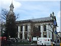
Families considering schools near SE10 8HB have access to two specific institutions listed in the immediate vicinity. St Ursula's Convent School operates as a primary establishment and holds a satisfactory Ofsted rating. You should note that while satisfactory indicates the school is meeting standards, it is not deemed particularly outstanding compared to higher-rated peers. James Wolfe Primary School and Centre for the Deaf also serves the area as a primary institution, but it carries a good Ofsted rating. This distinction in ratings means you may encounter different teaching methodologies and outcomes depending on which school you choose for your children. The presence of a special centre within the primary sector suggests the local catchment supports specific educational needs, particularly for hearing-impaired students. Neither school is rated as outstanding or good and good by yours over and above letters of the data, so manage your expectations accordingly. The mix of a convent and a specialist deaf Centre indicates a diverse educational offering without the breadth of a secondary school catchment. Living in SE10 8HB requires you to verify which specific catchment zone applies to your property address before making firm commitments.
| Rank | School | Type | Entry gender | Ages |
|---|
Explore more schools in this area
Go to Schools tabDemographics
The community within SE10 8HB is defined by an older population profile compared to the national average. The median age stands at 47 years, and the majority of residents are adults falling into the 30 to 64 year age range. This demographic reality shapes a neighbourhood where stability and long-term settlement are common traits. You will find that 65% of households own their homes, indicating a strong sense of rootedness among the population. The remaining 35% likely consist of rented occupants or shared living arrangements. Houses form the predominant accommodation type in this cluster, reflecting the architectural character of the surrounding green authority areas. The resident population is primarily White, a fact that shapes the local cultural identity and social interactions. With such a high concentration of home owners and an adult-centric age distribution, the area does not cater to a transient youth market. The demographic data suggests a quiet environment where families and established singles dominate the social landscape. You should be aware that the area is not skewed towards young professionals or retirees exclusively, but rather represents a mature working-age cohort. The specific figure of 1448 people per square kilometre supports a density that feels immediate rather than sprawling.
Household Size
Accommodation Type
Tenure
Ethnic Group
Religion
Household Composition
Age
Household Deprivation
NS-SEC
Explore more demographic insights in this area
Go to Demographics tabPlanning
Planning Constraints
- Flood RiskPremium
- Ramsar Wetland SitesPremium
- Area of Outstanding Natural BeautyPremium
- Protected Nature ReservePremium
- Protected WoodlandPremium