Area Overview for SE10 8EQ
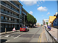
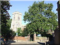
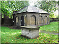
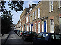
Photos of SE10 8EQ


Area Information
SE10 8EQ is a specific postcode area covering a small residential cluster in England with a population of 1,399. This compact neighbourhood functions as a distinct pocket of housing within the broader South East London landscape. Residents benefit from a sheltered environment defined by flat-style accommodation rather than detached houses. The area serves as a practical base for those seeking a contained residential experience while remaining minutes away from major transport hubs. You find yourself in a setting where daily life revolves around proximity to commercial and social nodes. Living in SE10 8EQ means accessing a network of key infrastructures immediately surrounding your doorstep. You are close to retail providers like Co-op London and Tesco Deptford, ensuring your daily shopping needs are met without significant travel time. Transport options are extensive, encompassing five national rail stations, five DLR and underground stations, and five ferry terminals within practical reach. This density of connectivity transforms the postcode into a strategic location for commuters targeting central London employment centres. The area sits near significant leisure and transport terminals, including Greenwich Pier and Masthouse Terrace Pier. London City Airport lies in your immediate vicinity, offering an alternative to major international airports for domestic and regional travel. Bus connections link you to the Green Line Coach Station and Victoria Coach Station. These facilities provide flexible mobility choices for residents navigating the city. The postcode represents a compact community where transport infrastructure supports a high volume of movement for work and leisure.
- Area Type
- Postcode
- Area Size
- Not available
- Population
- 1399
- Population Density
- 13962 people/km²
The property market in SE10 8EQ is characterised by a specific housing stock where flats dominate the landscape. Three in ten properties, or 37 per cent of the total, are owner-occupied. This statistic leaves a large majority of the housing stock in the private rental sector. You are looking at an area where renting is the primary mode of accommodation security rather than mortgage ownership. This market dynamic influences the types of homes available for purchase, though most residents are tenants. The area features flat-style accommodation as the predominant form of housing. This contrasts with regions where detached houses or semi-detached properties form the majority of the stock. The high rental rate of 63 per cent means the local economy relies heavily on consistent tenancy agreements. For buyers considering homes in SE10 8EQ, this suggests a market driven by investors and landlords targeting a specific demographic. The preponderance of flats appeals to professionals and couples seeking a low-maintenance lifestyle without the responsibility of a garden or driveway. The area functions well as a satellite community for the wider London property market. You cannot expect to find a typical suburban street of townhouses here; instead, you encounter a dense collection of flats designed for efficient use of space.
House Prices in SE10 8EQ
Showing 71 properties
Energy Efficiency in SE10 8EQ
Living in SE10 8EQ places you within easy reach of a comprehensive range of amenities. Retail options include five nearby stores, with Co-op London and Tesco Deptford serving as primary destinations for groceries and essentials. These shops are located within practical reach, reducing the need for multiple grocery store visits. Your daily commutes benefit from a robust network connecting you to the city centre. You have access to five nearby metro stations as well as five national rail hubs, including Greenwich Station, Deptford, and St Johns. For those preferring river crossings, you can reach Greenwich Pier, Masthouse Terrace Pier, and Greenland Surrey Quays Pier for ferry travel. These transport nodes provide flexibility depending on your schedule or weather conditions. Air travel options are close by, with London City Airport situated within a short distance. If you prefer road travel, the Green Line Coach Station and Victoria Coach Station are accessible for long-distance journeys. This variety of transport modes means you can adapt your travel routine to suit personal preferences or work requirements. The location supports a comfortable lifestyle with essential services readily available. You do not need to travel far for basic shopping, which is particularly convenient for residents without private vehicles. The proximity to these venues contributes to a convenient daily routine where errands take little time. The area balances residential quiet with the convenience of city-wide access.
Amenities
Schools
| Rank | School | Type | Entry gender | Ages |
|---|
Explore more schools in this area
Go to Schools tabDemographics
The community in SE10 8EQ comprises 1,399 residents with a median age of 47 years. The most common age range for locals is adults between 30 and 64 years old. This demographic profile suggests a neighbourhood dominated by established households rather than young families or single young adults. You will find that the population consists primarily of individuals in their middle years of life. Home ownership stands at 37 per cent within this postcode area. This figure indicates that a significant majority of residents rent their properties instead of owning them outright. The accommodation type is almost exclusively flats, which aligns with the higher proportion of tenants. This housing stock suits individuals or couples who prefer low-maintenance living arrangements typical of flat ownership or tenancy. The predominant ethnic group in SE10 8EQ is White. While this represents the majority, the rental context of nearly two-thirds of homes suggests a diverse flow of tenants through the area. The concentration of adults in the 30 to 64 age bracket implies a somewhat stable tenant base compared to areas with a high student population. The demographic structure does not show a heavy skew towards retirement ages, meaning the local shops and services cater to the needs of working-age adults and active seniors. You are living in a community defined by stability and established demographics rather than rapid population turnover.
Household Size
Accommodation Type
Tenure
Ethnic Group
Religion
Household Composition
Age
Household Deprivation
NS-SEC
Explore more demographic insights in this area
Go to Demographics tabPlanning
Planning Constraints
- Flood RiskPremium
- Ramsar Wetland SitesPremium
- Area of Outstanding Natural BeautyPremium
- Protected Nature ReservePremium
- Protected WoodlandPremium