Area Overview for SE10 8AZ
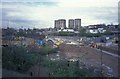
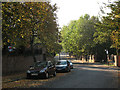
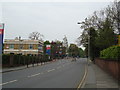
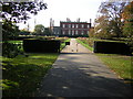
Photos of SE10 8AZ


Area Information
SE10 8AZ is a compact residential cluster located in England, defined by a specific postcode that covers only 4583 square metres. Despite its small physical footprint, the area is home to 1612 residents, resulting in a population density of 351722 people per square kilometre. This high density suggests a tightly packed urban environment where neighbours are likely within sight of one another. The area functions as a distinct micro-commune rather than a sprawling neighbourhood, offering a unique form of urban living where proximity is maximised. Daily life here is characterised by immediate access to major transport hubs and retail centres. You will find yourself just steps away from key landmarks such as Elverson Road and Cutty Sark for Maritime Greenwich. The sheer concentration of people and the limited land area create a dynamic setting where public services and amenities are clustered closely together. For anyone considering living in SE10 8AZ, the scale of the area means that convenience is a primary feature of daily existence. The environment is built for efficiency, ensuring that essential services are rarely far away, even if the variety of open space may be limited by the high density.
- Area Type
- Postcode
- Area Size
- 4583 m²
- Population
- 1612
- Population Density
- 6272 people/km²
The property market in SE10 8AZ is dominated by flats, which constitute the primary accommodation type in this postcode sector. With home ownership rates sitting at 35%, the area operates as a mixed market where purchased properties coexist with a significant rental sector. This balance is typical for London perimeter zones where high demand for space near transport links drives rental investment alongside owner-occupier purchases. Buyers looking at homes in SE10 8AZ should expect a landscape of converted buildings or purpose-built apartments designed to accommodate the area's high demographic density of 351722 people per square kilometre. The small physical area of 4583 square metres means that the available housing stock is concentrated, likely consisting of efficient, compact living spaces rather than sprawling semi-detached houses. This configuration suits the adult population aged 30 to 64 years, many of whom prioritise location over square footage. The lower rate of owner occupancy implies that you may face more competition from institutional landlords when purchasing, or have the option to rent if you are not ready to commit. For those seeking to live in SE10 8AZ, the market offers practical, density-focused living at the expense of traditional garden space. The high population count of 1612 within such a small boundary reinforces the idea that this is an investment-heavy area where property values are influenced by accessibility rather than land size.
House Prices in SE10 8AZ
Showing 48 properties
| Address | Type | Beds | Baths | Last Sale Price | Last Sale Date | |
|---|---|---|---|---|---|---|
| 44 Allison Close, London, SE10 8AZ | Flat | - | - | £370,000 | Nov 2024 | |
| 29 Allison Close, London, SE10 8AZ | Flat | - | - | £390,000 | Feb 2024 | |
| 36 Allison Close, London, SE10 8AZ | Flat | - | - | £360,000 | May 2023 | |
| 31 Allison Close, London, SE10 8AZ | Flat | - | - | £415,000 | Jun 2021 | |
| 48 Allison Close, London, SE10 8AZ | Flat | - | - | £405,000 | Oct 2020 | |
| 39 Allison Close, London, SE10 8AZ | Flat | 2 | 1 | £425,000 | Aug 2016 | |
| 2 Allison Close, London, SE10 8AZ | Flat | 2 | 1 | £325,099 | Jul 2015 | |
| 34 Allison Close, London, SE10 8AZ | Flat | - | - | £335,000 | Nov 2014 | |
| 4 Allison Close, London, SE10 8AZ | Flat | 2 | 1 | £360,000 | Jun 2014 | |
| 47 Allison Close, London, SE10 8AZ | Flat | - | - | £267,000 | Oct 2013 |
Energy Efficiency in SE10 8AZ
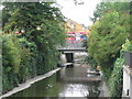
Living in SE10 8AZ offers immediate access to a diverse range of amenities within walking distance. You will find 5 retail outlets nearby, including Sainsburys Greenwich, Tesco Lewisham, and Aldi Greenwich, ensuring your weekly shopping is convenient. For social and leisure activities, the area is adjacent to 5 metro stops and iconic sites such as Cutty Sark for Maritime Greenwich and Elverson Road. Transport options are plentiful, with 5 rail stations including Greenwich Station and 5 ferry terminals like Greenwich Pier and Masthouse Terrace Pier. These water and rail connections provide an alternative to road travel, reducing congestion for daily commutes. You also have access to lodging services via 5 bus routes, including the London Green Line Coach Station for longer journeys. Cultural and travel infrastructure is supported by London City Airport, located just one airport access point away. This combination of high-street shopping, maritime heritage, and efficient public transport creates a lifestyle that balances urban convenience with easy access to the rest of the country. Residents can enjoy a mix of coastal scenery and city centre access, making this a versatile location for all ages.
Amenities
Schools
| Rank | School | Type | Entry gender | Ages |
|---|
Explore more schools in this area
Go to Schools tabDemographics
The community within SE10 8AZ reflects a mature demographic profile, centred primarily on adults aged between 30 and 64 years. The median age of residents is 47, indicating a neighbourhood where younger families and elderly residents make a smaller proportion of the total population. You will find that the housing stock largely consists of flats, a format suited to the high population density of 351722 people per square kilometre. Home ownership stands at 35%, meaning that just over a third of residents own their property outright. The remaining two-thirds are likely renters, living in properties managed by landlords or housing associations. The predominant ethnic group in the area is White, forming the majority of the local population. These figures paint a picture of a stable, established community where the average resident has substantial life experience. The prevalence of flat living combined with a high median age suggests an environment favourable to professionals and empty-nesters rather than young households with children requiring large gardens or single-family homes.
Household Size
Accommodation Type
Tenure
Ethnic Group
Religion
Household Composition
Age
Household Deprivation
NS-SEC
Explore more demographic insights in this area
Go to Demographics tabPlanning
Planning Constraints
- Flood RiskPremium
- Ramsar Wetland SitesPremium
- Area of Outstanding Natural BeautyPremium
- Protected Nature ReservePremium
- Protected WoodlandPremium