Area Overview for SE10 8AW
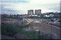
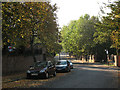
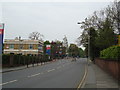
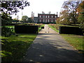
Photos of SE10 8AW


Area Information
SE10 8AW is a compact postcode covering a small residential cluster of 2.3 hectares. It currently accommodates a population of 1,612 people. This results in a very high population density of 71,383 people per square kilometre. You are looking at a tightly knit environment where daily encounters with neighbours are likely common. The area functions as a distinct pocket within the broader Lewisham and Greenwich landscape. Its size limits the space for expansive gardens compared to larger postcodes in the region. Instead, the focus is on efficient urban living within a confined footprint. For someone seeking homes in SE10 8AW, this density means you will need to adapt to close quarters. The community benefits from a compact layout that often fosters a strong sense of locality. You gain quick access to nearby hubs without the sprawl of larger districts. Living in SE10 8AW means prioritising proximity over space. The immediate surroundings offer a concentrated residential experience. This postcode serves as a specific entry point to London life for many. ### The community in SE10 8AW reflects an established demographic profile. The median age sits at 47 years. Most residents fall into the adults' age range of 30 to 64 years. This indicates a mature neighbourhood with fewer young families or retirees compared to younger areas. Accommodation types are predominantly flats. This structural reality influences the lifestyle and household arrangement for those living there. Home ownership stands at 35 per cent. This means the majority of residents are likely renting their properties. You should expect a community of tenants balancing with owner-occupiers. The predominant ethnic group in this area is White. These figures define the social fabric of the estate. With over half the population aged 30 and above, the area retains a stable character. Families in the 30-64 bracket form the core of the social round. The flat-based accommodation supports shared living or single occupancies rather than large households. Understanding these numbers helps you gauge the vibrancy and composition of life here. ### The housing stock in SE10 8AW is defined by its accommodation type: flats. This predominance suggests a layout suited for urban living rather than detached houses or semi-detached homes. Home ownership rates sit at 35 per cent. This fairly low figure signals a market with significant rental activity. You are more likely to encounter tenancies than outright purchases when browsing this postcode. For buyers, this implies competition among investors and landlords alongside individual purchasers. The small area size of 2.3 hectares further constrains the variety of property styles you can find. Most homes here cater to those comfortable with vertical living. FLats are built to maximise the limited 2.3 hectares of land. This configuration is typical for postcodes with high population density. If you seek a family home with a garden, SE10 8AW presents limited options due to the flat nature. Conversely, if you require a low-maintenance flat, this market aligns well. The low ownership rate also affects price stability and negotiation leverage differently than in owner-occupied zones. ### Connectivity for residents of SE10 8AW is robust, supporting both remote work and daily commutes. Digital infrastructure scores high across the board. Fixed broadband quality scores 87 on a scale of 100. This translates to an excellent standard for video calls, large file transfers, and streaming services. Mobile coverage alongside scores 85 on the same scale. This level of signal strength ensures reliable connectivity for you at home and while out. Working from home in this postcode is practical, given these strong digital foundations. Users can expect minimal interruption to their online workflows. High-speed internet is available for residents relying on cloud-based applications. The area is well-served by transport links beyond just digital connections. Nearby metro stations include Elverson Road, Deptford Bridge, and Cutty Sark for Maritime Greenwich. Railway options feature Lewisham, Greenwich, and St Johns. A bus service from the Green Line Coach Station offers further local links. You have multiple layers of transport access to facilitate your daily routine without reliance on a single provider. ### Your daily lifestyle in SE10 8AW benefits from five major retail locations within easy reach. You can shop at Tesco Lewisham, Asda Lewisham, and Sainsburys Greenwich for your groceries. Convenience is a key feature for residents living in this dense postcode. Traffic flows through five metro stations including Elverson Road and Deptford Bridge. You can transfer between bus, rail, and water transport effortlessly. Rail connections to Lewisham Station and Greenwich Station reduce commute times significantly. The Greenwich Crossing and Ferry routes at Greenwich Pier and Greenland Surrey Quays add variety to your travel plans. London City Airport lies just one transfer away for business or leisure flights. You also have access via the Green Line Coach Station for longer journeys. These amenities create a practical network for getting goods, work, and recreation. Dining and shopping options are immediate without requiring long travel. The proximity of these six transport and retail categories ensures you do not need to venture far to manage your week. ### Safety and environmental data for SE10 8AW show a generally secure living environment. The crime risk assessment passes with a score of 75. This indicates low crime rates below the average for the region. You can expect a neighbourhood where safety is a priority. Flood risk is rated as a pass with a score of zero. The area has low flood risk coverage, protecting your home from water damage. Planning constraints are also clear with zero scores for Ramsar wetland sites. There is no AONB coverage or protected nature reserve coverage in your immediate vicinity. Nor is there protected woodland within the postcode boundaries. These zero scores mean no significant environmental restrictions apply to your property. The absence of these planning constraints simplifies potential future development or extension plans. For safety, the low crime score provides reassurance that the area is controlled and monitored effectively. Environmental assessments confirm your home is free from specific natural hazards. This combination of low crime and low environmental risk creates a stable backdrop for living. ### Who typically lives in SE10 8AW?The area has a median age of 47 years, with most residents being adults between 30 and 64 years old. Home ownership stands at just 35%, meaning the majority of people in this postcode are renting. The predominant ethnic group is White. How is the transport and digital connectivity?Digital infrastructure is excellent with a fixed broadband score of 87 and mobile coverage of 85 out of 100. Travel links include five metro stations like Deptford Bridge, major railway hubs at Lewisham and Greenwich, plus ferry terminals. A Green Line Coach Station is also nearby. Is the area safe and free from environmental risks?Yes. The crime risk score is 75, indicating an area with below-average crime rates. Environmental assessments pass with zero scores for flood risk, Ramsar sites, AONB, and protected woodlands. This means minimal environmental constraints or safety concerns for residents. ### What kind of property will I find in SE10 8AW?The accommodation type in this postcode is predominantly flats. With a population density of over 71,000 people per sq km, the housing stock is built for efficient urban living rather than large detached homes. You will need an urban mindset to live here. Which amenities serve the residents of SE10 8AW?Residents have five retail options including Tesco Lewisham and Asda Lewisham. Transport hubs include Elieter Road, Deptford Bridge, and Cutty Sark stations. You can also access Greenwich Pier for ferries or the London City Airport for flying. Is SE10 8AW suitable for those working from home?The area excels in digital connectivity. Fixed broadband scores 87 and mobile scores 85, both near the top of the quality scale. You can expect reliable high-speed internet and strong mobile signals to support daily work tasks without interruption.
- Area Type
- Postcode
- Area Size
- 2.3 hectares
- Population
- 1612
- Population Density
- 6272 people/km²
The housing stock in SE10 8AW is defined by its accommodation type: flats. This predominance suggests a layout suited for urban living rather than detached houses or semi-detached homes. Home ownership rates sit at 35 per cent. This fairly low figure signals a market with significant rental activity. You are more likely to encounter tenancies than outright purchases when browsing this postcode. For buyers, this implies competition among investors and landlords alongside individual purchasers. The small area size of 2.3 hectares further constrains the variety of property styles you can find. Most homes here cater to those comfortable with vertical living. FLats are built to maximise the limited 2.3 hectares of land. This configuration is typical for postcodes with high population density. If you seek a family home with a garden, SE10 8AW presents limited options due to the flat nature. Conversely, if you require a low-maintenance flat, this market aligns well. The low ownership rate also affects price stability and negotiation leverage differently than in owner-occupied zones. ### Connectivity for residents of SE10 8AW is robust, supporting both remote work and daily commutes. Digital infrastructure scores high across the board. Fixed broadband quality scores 87 on a scale of 100. This translates to an excellent standard for video calls, large file transfers, and streaming services. Mobile coverage alongside scores 85 on the same scale. This level of signal strength ensures reliable connectivity for you at home and while out. Working from home in this postcode is practical, given these strong digital foundations. Users can expect minimal interruption to their online workflows. High-speed internet is available for residents relying on cloud-based applications. The area is well-served by transport links beyond just digital connections. Nearby metro stations include Elverson Road, Deptford Bridge, and Cutty Sark for Maritime Greenwich. Railway options feature Lewisham, Greenwich, and St Johns. A bus service from the Green Line Coach Station offers further local links. You have multiple layers of transport access to facilitate your daily routine without reliance on a single provider. ### Your daily lifestyle in SE10 8AW benefits from five major retail locations within easy reach. You can shop at Tesco Lewisham, Asda Lewisham, and Sainsburys Greenwich for your groceries. Convenience is a key feature for residents living in this dense postcode. Traffic flows through five metro stations including Elverson Road and Deptford Bridge. You can transfer between bus, rail, and water transport effortlessly. Rail connections to Lewisham Station and Greenwich Station reduce commute times significantly. The Greenwich Crossing and Ferry routes at Greenwich Pier and Greenland Surrey Quays add variety to your travel plans. London City Airport lies just one transfer away for business or leisure flights. You also have access via the Green Line Coach Station for longer journeys. These amenities create a practical network for getting goods, work, and recreation. Dining and shopping options are immediate without requiring long travel. The proximity of these six transport and retail categories ensures you do not need to venture far to manage your week. ### Safety and environmental data for SE10 8AW show a generally secure living environment. The crime risk assessment passes with a score of 75. This indicates low crime rates below the average for the region. You can expect a neighbourhood where safety is a priority. Flood risk is rated as a pass with a score of zero. The area has low flood risk coverage, protecting your home from water damage. Planning constraints are also clear with zero scores for Ramsar wetland sites. There is no AONB coverage or protected nature reserve coverage in your immediate vicinity. Nor is there protected woodland within the postcode boundaries. These zero scores mean no significant environmental restrictions apply to your property. The absence of these planning constraints simplifies potential future development or extension plans. For safety, the low crime score provides reassurance that the area is controlled and monitored effectively. Environmental assessments confirm your home is free from specific natural hazards. This combination of low crime and low environmental risk creates a stable backdrop for living. ### Who typically lives in SE10 8AW?The area has a median age of 47 years, with most residents being adults between 30 and 64 years old. Home ownership stands at just 35%, meaning the majority of people in this postcode are renting. The predominant ethnic group is White. How is the transport and digital connectivity?Digital infrastructure is excellent with a fixed broadband score of 87 and mobile coverage of 85 out of 100. Travel links include five metro stations like Deptford Bridge, major railway hubs at Lewisham and Greenwich, plus ferry terminals. A Green Line Coach Station is also nearby. Is the area safe and free from environmental risks?Yes. The crime risk score is 75, indicating an area with below-average crime rates. Environmental assessments pass with zero scores for flood risk, Ramsar sites, AONB, and protected woodlands. This means minimal environmental constraints or safety concerns for residents. ### What kind of property will I find in SE10 8AW?The accommodation type in this postcode is predominantly flats. With a population density of over 71,000 people per sq km, the housing stock is built for efficient urban living rather than large detached homes. You will need an urban mindset to live here. Which amenities serve the residents of SE10 8AW?Residents have five retail options including Tesco Lewisham and Asda Lewisham. Transport hubs include Elieter Road, Deptford Bridge, and Cutty Sark stations. You can also access Greenwich Pier for ferries or the London City Airport for flying. Is SE10 8AW suitable for those working from home?The area excels in digital connectivity. Fixed broadband scores 87 and mobile scores 85, both near the top of the quality scale. You can expect reliable high-speed internet and strong mobile signals to support daily work tasks without interruption.
House Prices in SE10 8AW
Showing 42 properties
| Address | Type | Beds | Baths | Last Sale Price | Last Sale Date | |
|---|---|---|---|---|---|---|
| 36A Dartmouth Row, London, SE10 8AW | Semi-detached | 4 | 2 | £2,845,000 | Oct 2023 | |
| 7 Dartmouth Row, London, SE10 8AW | house | 3 | 2 | £1,210,000 | Aug 2022 | |
| 34 Dartmouth Row, London, SE10 8AW | Retail | 6 | 3 | £3,950,000 | Jul 2022 | |
| 18A Dartmouth Row, London, SE10 8AW | Terraced | 2 | 2 | £643,000 | Dec 2021 | |
| 36 Dartmouth Row, London, SE10 8AW | Terraced | - | - | £2,640,000 | Aug 2021 | |
| 44 Dartmouth Row, London, SE10 8AW | house | - | - | £2,930,000 | Mar 2021 | |
| 13 Dartmouth Row, London, SE10 8AW | Terraced | 5 | 2 | £1,500,000 | Dec 2020 | |
| 22 Dartmouth Row, London, SE10 8AW | Terraced | 5 | 3 | £2,150,000 | Feb 2020 | |
| 9 Dartmouth Row, London, SE10 8AW | Flat | 2 | 2 | £1,075,000 | Aug 2017 | |
| 26 Dartmouth Row, London, SE10 8AW | Detached | 6 | 4 | £4,625,000 | Sep 2016 |
Energy Efficiency in SE10 8AW
Your daily lifestyle in SE10 8AW benefits from five major retail locations within easy reach. You can shop at Tesco Lewisham, Asda Lewisham, and Sainsburys Greenwich for your groceries. Convenience is a key feature for residents living in this dense postcode. Traffic flows through five metro stations including Elverson Road and Deptford Bridge. You can transfer between bus, rail, and water transport effortlessly. Rail connections to Lewisham Station and Greenwich Station reduce commute times significantly. The Greenwich Crossing and Ferry routes at Greenwich Pier and Greenland Surrey Quays add variety to your travel plans. London City Airport lies just one transfer away for business or leisure flights. You also have access via the Green Line Coach Station for longer journeys. These amenities create a practical network for getting goods, work, and recreation. Dining and shopping options are immediate without requiring long travel. The proximity of these six transport and retail categories ensures you do not need to venture far to manage your week. ### Safety and environmental data for SE10 8AW show a generally secure living environment. The crime risk assessment passes with a score of 75. This indicates low crime rates below the average for the region. You can expect a neighbourhood where safety is a priority. Flood risk is rated as a pass with a score of zero. The area has low flood risk coverage, protecting your home from water damage. Planning constraints are also clear with zero scores for Ramsar wetland sites. There is no AONB coverage or protected nature reserve coverage in your immediate vicinity. Nor is there protected woodland within the postcode boundaries. These zero scores mean no significant environmental restrictions apply to your property. The absence of these planning constraints simplifies potential future development or extension plans. For safety, the low crime score provides reassurance that the area is controlled and monitored effectively. Environmental assessments confirm your home is free from specific natural hazards. This combination of low crime and low environmental risk creates a stable backdrop for living. ### Who typically lives in SE10 8AW?The area has a median age of 47 years, with most residents being adults between 30 and 64 years old. Home ownership stands at just 35%, meaning the majority of people in this postcode are renting. The predominant ethnic group is White. How is the transport and digital connectivity?Digital infrastructure is excellent with a fixed broadband score of 87 and mobile coverage of 85 out of 100. Travel links include five metro stations like Deptford Bridge, major railway hubs at Lewisham and Greenwich, plus ferry terminals. A Green Line Coach Station is also nearby. Is the area safe and free from environmental risks?Yes. The crime risk score is 75, indicating an area with below-average crime rates. Environmental assessments pass with zero scores for flood risk, Ramsar sites, AONB, and protected woodlands. This means minimal environmental constraints or safety concerns for residents. ### What kind of property will I find in SE10 8AW?The accommodation type in this postcode is predominantly flats. With a population density of over 71,000 people per sq km, the housing stock is built for efficient urban living rather than large detached homes. You will need an urban mindset to live here. Which amenities serve the residents of SE10 8AW?Residents have five retail options including Tesco Lewisham and Asda Lewisham. Transport hubs include Elieter Road, Deptford Bridge, and Cutty Sark stations. You can also access Greenwich Pier for ferries or the London City Airport for flying. Is SE10 8AW suitable for those working from home?The area excels in digital connectivity. Fixed broadband scores 87 and mobile scores 85, both near the top of the quality scale. You can expect reliable high-speed internet and strong mobile signals to support daily work tasks without interruption.
Amenities
Schools
| Rank | School | Type | Entry gender | Ages |
|---|
Explore more schools in this area
Go to Schools tabDemographics
The community in SE10 8AW reflects an established demographic profile. The median age sits at 47 years. Most residents fall into the adults' age range of 30 to 64 years. This indicates a mature neighbourhood with fewer young families or retirees compared to younger areas. Accommodation types are predominantly flats. This structural reality influences the lifestyle and household arrangement for those living there. Home ownership stands at 35 per cent. This means the majority of residents are likely renting their properties. You should expect a community of tenants balancing with owner-occupiers. The predominant ethnic group in this area is White. These figures define the social fabric of the estate. With over half the population aged 30 and above, the area retains a stable character. Families in the 30-64 bracket form the core of the social round. The flat-based accommodation supports shared living or single occupancies rather than large households. Understanding these numbers helps you gauge the vibrancy and composition of life here. ### The housing stock in SE10 8AW is defined by its accommodation type: flats. This predominance suggests a layout suited for urban living rather than detached houses or semi-detached homes. Home ownership rates sit at 35 per cent. This fairly low figure signals a market with significant rental activity. You are more likely to encounter tenancies than outright purchases when browsing this postcode. For buyers, this implies competition among investors and landlords alongside individual purchasers. The small area size of 2.3 hectares further constrains the variety of property styles you can find. Most homes here cater to those comfortable with vertical living. FLats are built to maximise the limited 2.3 hectares of land. This configuration is typical for postcodes with high population density. If you seek a family home with a garden, SE10 8AW presents limited options due to the flat nature. Conversely, if you require a low-maintenance flat, this market aligns well. The low ownership rate also affects price stability and negotiation leverage differently than in owner-occupied zones. ### Connectivity for residents of SE10 8AW is robust, supporting both remote work and daily commutes. Digital infrastructure scores high across the board. Fixed broadband quality scores 87 on a scale of 100. This translates to an excellent standard for video calls, large file transfers, and streaming services. Mobile coverage alongside scores 85 on the same scale. This level of signal strength ensures reliable connectivity for you at home and while out. Working from home in this postcode is practical, given these strong digital foundations. Users can expect minimal interruption to their online workflows. High-speed internet is available for residents relying on cloud-based applications. The area is well-served by transport links beyond just digital connections. Nearby metro stations include Elverson Road, Deptford Bridge, and Cutty Sark for Maritime Greenwich. Railway options feature Lewisham, Greenwich, and St Johns. A bus service from the Green Line Coach Station offers further local links. You have multiple layers of transport access to facilitate your daily routine without reliance on a single provider. ### Your daily lifestyle in SE10 8AW benefits from five major retail locations within easy reach. You can shop at Tesco Lewisham, Asda Lewisham, and Sainsburys Greenwich for your groceries. Convenience is a key feature for residents living in this dense postcode. Traffic flows through five metro stations including Elverson Road and Deptford Bridge. You can transfer between bus, rail, and water transport effortlessly. Rail connections to Lewisham Station and Greenwich Station reduce commute times significantly. The Greenwich Crossing and Ferry routes at Greenwich Pier and Greenland Surrey Quays add variety to your travel plans. London City Airport lies just one transfer away for business or leisure flights. You also have access via the Green Line Coach Station for longer journeys. These amenities create a practical network for getting goods, work, and recreation. Dining and shopping options are immediate without requiring long travel. The proximity of these six transport and retail categories ensures you do not need to venture far to manage your week. ### Safety and environmental data for SE10 8AW show a generally secure living environment. The crime risk assessment passes with a score of 75. This indicates low crime rates below the average for the region. You can expect a neighbourhood where safety is a priority. Flood risk is rated as a pass with a score of zero. The area has low flood risk coverage, protecting your home from water damage. Planning constraints are also clear with zero scores for Ramsar wetland sites. There is no AONB coverage or protected nature reserve coverage in your immediate vicinity. Nor is there protected woodland within the postcode boundaries. These zero scores mean no significant environmental restrictions apply to your property. The absence of these planning constraints simplifies potential future development or extension plans. For safety, the low crime score provides reassurance that the area is controlled and monitored effectively. Environmental assessments confirm your home is free from specific natural hazards. This combination of low crime and low environmental risk creates a stable backdrop for living. ### Who typically lives in SE10 8AW?The area has a median age of 47 years, with most residents being adults between 30 and 64 years old. Home ownership stands at just 35%, meaning the majority of people in this postcode are renting. The predominant ethnic group is White. How is the transport and digital connectivity?Digital infrastructure is excellent with a fixed broadband score of 87 and mobile coverage of 85 out of 100. Travel links include five metro stations like Deptford Bridge, major railway hubs at Lewisham and Greenwich, plus ferry terminals. A Green Line Coach Station is also nearby. Is the area safe and free from environmental risks?Yes. The crime risk score is 75, indicating an area with below-average crime rates. Environmental assessments pass with zero scores for flood risk, Ramsar sites, AONB, and protected woodlands. This means minimal environmental constraints or safety concerns for residents. ### What kind of property will I find in SE10 8AW?The accommodation type in this postcode is predominantly flats. With a population density of over 71,000 people per sq km, the housing stock is built for efficient urban living rather than large detached homes. You will need an urban mindset to live here. Which amenities serve the residents of SE10 8AW?Residents have five retail options including Tesco Lewisham and Asda Lewisham. Transport hubs include Elieter Road, Deptford Bridge, and Cutty Sark stations. You can also access Greenwich Pier for ferries or the London City Airport for flying. Is SE10 8AW suitable for those working from home?The area excels in digital connectivity. Fixed broadband scores 87 and mobile scores 85, both near the top of the quality scale. You can expect reliable high-speed internet and strong mobile signals to support daily work tasks without interruption.
Household Size
Accommodation Type
Tenure
Ethnic Group
Religion
Household Composition
Age
Household Deprivation
NS-SEC
Explore more demographic insights in this area
Go to Demographics tabPlanning
Planning Constraints
- Flood RiskPremium
- Ramsar Wetland SitesPremium
- Area of Outstanding Natural BeautyPremium
- Protected Nature ReservePremium
- Protected WoodlandPremium