Area Overview for SE10 0UJ
Photos of SE10 0UJ


Area Information
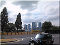
SE10 0UJ is a small residential cluster covering just 5.4 hectares within the wider Greenwich postcode area. The population here stands at 1,479 people. This compact size creates a dense living environment where the feel of the neighbourhood is shaped by its concentration of residents. Living in SE10 0UJ means being part of a tightly knit community where proximity to transport links and city amenities is a defining characteristic of daily life. The area functions as a practical choice for those who want to be minutes away from central London connections while remaining in a distinct postcode zone. The high population density of 27,609 people per square kilometre suggests a vibrant, busy atmosphere where space is at a premium. You will find yourself surrounded by active neighbours and immediate access to major infrastructure rather than expansive green belts. This specific postal code offers a solution for buyers who prioritise location convenience above all else. The area represents a slice of inner London living where every step likely takes you closer to work or leisure facilities. It is an urban pocket designed for efficiency and accessibility.
- Area Type
- Postcode
- Area Size
- 5.4 hectares
- Population
- 1479
- Population Density
- 13745 people/km²
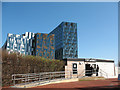
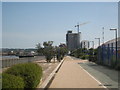
The property market in SE10 0UJ is defined by a significant dominance of private renting over ownership. Only 28% of residents own their homes, which means that seven out of ten people are renting their properties. This statistic clearly marks the area as a bustling rental hub rather than a typical owner-occupied estate. Flats form the main accommodation type here, reflecting the high population density of 27,609 people per square kilometre. You should anticipate a housing stock comprised largely of apartments suited to single professionals or small families. This type of inventory is ideal for those seeking low-maintenance living in a central location. The prevalence of flats and the low ownership rate indicate high turnover in the local market. Buyers looking for a family home with a large garden might find this area less suited to their needs compared to suburbs with higher owner-occupier rates. Conversely, investors or renters will find familiar terrain here. The small area size of 5.4 hectares limits the variety of housing available within the immediate postal code. When viewing homes in SE10 0UJ, expect to see modern, compact flats designed for urban efficiency. This market structure serves the many young adults and workers who prioritise location over property ownership.
House Prices in SE10 0UJ
Showing 66 properties
| Address | Type | Beds | Baths | Last Sale Price | Last Sale Date | |
|---|---|---|---|---|---|---|
| Flat 16, 10 Reminder Lane, Greenwich, SE10 0UJ | Flat | 1 | 1 | - | - | |
| Flat 21, 10 Reminder Lane, Greenwich, SE10 0UJ | Flat | 1 | 1 | - | - | |
| Flat 20, 3 Pilot Walk, Greenwich, SE10 0UJ | Flat | - | - | - | - | |
| 1 Pilot Walk, Greenwich, SE10 0UJ | Flat | - | - | - | - | |
| Flat 1, 2 Reminder Lane, Greenwich, SE10 0UJ | Flat | - | - | - | - | |
| Flat 13, 2 Reminder Lane, Greenwich, SE10 0UJ | Flat | - | - | - | - | |
| Flat 17, 2 Reminder Lane, Greenwich, SE10 0UJ | Flat | - | - | - | - | |
| Flat 27, 2 Reminder Lane, Greenwich, SE10 0UJ | Flat | - | - | - | - | |
| Flat 19, 2 Reminder Lane, Greenwich, SE10 0UJ | Flat | - | - | - | - | |
| Flat 19, 10 Reminder Lane, Greenwich, SE10 0UJ | Flat | - | - | - | - |
Energy Efficiency in SE10 0UJ
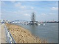
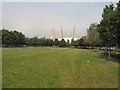
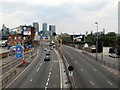
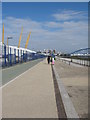
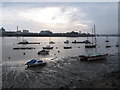
Living in SE10 0UJ places a wide array of amenities at your fingertips. Five retail outlets are located nearby, including Co-op Greenwich, Tesco Greenwich, and a second Co-op branch. These shops provide essential grocery shopping and daily necessities without requiring a long journey. Your commute begins with excellent transport options. Five metro stations serve the area, featuring IFS Cloud Greenwich Peninsula, North Greenwich, and West Silvertown DLR Station. You can also reach five railway stations, such as Westcombe Park, Custom House, and Charlton. If you enjoy water travel, ferries depart from North Greenwich Pier, Royal Wharf Pier, and East India Pier. London City Airport is another option for longer trips or business flights. For those who prefer buses, the Whipps Cross Bus Interchange offers further connectivity. The proximity to five different transport hubs means you have numerous choices for your daily commute. This density of services supports a self-sufficient lifestyle where most needs can be met locally. Residents do not need to travel far to find food, entertainment, or transport links. The concentration of these facilities within a small geographic footprint enhances the overall convenience of living in this specific postcode.
Amenities
Schools
| Rank | School | Type | Entry gender | Ages |
|---|
Explore more schools in this area
Go to Schools tabDemographics
The community within SE10 0UJ carries a median age of 22 years. This figure indicates a youthful population profile compared to the wider city. Despite the low median age, adults aged between 30 and 64 years represent the most common age range for residents. You can expect to meet a significant number of working-age individuals in this area. Home ownership remains relatively low at 28%, suggesting that rental living is the predominant mode of accommodation for the majority of households. Flats constitute the primary type of housing structure in this postcode area. This housing stock aligns with the high-density nature of the location and the lower rate of owner occupancy. The predominant ethnic group in SE10 0UJ is White, though the area benefits from the dynamic diversity typical of East London. The demographic mix supports a youthful, transient energy where professional careers and urban lifestyles often take centre stage. Young professionals and city workers likely form the backbone of this neighbourhood. The combination of a young median age with a large working-age adult population creates a vicinity focused on career progression and modern living standards.
Household Size
Accommodation Type
Tenure
Ethnic Group
Religion
Household Composition
Age
Household Deprivation
NS-SEC
Explore more demographic insights in this area
Go to Demographics tabPlanning
Planning Constraints
- Flood RiskPremium
- Ramsar Wetland SitesPremium
- Area of Outstanding Natural BeautyPremium
- Protected Nature ReservePremium
- Protected WoodlandPremium