Area Overview for SE10 0SG
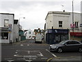
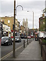
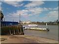
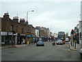
Photos of SE10 0SG

Area Information
Living in SE10 0SG means residing in a highly concentrated residential cluster covering just 1361 m². This tiny footprint supports a population of 1890 people, creating an exceptionally dense environment where neighbours are inevitably close by. The area functions as a specific postcode pocket within the wider Lambeth region, offering a distinct intensity that differs from broader suburban spreads. For those seeking character through density, the sheer volume of people in such a small physical space defines the daily rhythm of the neighbourhood. You will experience a community where spatial proximity is the dominant feature of home life. The small area size ensures that everything happens within a microscopic radius, removing the need for long commutes across the postcode. Challenges of such high density exist, yet the convenience of having an entire community contained within a few hundred metres remains a tangible reality for current residents. Understanding the scale of SE10 0SG is essential for grasping the unique pace and proximity of life here.
- Area Type
- Postcode
- Area Size
- 1361 m²
- Population
- 1890
- Population Density
- 10140 people/km²
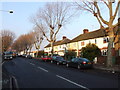
The housing stock in SE10 0SG is defined by houses rather than blocks of flats or terraced rows found in denser inner city zones. With a home ownership rate of 47%, the area maintains a steady proportion of residents who have secured their own property compared to renters. This balance indicates a market where ownership and tenancy coexist without one completely overshadowing the other. Buyers looking at homes in SE10 0SG will find a stock characterised by residential independence rather than the high-rise living common in Canary Wharf or Docklands. The low area size of just 1361 m² implies that every plot is maximised, leading to a landscape where land value is concentrated. Prospective buyers should expect a compact environment where property boundaries are close and the housing mix remains consistent with the area's historical development. The predominance of houses suggests a preference for traditional living arrangements even within this tightly packed postcode.
House Prices in SE10 0SG
Showing 7 properties
| Address | Type | Beds | Baths | Last Sale Price | Last Sale Date | |
|---|---|---|---|---|---|---|
| 1B Marlton Street, Greenwich, SE10 0SG | Retail | 2 | 1 | £575,000 | Jan 2022 | |
| 1A Marlton Street, Greenwich, SE10 0SG | Semi-detached | 2 | 1 | £10,000 | Sep 2021 | |
| 3 Marlton Street, Greenwich, SE10 0SG | house | - | - | £348,750 | Oct 2018 | |
| 2 Marlton Street, Greenwich, SE10 0SG | Terraced | - | - | - | - | |
| 5 Marlton Street, Greenwich, SE10 0SG | house | - | - | - | - | |
| 1 Marlton Street, Greenwich, SE10 0SG | house | - | - | - | - | |
| 4 Marlton Street, Greenwich, SE10 0SG | house | - | - | - | - |
Energy Efficiency in SE10 0SG
Residents of SE10 0SG enjoy immediate access to a wide array of transport and retail options despite the small physical size of the area. Five retail outlets serve the local community, including Sainsburys Greenwich, Iceland Trafalgar, and Co-op Greenwich, providing essential grocery needs just a short walk away. Travel by rail is equally convenient with five stations nearby, including Westcombe Park, Maze Hill Railway Station, and Charlton Station. Five ferry terminals, such as Royal Wharf Pier, Greenwich Pier, and North Greenwich Pier, offer direct water crossings to the Capital. Additionally, five metro stops including IFS Cloud Greenwich Peninsula and Island Gardens provide access to the DLR network. Residents living in SE10 0SG benefit from being surrounded by five airport connections including London City Airport. This density of transport links means you rarely need a car for daily commutes. The concentration of amenities transforms the area into a hub where work, shopping, and leisure are all within immediate reach.
Amenities
Schools
Families living in SE10 0SG have access to a selection of educational institutions within practical reach. Halstow Primary School appears twice in the local directory, confirming its presence as a key educational hub for the area. It operates as a primary school and holds an Ofsted rating of good, signalling a standard of education that meets government expectations. Westcombe Centre serves as another nearby option, listed specifically as an other type facility, likely providing special educational needs or alternative provision. This combination of a highly rated primary school and a specialist centre supports a range of family needs. The presence of these specific institutions means parents do not need to travel far to secure schooling for their children. When evaluating homes in SE10 0SG, the proximity to Halstow Primary School and Westcombe Centre forms a central part of the location's appeal for school-run households.
| Rank | School | Type | Entry gender | Ages |
|---|
Explore more schools in this area
Go to Schools tabDemographics
The community in SE10 0SG reflects a mature demographic profile with a median age of 47 years. Most residents fall into the adult age range between 30 and 64 years, indicating a settled population likely focused on stability and family formation. Nearly half of the households, standing at exactly 47%, own their homes outright or with a mortgage, while the remainder rents. This balanced split suggests a mixed economy of residents rather than a market dominated solely by landlords or owner-occupiers. The accommodation type is predominantly houses, providing suburban-style living details for a density that might usually suggest flats. Ethnic diversity shows White as the predominant group, though one-third of the community represents other ethnicities. This composition creates a suburban atmosphere typical of older parts of Southeast London where established families have lived for generations.
Household Size
Accommodation Type
Tenure
Ethnic Group
Religion
Household Composition
Age
Household Deprivation
NS-SEC
Explore more demographic insights in this area
Go to Demographics tabPlanning
Planning Constraints
- Flood RiskPremium
- Ramsar Wetland SitesPremium
- Area of Outstanding Natural BeautyPremium
- Protected Nature ReservePremium
- Protected WoodlandPremium