Area Overview for SE10 0RX
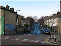
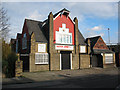
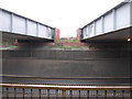
Photos of SE10 0RX

Area Information
living in SE10 0RX offers a distinct experience within this specific postcode area. This small residential cluster covers just 3755 square metres and houses a population of 1890 people. The population density stands at 503325 people per square kilometre, indicating a tightly packed environment. You are in a setting where space is at a premium, as the area is defined by its compact footprint rather than broad open landscapes. While the location offers close proximity to major transport hubs like Charlton Station and Greenwich Pier, the physical space available for residents is limited. Daily life here means navigating a concentrated neighbourhood where local facilities are within immediate reach. The area functions as a dense residential node, connecting directly to the wider transport network of South East London. For those seeking high-density living with quick access to amenities, this postcode represents a functional slice of South East London.
- Area Type
- Postcode
- Area Size
- 3755 m²
- Population
- 1890
- Population Density
- 10140 people/km²
Buying a home in SE10 0RX means entering a market defined by houses rather than flats or tower blocks. The accommodation type data confirms that houses are the standard building style across this cluster. Home ownership stands at 47%, which suggests a balanced market where buyers can secure mortgages to purchase property. However, the small area size of 3755 square metres limits the total number of available properties. Potential buyers must act quickly, as there are not many homes for sale within this specific postcode boundary. The high population density of 503325 per square kilometre correlates with the prevalence of attached housing or terraced streets. Investors or first-time buyers looking specifically for a house in this location need to focus their search tightly. The area does not offer the variety of flat conversions found in larger development zones. Instead, the property stock consists of traditional housing suited to the local demographic. Ownership rates suggest that the neighbourhood is reasonably stable and not dominated exclusively by the private rental sector.
House Prices in SE10 0RX
Showing 8 properties
| Address | Type | Beds | Baths | Last Sale Price | Last Sale Date | |
|---|---|---|---|---|---|---|
| 6 Denham Street, Greenwich, SE10 0RX | house | 3 | 2 | £485,000 | Aug 2017 | |
| 1 Denham Street, Greenwich, SE10 0RX | house | 1 | 1 | £320,000 | Jul 2011 | |
| 5 Denham Street, Greenwich, SE10 0RX | Terraced | 3 | - | £239,000 | Oct 2008 | |
| 7 Denham Street, Greenwich, SE10 0RX | Semi-detached | 3 | 2 | £285,000 | May 2007 | |
| 2 Denham Street, Greenwich, SE10 0RX | Terraced | 3 | 2 | £232,000 | Jan 2006 | |
| 4 Denham Street, Greenwich, SE10 0RX | house | - | - | £190,000 | Aug 2003 | |
| 3 Denham Street, Greenwich, SE10 0RX | house | - | - | £195,000 | Jan 2003 | |
| Cube, Purvis House, 18 Denham Street, Greenwich, SE10 0RX | studentAccommodation | - | - | - | - |
Energy Efficiency in SE10 0RX
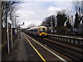
Convenience defines the lifestyle available to residents of SE10 0RX. You have immediate access to five nearby railway stations, including Westcombe Park, Maze Hill, and Charlton. These rail links provide direct connections to the wider London network. Retail options are equally accessible, with five notable shops serving the community. Sainsburys Greenwich, Asda Charlton, and Co-op Greenwich offer ranges of groceries and household essentials. Ferry services provide an alternative transport route via Royal Wharf Pier, Greenwich Pier, and North Greenwich Pier. The DLR runs through the area, offering stations like IFS Cloud Greenwich Peninsula and Island Gardens. London City Airport is located nearby, facilitating international travel for some residents. This density of amenities ensures daily errands require minimal travel time. The availability of five retail outlets and multiple transport hubs creates a self-sufficient neighbourhood. Residents do not need to travel far for shopping or commuting.
Amenities
Schools
Families relying on schools near SE10 0RX have two primary options within the data. Halstow Primary School is listed as a nearby primary institution. It holds a good Ofsted rating, indicating a satisfactory standard of education according to official inspections. Westcombe Centre appears in the list of nearest schools, though it is classified as an other type of facility. This mix provides a degree of educational choice for parents living in the cluster. While a dedicated secondary school is not explicitly named in the provided data, the presence of a primary school with a good rating offers reassurance for younger children. The "other" category school suggests additional academic or community resources may be located nearby. Residents dependent on private institutions will find Halstow Primary School as a key public reference point. The concentration of schools near the cluster supports the residential nature of the neighbourhood. Parents can utilise the good rating of Halstow when assessing local educational quality.
| Rank | School | Type | Entry gender | Ages |
|---|
Explore more schools in this area
Go to Schools tabDemographics
The community in SE10 0RX reflects an older demographic profile. The median age is 47, and most residents fall within the 30-64 year range. This indicates a mature neighbourhood where long-term families and established households dominate the local population. Home ownership levels sit at 47%, meaning roughly half of all residents own their homes. The remaining residents are likely tenants within the local housing stock. Houses are the primary type of accommodation found in this postcode. The predominant ethnic group is White, which shapes the cultural fabric of the neighbourhood. The age distribution suggests an area where children may be less common compared to younger urban centres, favouring families with older children or households in retirement. The 47% ownership rate balances residential stability with some rental presence. This demographic mix creates a settled community environment where neighbours have likely lived in their homes for many years.
Household Size
Accommodation Type
Tenure
Ethnic Group
Religion
Household Composition
Age
Household Deprivation
NS-SEC
Explore more demographic insights in this area
Go to Demographics tabPlanning
Planning Constraints
- Flood RiskPremium
- Ramsar Wetland SitesPremium
- Area of Outstanding Natural BeautyPremium
- Protected Nature ReservePremium
- Protected WoodlandPremium