Area Overview for SE10 0RR
Photos of SE10 0RR
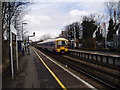
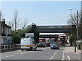
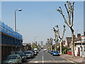
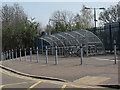

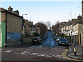
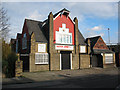
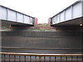
100 photos from this area
Area Information
Key information about the SE10 0RR including its size, population, and administrative classification.
- Area Type
- Postcode
- Area Size
- 4850 m²
- Population
- 1861
- Population Density
- 6425 people/km²
House Prices in SE10 0RR
29
Properties
£447,559
Average Sold Price
£135,000
Lowest Price
£610,000
Highest Price
Showing 29 properties
| Address | Type | Beds | Baths | Last Sale Price | Last Sale Date | |
|---|---|---|---|---|---|---|
| 34 Aldeburgh Street, Greenwich, SE10 0RR | Terraced | 3 | 1 | £590,000 | Nov 2024 | |
| 12 Aldeburgh Street, Greenwich, SE10 0RR | Terraced | 3 | 1 | £600,000 | Dec 2023 | |
| 58 Aldeburgh Street, Greenwich, SE10 0RR | Terraced | 3 | 2 | £610,000 | Jul 2021 | |
| 48 Aldeburgh Street, Greenwich, SE10 0RR | Terraced | 2 | 1 | £560,000 | Jun 2021 | |
| 52 Aldeburgh Street, Greenwich, SE10 0RR | Terraced | 2 | 1 | £470,000 | Jun 2021 | |
| 54 Aldeburgh Street, Greenwich, SE10 0RR | house | 1 | 1 | £445,000 | Jul 2018 | |
| 24 Aldeburgh Street, Greenwich, SE10 0RR | house | 3 | 1 | £500,000 | Mar 2018 | |
| 2 Aldeburgh Street, Greenwich, SE10 0RR | Terraced | 1 | 2 | £585,000 | Nov 2017 | |
| 14 Aldeburgh Street, Greenwich, SE10 0RR | Terraced | 4 | 2 | £560,500 | Jun 2017 | |
| 50 Aldeburgh Street, Greenwich, SE10 0RR | Terraced | 4 | 2 | £530,000 | Jun 2017 |
Page 1 of 3
Energy Efficiency in SE10 0RR
Amenities
Schools
| Rank | School | Type | Entry gender | Ages |
|---|
Explore more schools in this area
Go to Schools tabDemographics
Household Size
Family (3-5 people)
most common
Accommodation Type
Flats
most common
Tenure
45
majority
Ethnic Group
White
most common
Religion
N/A
most common
Household Composition
N/A
most common
Age
47
median
Adults (30-64 years)
most common
Household Deprivation
N/A
with no deprivation
NS-SEC
48
in Lower managerial occupations
Explore more demographic insights in this area
Go to Demographics tabPlanning
Planning Constraints
- Flood RiskPremium
- Ramsar Wetland SitesPremium
- Area of Outstanding Natural BeautyPremium
- Protected Nature ReservePremium
- Protected WoodlandPremium