Area Overview for SE10 0JZ
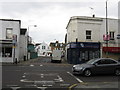
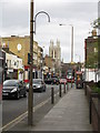
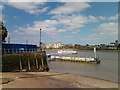
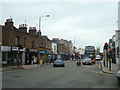
Photos of SE10 0JZ

Area Information
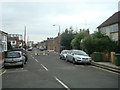
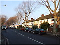
Living in SE10 0JZ means inhabiting a tightly packed residential cluster in the south-east of England. This specific postcode covers just 1.5 hectares, yet it accommodates a population of 1,890 people. The result is a neighbourhood defined by high density, with an estimated 126,402 people per square kilometre. Residents here experience close proximity to one another within a confined geographical footprint. The area functions as a small, distinct pocket within the larger Greenwich district. Daily life revolves around immediate access to transport links and local services due to the compact nature of the site. You are buying into a space where volume of residents meets a very small physical area. The environment prioritises convenience over sprawling green space because of these spatial constraints. This concentration of housing creates a lively, urban atmosphere throughout the day. Prospective buyers should understand that this location offers a specific, dense living experience rather than a spacious suburban feel. The high population density shapes the rhythm of the community and the character of the streets.
- Area Type
- Postcode
- Area Size
- 1.5 hectares
- Population
- 1890
- Population Density
- 10140 people/km²
Looking at homes in SE10 0JZ reveals a market heavily influenced by restricted space and established ownership patterns. With 47% homeownership, nearly half of the properties in this 1.5-hectare cluster are owner-occupied. This statistic points to a neighbourhood where investment in residential property is common and longstanding. The predominant accommodation type here is houses, distinguishing this small cluster from nearby areas that might feature more high-rise flats or modern apartments. This preference for houses suggests buyers prioritise traditional living arrangements over vertical density. When searching for properties, you will find a mix of family homes suited to the local adult population. The limited land area of 1.5 hectares means there is no room for new large-scale developments. The market operates within a fixed, small footprint where every existing building is a potential opportunity. Buyers looking for starter homes or first-time purchases must navigate a mix of family-sized houses. The high density of 126,402 people per square kilometre intensifies competition for available stock. Your search will focus on securing a house within this specific, saturated postcode.
House Prices in SE10 0JZ
Showing 54 properties
| Address | Type | Beds | Baths | Last Sale Price | Last Sale Date | |
|---|---|---|---|---|---|---|
| 88 Annandale Road, Greenwich, SE10 0JZ | house | 5 | 2 | £1,450,000 | Jan 2025 | |
| 98 Annandale Road, Greenwich, SE10 0JZ | Terraced | 3 | 1 | £840,000 | May 2024 | |
| 126 Annandale Road, Greenwich, SE10 0JZ | house | - | - | £873,000 | Apr 2024 | |
| 118 Annandale Road, Greenwich, SE10 0JZ | Terraced | 3 | 1 | £745,000 | Oct 2023 | |
| 102 Annandale Road, Greenwich, SE10 0JZ | Terraced | 3 | 2 | £1,195,000 | Jul 2022 | |
| 106 Annandale Road, Greenwich, SE10 0JZ | Terraced | 5 | 2 | £1,211,000 | Mar 2022 | |
| 92 Annandale Road, Greenwich, SE10 0JZ | Terraced | 5 | 2 | £840,000 | Jul 2019 | |
| 128 Annandale Road, Greenwich, SE10 0JZ | Terraced | 5 | 2 | £1,030,000 | Apr 2019 | |
| 82 Annandale Road, Greenwich, SE10 0JZ | Terraced | 3 | 2 | £910,000 | Oct 2018 | |
| 144 Annandale Road, Greenwich, SE10 0JZ | house | - | - | £865,000 | Jul 2018 |
Energy Efficiency in SE10 0JZ
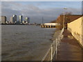
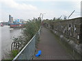
Your daily lifestyle in SE10 0JZ is defined by immediate access to a wide array of amenities. Retail options are plentiful, with five local stores including Sainsburys Greenwich, Iceland Trafalgar, and Co-op Greenwich. These outlets provide for all your grocery and convenience needs without requiring a long commute. Transport links are exceptionally dense, boasting five nearby rail stations such as Westcombe Park, Maze Hill Railway Station, and Charlton Station. Fermess access is equally strong, with five piers including Greenwich Pier, Royal Wharf Pier, and North Greenwich Pier offering trips across the river. For those preferring tube travel, five metro stations are nearby, featuring Island Gardens, Cutty Sark for Maritime Greenwich, and Cutty Sark DLR Station. Aviation access is convenient too, with London City Airport just one venue away. You can reach major highways and business districts via these multiple transport modes. The concentration of services means your daily errands are quick and efficient. Your leisure time includes diverse shopping, dining, and transit options within a short walk.
Amenities
Schools
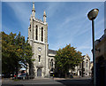
Choosing schools for children living in SE10 0JZ involves a short list of nearby options. Halstow Primary School stands as the only listed primary institution with verifiable performance metrics. This school holds an Ofsted rating of good, providing a clear indicator of educational quality for young learners. In addition to this primary option, Westcombe Centre is available for families seeking further education or alternative learning environments. The centre offers classes for older students or those requiring specific support beyond the primary curriculum. The mix of institutions suggests a comprehensive local education pathway despite the small scale of the resident population. You have access to a well-regarded primary school and a supplementary educational centre. These facilities sit within practical reach of the 1,890 residents who call this postcode home. The presence of a 'good' rated school adds significant value to the area for parents. Families can rely on the established reputation of Halstow Primary for standard schooling needs. Westcombe Centre complements this by offering flexibility for broader educational requirements.
| Rank | School | Type | Entry gender | Ages |
|---|
Explore more schools in this area
Go to Schools tabDemographics
The community in SE10 0JZ is dominated by adults between the ages of 30 and 64 years. The median age across the cluster sits at 47, indicating a mature resident base. Nearly half of all households, representing 47% of the total, are in homeownership. This ownership rate suggests a stable environment where long-term residents often hold their properties. The remaining households consist primarily of rental arrangements or shared living situations. Families and empty nesters form the core of the demographic profile in this postcode. The area is predominantly white, reflecting the broader ethnic composition of the local neighbourhood. Most homes in SE10 0JZ are traditional houses rather than flats, which aligns with the established character of the 1.5-hectare地块. This housing stock supports a demographic that values ground-floor access and private garden space. The age profile implies a community that may prioritise quiet, established living over youthful vibrancy. You are joining a bubble of mid-life residents who have already invested in their local surroundings.
Household Size
Accommodation Type
Tenure
Ethnic Group
Religion
Household Composition
Age
Household Deprivation
NS-SEC
Explore more demographic insights in this area
Go to Demographics tabPlanning
Planning Constraints
- Flood RiskPremium
- Ramsar Wetland SitesPremium
- Area of Outstanding Natural BeautyPremium
- Protected Nature ReservePremium
- Protected WoodlandPremium