Area Overview for SE10 0JT
Photos of SE10 0JT


Area Information
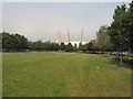
The postcode SE10 0JT encompasses a specific residential cluster covering just 4.1 hectares. This tightly packed area holds a population of 1,397 people, resulting in a density of 1,390 people per square kilometre. You are entering a small, concentrated neighbourhood where daily life revolves around the immediate vicinity. The character of SE10 0JT is defined by its high density within a very limited geographic footprint. Residents live close to one another, creating a compact community environment. The area sits firmly within south-east London, offering a blend of urban convenience and residential focus. When you look for homes in SE10 0JT, you are selecting properties situated in a well-defined pocket. This postcode does not sprawl; instead, it presents a focused living environment where distance to local amenities remains minimal. The sheer number of residents contributes to a sense of community, while the small size ensures everything is within easy reach. For a potential buyer, SE10 0JT offers a distinct scale of living that differs from larger boroughs. The physical boundaries of this postcode create a clear, manageable sphere of influence for daily routines. You will find a population that has settled into a defined space, making this a practical choice for those who value proximity.
- Area Type
- Postcode
- Area Size
- 4.1 hectares
- Population
- 1397
- Population Density
- 1390 people/km²
The property market in SE10 0JT is defined by a housing stock that consists entirely of flats. This means there are no semi-detached or detached homes available within this specific postcode boundary. The 37% home ownership rate indicates that a significant majority of residents rent their homes. Consequently, this is a heavily rental-leaning market where many people move frequently or live in houses of multiple occupation. For buyers looking to purchase in SE10 0JT, you will only encounter apartment options. This property type is suited to single persons, couples, or small households rather than large families requiring gardens or multiple rooms. The small area size of 4.1 hectares reinforces the notion that this is a high-density urban environment. With only 1,397 residents across this tiny footprint, the housing supply is naturally limited and specific. If you seek a semi-detached family home, SE10 0JT is not the location for you. However, if you require a flat in a dense urban setting, this postcode provides the exact configuration you need. The market dynamics here favour investors or those seeking urban convenience over traditional suburban family housing. Understanding that every property is a flat is essential before viewing homes in SE10 0JT.
House Prices in SE10 0JT
Showing 15 properties
| Address | Type | Beds | Baths | Last Sale Price | Last Sale Date | |
|---|---|---|---|---|---|---|
| 25 West Parkside, Greenwich, SE10 0JT | Maisonette | - | - | £650,000 | Jan 2021 | |
| 29 West Parkside, Greenwich, SE10 0JT | Maisonette | - | - | £654,995 | Jan 2021 | |
| 23 West Parkside, Greenwich, SE10 0JT | Flat | 3 | 2 | £670,000 | Jan 2021 | |
| 33 West Parkside, Greenwich, SE10 0JT | Maisonette | - | - | £644,995 | Dec 2020 | |
| 15 West Parkside, Greenwich, SE10 0JT | Flat | 3 | 2 | £600,000 | Dec 2020 | |
| 9 West Parkside, Greenwich, SE10 0JT | Flat | - | 1 | £649,995 | Dec 2020 | |
| 31 West Parkside, Greenwich, SE10 0JT | Maisonette | - | - | £649,995 | Dec 2020 | |
| 21 West Parkside, Greenwich, SE10 0JT | Flat | 2 | 2 | £640,000 | Nov 2020 | |
| 19 West Parkside, Greenwich, SE10 0JT | Maisonette | - | - | £680,000 | Oct 2020 | |
| 3 West Parkside, Greenwich, SE10 0JT | Flat | 3 | 2 | £660,000 | Oct 2020 |
Energy Efficiency in SE10 0JT
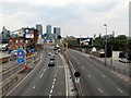
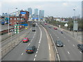
Living in SE10 0JT grants you access to a wide array of local amenities within practical reach. You have five retail options very close by, including Co-op Greenwich and Tesco Greenwich. These supermarkets and convenience stores handle your daily shopping needs for groceries and essentials. For movement, you are surrounded by five metro stations, including IFS Cloud Greenwich Peninsula, North Greenwich, and West Silvertown DLR Station. This network connects you seamlessly across London via the Docklands Light Railway and Underground. Ferry transport is equally accessible, with five piers nearby such as North Greenwich Pier, Royal Wharf Pier, and East India Pier. These water crossings offer leisure and transport alternatives to the dry land routes. Rail access is robust, with Westcombe Park, Maze Hill Railway Station, and Charlton Station nearby providing national connections. You also have access to one airport, London City Airport, allowing for quick travel to continental Europe. Bus services connect you to Whipps Cross Bus Interchange for further regional access. This layout ensures that work, leisure, and shopping are never far away for those living in SE10 0JT.
Amenities
Schools
There is one school listed in the immediate vicinity of SE10 0JT. This educational facility is Ravensbourne. The data categorises Ravensbourne as a secondary school type other than primary or infant school. Specifically, it is an alternative provision or other secondary institution, distinguishing it from standard academic secondary schools. The Ofsted rating is not provided in the available information, so you cannot verify the quality of education offered based on official inspections. You must consider the availability of primary schools and standard secondary schools separately if your family has young children. The presence of Ravensbourne indicates that the area serves a student population requiring further or alternative education. For families seeking a traditional primary or secondary school experience nearby, this data point alone is insufficient to determine suitability. You may need to look to neighbouring postcodes for primary options, as the only listed institution for SE10 0JT is this specific secondary-type school. The school mix is narrow, offering only this single venue within the defined reach of the postcode. When planning your route to schools near SE10 0JT, Ravensbourne is the only named destination available for reference.
| Rank | School | Type | Entry gender | Ages |
|---|
Explore more schools in this area
Go to Schools tabDemographics
The community within SE10 0JT has a clear demographic profile driven by specific statistics. The median age is 47 years, indicating a mature population that is predominantly occupied by adults between 30 and 64 years old. This age bracket constitutes the most common group, suggesting a neighbourhood where many residents are in their mid-career or retirement phases. Home ownership stands at 37%, meaning roughly one in three households owns their property outright or with a mortgage. The remaining two-thirds of households consist of tenants. Accommodation type in SE10 0JT is exclusively flats. There are no standalone houses or terraced homes in this specific postcode, only apartment living. This structural reality defines the social fabric and spatial arrangement of the area. Regarding diversity, the predominant ethnic group is White, though this does not reflect the cosmopolitan nature of wider south-east London. Deprivation levels are not detailed in the available statistics, but the specific age and ownership data paint a picture of a stable, flat-based community. The lack of family houses correlates with the median age, as most residents are not in the age group typically raising young children. You are looking at an area where older adults and professionals in flats make up the majority of the population.
Household Size
Accommodation Type
Tenure
Ethnic Group
Religion
Household Composition
Age
Household Deprivation
NS-SEC
Explore more demographic insights in this area
Go to Demographics tabPlanning
Planning Constraints
- Flood RiskPremium
- Ramsar Wetland SitesPremium
- Area of Outstanding Natural BeautyPremium
- Protected Nature ReservePremium
- Protected WoodlandPremium