Area Overview for SE1 8AN
Photos of SE1 8AN


Area Information
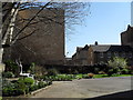
Living in SE1 8AN means residing in a compact residential cluster defined by precise boundaries rather than broad neighbourhood character. This specific postcode area covers 713 m² and houses 1631 residents. The population density here reaches 2288025 people per km², creating an intensely packed environment where every square metre is occupied. Despite the miniscule physical size of this cluster, it functions as a distinct segment within Southwark. Residents navigate a space where proximity to major transport hubs and commercial districts is immediate rather than convenient. Daily life here involves moving through a high-density corridor that connects residents to London Waterloo, Blackfriars, and the River Thames piers. The area lacks the sprawling green spaces typical of outer London but offers direct access to railway and ferry terminals. You will find yourself adjacent to bustling retail parks and office blocks rather than quiet suburban streets. The character of SE1 8AN is defined by its integration into the city's core infrastructure. The sheer number of people in such a small area creates a unique rhythm of urban movement.
- Area Type
- Postcode
- Area Size
- 713 m²
- Population
- 1631
- Population Density
- 12537 people/km²
The housing stock in SE1 8AN consists entirely of flats, a direct result of the limited 713 m² land available. With a home ownership rate standing at only 20%, the area operates primarily as a rental market or a zone where investment leads to private rentals rather than owner occupation. Prospective buyers here encounter a market dominated by leasehold properties rather than freehold houses. This profile is typical for a specific postcode cluster located in a high-demand central London zone. The absence of terraced or semi-detached homes means that buyers must adapt to apartment living within a dense urban setting. The low ownership percentage indicates that many residents pay rent to landlords or housing associations. Families considering homes in SE1 8AN will face competition in a market where purchase thresholds are high. Unlike areas where buying a house is the norm, this location requires a focus on flat buying. The 20% ownership figure suggests that the majority of current occupants are tenants seeking stability without the responsibility of major maintenance. This market structure suits investors and professionals who value location over traditional property standards.
House Prices in SE1 8AN
Showing 14 properties
Energy Efficiency in SE1 8AN
Residents of SE1 8AN benefit from an extensive range of amenities within practical reach. Five metro points include Southwark Station, Temple, and Borough Station, allowing quick access to the rest of the capital. Retail options are plentiful nearby, with notable mentions including Tesco Southwark, Waitrose South, and Sainsburys Lambeth. These supermarkets cater to daily shopping needs without requiring a long journey for groceries. Transport links extend to five railway stations, including London Waterloo, Blackfriars, and the London Blackfriars Railway Station. Ferry options are also available through Blackfriars Pier, Festival Pier, and Bankside Pier, offering an alternative for commuting along the Thames. Bus connections include the Green Line Coach Station, London Victoria Coach Station Arrivals, and the main Victoria Coach Station hub. This density of transport and retail nodes creates a self-sufficient lifestyle where most daily needs are met locally. You can dine, shop, and travel all within view of your flat. The area functions as a logistical hub where convenience is prioritised over quiet retreat.
Amenities
Schools
Parents in SE1 8AN have access to specific educational institutions within the immediate vicinity. The London Nautical School serves the area as a primary school, offering early education for younger children. For secondary education, families look to the London Nautical, City of London Academy, which operates as an academy. This mix of a primary institution and an academy provides a local pipeline for students living in the postcode. The location of the London Nautical School ensures that younger residents do not need to travel far for their education. The academy serves older students living in the cluster, connecting the local population with the City of London education network. Families considering living in SE1 8AN must weigh the proximity of these schools against the age profile of the current residents. The presence of both primary and secondary options means that older families can find schools within their child's age range. While the number of schools is limited to this list, the integration of primary and academy types offers a structured learning environment.
| Rank | School | Type | Entry gender | Ages |
|---|
Explore more schools in this area
Go to Schools tabDemographics
The community in SE1 8AN reflects a mature population with a median age of 47 years. Adults aged between 30 and 64 years constitute the most common age range, suggesting a stable established workforce rather than a transient student or young professional demographic. Household dynamics indicate that 20% of residents own their homes outright. The remaining 80% of households likely consist of renters or those purchasing through shared ownership schemes. Accommodation types are exclusively flats, which aligns with the density constraints of the postcode area. Ethnically, the predominant group is White, forming the primary demographic profile of the residents. This area does not feature a significant youth population, as the age skew heavily towards middle age. The low home ownership rate of 20% suggests a rental market or areas alongside the river where living costs prevent outright purchase for many. Families in this bracket may prioritize location over equity building. The demographic profile supports a community seeking ease of access to employment rather than long-term residential projects.
Household Size
Accommodation Type
Tenure
Ethnic Group
Religion
Household Composition
Age
Household Deprivation
NS-SEC
Explore more demographic insights in this area
Go to Demographics tabPlanning
Planning Constraints
- Flood RiskPremium
- Ramsar Wetland SitesPremium
- Area of Outstanding Natural BeautyPremium
- Protected Nature ReservePremium
- Protected WoodlandPremium