Area Overview for SE1 5XN
Photos of SE1 5XN


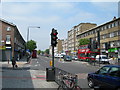
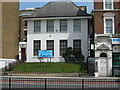
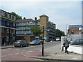
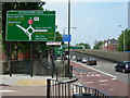
100 photos from this area
Area Information
Key information about the SE1 5XN including its size, population, and administrative classification.
- Area Type
- Postcode
- Area Size
- 4367 m²
- Population
- 2000
- Population Density
- 10315 people/km²
House Prices in SE1 5XN
33
Properties
£272,833
Average Sold Price
£35,500
Lowest Price
£600,000
Highest Price
Showing 33 properties
| Address | Type | Beds | Baths | Last Sale Price | Last Sale Date | |
|---|---|---|---|---|---|---|
| 56 Hazel Way, London, SE1 5XN | Detached | 4 | 2 | £600,000 | Mar 2016 | |
| 129 Hazel Way, London, SE1 5XN | Flat | - | - | £320,000 | Feb 2015 | |
| 48 Hazel Way, London, SE1 5XN | house | 3 | - | £550,000 | Nov 2014 | |
| 103 Hazel Way, London, SE1 5XN | Flat | 3 | 1 | £185,000 | Oct 2011 | |
| 119 Hazel Way, London, SE1 5XN | Flat | 1 | 1 | £150,000 | May 2011 | |
| 133 Hazel Way, London, SE1 5XN | Flat | 1 | - | £159,995 | Apr 2008 | |
| 117 Hazel Way, London, SE1 5XN | Flat | 1 | 1 | £165,000 | Sep 2007 | |
| 52 Hazel Way, London, SE1 5XN | Terraced | - | - | £290,000 | Jun 2007 | |
| 101 Hazel Way, London, SE1 5XN | Flat | - | - | £35,500 | Sep 1996 | |
| 99 Hazel Way, London, SE1 5XN | Flat | 2 | 1 | - | - |
Page 1 of 4
Energy Efficiency in SE1 5XN
Amenities
Schools
| Rank | School | Type | Entry gender | Ages |
|---|
Explore more schools in this area
Go to Schools tabDemographics
Household Size
One person
most common
Accommodation Type
Flats
most common
Tenure
11
majority
Ethnic Group
White
most common
Religion
N/A
most common
Household Composition
N/A
most common
Age
47
median
Adults (30-64 years)
most common
Household Deprivation
N/A
with no deprivation
NS-SEC
29
in Lower managerial occupations
Explore more demographic insights in this area
Go to Demographics tabPlanning
Planning Constraints
- Flood RiskPremium
- Ramsar Wetland SitesPremium
- Area of Outstanding Natural BeautyPremium
- Protected Nature ReservePremium
- Protected WoodlandPremium