Area Overview for SE1 2EB
Photos of SE1 2EB
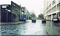
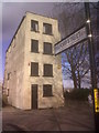

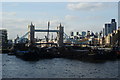

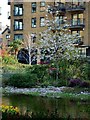
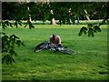
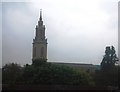
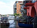
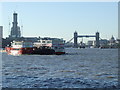
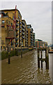
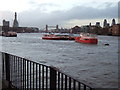
100 photos from this area
Area Information
Key information about the SE1 2EB including its size, population, and administrative classification.
- Area Type
- Postcode
- Area Size
- 1561 m²
- Population
- 1102
- Population Density
- 27277 people/km²
House Prices in SE1 2EB
73
Properties
£602,772
Average Sold Price
£190,000
Lowest Price
£1,130,000
Highest Price
Showing 73 properties
| Address | Type | Beds | Baths | Last Sale Price | Last Sale Date | |
|---|---|---|---|---|---|---|
| 73 Providence Square, London, SE1 2EB | Flat | 2 | 2 | £885,000 | Sep 2025 | |
| 62 Providence Square, London, SE1 2EB | Flat | 2 | 2 | £875,000 | Mar 2025 | |
| 92 Providence Square, London, SE1 2EB | Flat | 2 | 2 | £880,000 | Nov 2024 | |
| 109 Providence Square, London, SE1 2EB | Flat | - | - | £880,000 | Oct 2024 | |
| 67 Providence Square, London, SE1 2EB | Flat | 2 | 2 | £855,000 | Sep 2024 | |
| 77 Providence Square, London, SE1 2EB | Flat | - | - | £895,000 | Nov 2023 | |
| 57 Providence Square, London, SE1 2EB | Flat | 2 | 2 | £880,000 | Aug 2023 | |
| 86A Providence Square, London, SE1 2EB | Flat | 2 | 2 | £960,000 | Sep 2022 | |
| 61 Providence Square, London, SE1 2EB | Flat | - | - | £955,000 | Jul 2022 | |
| 99 Providence Square, London, SE1 2EB | Flat | 2 | 2 | £855,000 | Apr 2022 |
Page 1 of 8
Energy Efficiency in SE1 2EB
Amenities
Schools
| Rank | School | Type | Entry gender | Ages |
|---|
Explore more schools in this area
Go to Schools tabDemographics
Household Size
Two person
most common
Accommodation Type
Flats
most common
Tenure
39
majority
Ethnic Group
White
most common
Religion
N/A
most common
Household Composition
N/A
most common
Age
47
median
Adults (30-64 years)
most common
Household Deprivation
N/A
with no deprivation
NS-SEC
77
in Lower managerial occupations
Explore more demographic insights in this area
Go to Demographics tabPlanning
Planning Constraints
- Flood RiskPremium
- Ramsar Wetland SitesPremium
- Area of Outstanding Natural BeautyPremium
- Protected Nature ReservePremium
- Protected WoodlandPremium