Area Overview for Sands End Ward
Photos of Sands End Ward
Area Information
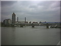
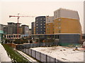
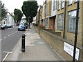
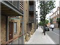
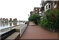
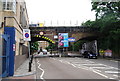
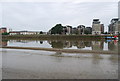
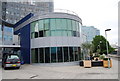
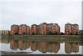
Sands End Ward is an urban village situated within the ancient parish of Fulham and the London Borough of Hammersmith and Fulham. The area covers 85.5 hectares and sits by the River Thames in a deep loop, incorporating the tidal Chelsea Creek and the old Peterborough estate. It lies west of Wandsworth Bridge with its northern edge at New King's Road. Despite intensive redevelopment in the late 20th century including Chelsea Harbour and Imperial Wharf, the ward retains some 300-year-old cottages and 19th-century streets. The ward elects three councillors to Hammersmith and Fulham London Borough Council and has a population of approximately 3,917 people. Historically a rural backwater cut off from main thoroughfares, the area evolved into an industrial heartland driven by the Imperial Gas Light and Coke Company and the Kops Brewery. Today, Sands End presents contrasting parallels, with some of the richest homes in the country situated alongside some of the poorest. You will find the Sands End Conservation Area designated and recent community development at the Sands End Arts & Community Centre. Living in Sands End means participating in a tightly knit area that has transitioned from a working-class community to a mixed-income urban neighbourhood while retaining its historic character.
- Area Type
- District Borough Unitary Ward
- Area Size
- 85.5 hectares
- Population
- 3917
- Population Density
- 4579 people/km²
Demographics
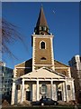
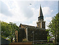
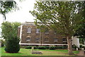
The community in Sands End Ward is characterised by a median age of 70, indicating an older demographic profile. The most common age range is recorded as Age: Total in the available data. Home ownership stands at 37%, meaning 63% of residents rent their accommodation. The ward does not provide specific breakdowns for household composition, predominant ethnic group, or religion in the current records. You should be aware that the area functions as an urban village that has undergone significant transformation from its rural origins. Historically a swampy, isolated backwater, it evolved into an industrial heartland where the Imperial Gas Light and Coke Company was the primary employer for generations of local families. The economy also historically housed a power station and petrol depot alongside clubs like the Hurlingham Club. Contemporary economic drivers now include Chelsea Football Club's involvement in funding community infrastructure and ongoing redevelopment projects such as Imperial Wharf. The Sands End Conservation Area exists as a designated conservation zone where you will find historic sites like Clancarty Lodge and Sandford Manor House, a Grade II* listed building.
Household Size
Accommodation Type
Tenure
Ethnic Group
Religion
Household Composition
Age
Household Deprivation
NS-SEC
Explore more demographic insights in this area
Go to Demographics tabPlanning
Planning Constraints
- Flood RiskPremium
- Ramsar Wetland SitesPremium
- Area of Outstanding Natural BeautyPremium
- Protected Nature ReservePremium
- Protected WoodlandPremium
- Crime RiskPremium