Area Overview for Ruislip Ward
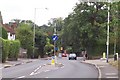
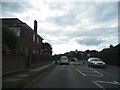
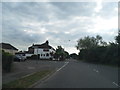
Photos of Ruislip Ward
Area Information
Living in Ruislip Ward offers a defined view of suburban life within a compact landscape. This ward covers an area of 8.7 km², which supports a population of 6249 people. The result is a neighbourhood with a population density of 722 people per km². You will find a community that sits comfortably between rural and urban settings. The geography is small enough that services are often nearby, yet large enough to maintain distinct local character. Residents experience density that is significant compared to the national average, ensuring a lively environment without the overwhelming scale of major cities. Every square kilometre serves a specific purpose within the ward structure. The community feels established, with enough inhabitants to keep local amenities active year-round. You can expect a setting where neighbours know each other, supported by a total population that creates a stable demographic base. The ward operates as a self-contained district within the broader borough, offering a predictable rhythm to daily life. This balance makes Ruislip Ward a practical choice for those seeking a settled atmosphere. The combination of manageable size and sufficient population ensures that the area remains functional and connected. You move here knowing exactly how populated your immediate surroundings are. The ward provides a clear, organised space for living that avoids the chaos of high-density zones.
- Area Type
- District Borough Unitary Ward
- Area Size
- 8.7 km²
- Population
- 6249
- Population Density
- 722 people/km²
Demographics
The community in Ruislip Ward possesses a very distinct age profile that defines daily life. The median age is 70, which places this area firmly within the senior demographic. Most residents fall into age categories that reflect retirement and older adulthood. This concentration means you are looking at a neighbourhood where friends, family, and services cater to older needs. The home ownership rate stands at 72, meaning that 72 per cent of households own their homes outright or with a mortgage. This high figure indicates a low number of private landlords operating in the ward. You will encounter fewer tenants than you might find in university towns or rapidly expanding cities. The settlement reflects stability, with long-term residents keeping their properties for extended periods. Household composition is heavily weighted towards older individuals who have secured housing. The demographic data shows a community that has reached a stage of life where property ownership is the norm rather than the exception. People living in Ruislip Ward share a common experience of stability. The age spread suggests that families with school-age children are less common than retirees enjoying their third act. You should anticipate a social environment centred on leisure, quiet living, and community engagement typical of this age bracket. The uniformity of the age range creates a cohesive society with shared priorities regarding noise levels and local infrastructure.
Household Size
Accommodation Type
Tenure
Ethnic Group
Religion
Household Composition
Age
Household Deprivation
NS-SEC
Explore more demographic insights in this area
Go to Demographics tabPlanning
Planning Constraints
- Flood RiskPremium
- Ramsar Wetland SitesPremium
- Area of Outstanding Natural BeautyPremium
- Protected Nature ReservePremium
- Protected WoodlandPremium
- Crime RiskPremium