Area Overview for Royal Albert Ward
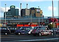
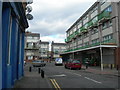
Photos of Royal Albert Ward


Area Information
Royal Albert Ward is an electoral ward situated within the London Borough of Newham in East London. This district covers a compact footprint of 3.6 km² and currently houses approximately 3,410 residents. The area was formally established as a ward for the 2022 elections, providing local representation through two councillors on Newham Council. Living in Royal Albert Ward means residing in a densely populated urban environment where close to a thousand people live on every square kilometre. The ward sits at coordinates near 51.5 degrees north latitude and is deeply integrated into the fabric of the capital's east side. You will find that the community functions as a self-contained unit within the larger borough, offering immediate access to the city grid while maintaining its own administrative identity. The sheer concentration of people in such a small area defines the daily rhythm of life here. It is a place where space is premium and neighbours are likely to be in close physical contact.
- Area Type
- District Borough Unitary Ward
- Area Size
- 3.6 km²
- Population
- 3410
- Population Density
- 960 people/km²
Demographics
The community profile of Royal Albert Ward reflects a mature population with a distinct concentration of older residents. The median age stands at 70 years, indicating that the typical household includes long-term inhabitants rather than a young family demographic. Most common age clusters fall into the higher bands, suggesting a settlement established over many decades. This age structure influences how services and amenities cater to specific needs within the ward. Home ownership presents a specific dynamic in Royal Albert Ward, as only 29 per cent of households own their property outright. Consequently, the majority of residents rely on the rental market to secure their accommodation. This high rental proportion often correlates with the needs of an older population who may prefer flexibility or lack the capital to purchase. You should expect a society where leasehold and tenancy arrangements dominate the residential landscape compared to freehold ownership.
Household Size
Accommodation Type
Tenure
Ethnic Group
Religion
Household Composition
Age
Household Deprivation
NS-SEC
Explore more demographic insights in this area
Go to Demographics tabPlanning
Planning Constraints
- Flood RiskPremium
- Ramsar Wetland SitesPremium
- Area of Outstanding Natural BeautyPremium
- Protected Nature ReservePremium
- Protected WoodlandPremium
- Crime RiskPremium