Area Overview for RM9 6XX
Photos of RM9 6XX

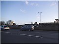

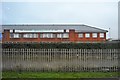
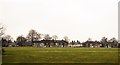
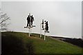
37 photos from this area
Area Information
Key information about the RM9 6XX including its size, population, and administrative classification.
- Area Type
- Postcode
- Area Size
- 5315 m²
- Population
- 1705
- Population Density
- 11678 people/km²
House Prices in RM9 6XX
23
Properties
£136,519
Average Sold Price
£53,750
Lowest Price
£310,000
Highest Price
Showing 23 properties
| Address | Type | Beds | Baths | Last Sale Price | Last Sale Date | |
|---|---|---|---|---|---|---|
| 332 Goresbrook Road, Dagenham, RM9 6XX | Terraced | 3 | 1 | £310,000 | Sep 2020 | |
| 338 Goresbrook Road, Dagenham, RM9 6XX | house | - | - | £195,000 | Jun 2013 | |
| 320 Goresbrook Road, Dagenham, RM9 6XX | house | - | - | £183,000 | Mar 2010 | |
| 328 Goresbrook Road, Dagenham, RM9 6XX | house | 3 | - | £166,000 | Dec 2009 | |
| 326 Goresbrook Road, Dagenham, RM9 6XX | Terraced | - | - | £145,000 | Mar 2006 | |
| 310 Goresbrook Road, Dagenham, RM9 6XX | Terraced | - | - | £148,000 | Dec 2004 | |
| 300 Goresbrook Road, Dagenham, RM9 6XX | house | - | - | £150,000 | Oct 2003 | |
| 340 Goresbrook Road, Dagenham, RM9 6XX | house | - | - | £113,000 | Jul 2002 | |
| 334 Goresbrook Road, Dagenham, RM9 6XX | Terraced | - | - | £87,000 | Sep 2001 | |
| 316 Goresbrook Road, Dagenham, RM9 6XX | house | - | - | £94,000 | Sep 2001 |
Page 1 of 3
Energy Efficiency in RM9 6XX
Amenities
Schools
| Rank | School | Type | Entry gender | Ages |
|---|
Explore more schools in this area
Go to Schools tabDemographics
Household Size
Family (3-5 people)
most common
Accommodation Type
Houses
most common
Tenure
45
majority
Ethnic Group
White
most common
Religion
N/A
most common
Household Composition
N/A
most common
Age
47
median
Adults (30-64 years)
most common
Household Deprivation
N/A
with no deprivation
NS-SEC
20
in Lower managerial occupations
Explore more demographic insights in this area
Go to Demographics tabPlanning
Planning Constraints
- Flood RiskPremium
- Ramsar Wetland SitesPremium
- Area of Outstanding Natural BeautyPremium
- Protected Nature ReservePremium
- Protected WoodlandPremium