Area Overview for RM9 6UU
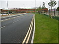
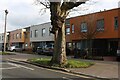
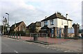
Photos of RM9 6UU


Area Information
Living in RM9 6UU means residing in a very small residential cluster defined by a single postcode. This specific location covers just 9,673 square metres and is home to 1,617 residents. The population density is extremely high at 167,158 people per square kilometre, indicating tightly packed housing. You are looking at a compact environment where daily life happens within close quarters. The area functions as a distinct residential pocket within the wider Dagenham and Rainham geography. Prospective buyers should understand the scale of this location immediately. It is not a sprawling neighbourhood but a concentrated community. The small footprint means that ground distances between homes are short, but the number of occupants is significant for the land area. This density shapes the character of the street scene and local interactions. You will find a defined community structure rather than a diffuse sprawl. The area serves as a specific point of reference for those searching for properties in the postcode RM9. Daily life here involves navigating a high-density setting. The concentration of 1,617 people in such a small space creates a unique living rhythm. This postcode represents a specific slice of Greater London's housing market. For anyone considering homes in this specific cluster, the physical constraints are immediately apparent. It is a place where boundaries are clear and the community is immediately recognizable to locals.
- Area Type
- Postcode
- Area Size
- 9673 m²
- Population
- 1617
- Population Density
- 8939 people/km²
The property market in RM9 6UU is characterised by a specific balance of tenancy and ownership. With 34% of homes owner-occupied, the area maintains a substantial rental market. This distribution shapes the dynamics for anyone looking to buy or rent in this small cluster. The preponderance of houses suggests a stock designed for traditional living rather than high-density blocks. Buyers looking at homes in this postcode should expect a variety of house styles suitable for families. This is a relational mix rather than a purely owner-occupied estate or a generic rental block. The fact that roughly two-thirds of residents rent often means the local agent portfolio includes many letting properties. However, the 34% ownership base proves there is a settled core of residents who value long-term stability in their environment. The accommodation type data confirms houses are the primary building structure, meaning you will find detached, semi-detached, or terraced houses rather than flats. For purchasers, this implies potential opportunities in both the sales and rental sectors. The small physical size of the area means the total number of listings is limited. Every house sold or let significantly impacts the local availability. The housing stock is established, lacking the new-build volatility found in redevelopment zones. If you are assessing homes in RM9 6UU, the high density and house-focused stock define your search parameters. Safety and accessibility remain key factors given the compact nature of this residential cluster.
House Prices in RM9 6UU
No properties found in this postcode.
Energy Efficiency in RM9 6UU
Your daily lifestyle in RM9 6UU benefits from a wide array of nearby amenities. Retail options include Aldi Dagenham, Farmfoods Dagenham, and Asda Dagenham. These five major locations ensure you can access groceries and household essentials without travelling far. For travel connections, you are near five key rail hubs. Dagenham Dock Station and Barking Riverside Station offer tube and rail lines for central London access. Five metro stations serve the area, including Dagenham Heathway, Becontree, and Dagenham East. These provide rapid transit choices. You also have access to five ferry services at points like Woolwich Arsenal Pier and Barrier Gardens Pier. This variety allows for scenic river crossings or direct mainland routes. London City Airport is a notable convenience just a short distance away. This airport connection is useful for short-haul international flights. The concentration of these facilities within practical reach defines your routine. Shopping trips are quick because supermarkets like Asda and Aldi are nearby. Commuters appreciate the choice between tube, rail, and ferry for their daily journeys. The proximity of London City Airport makes this location viable for international business travel needs. Living in RM9 6UU grants you direct access to these transport and retail nodes. The diversity of amenities supports a busy, well-connected daily life.
Amenities
Schools
Families living in RM9 6UU have access to specific educational options nearby. The primary school proximity is the main data point available for education planning. St Peter's Catholic Primary School is located close to the area and operates under a good Ofsted rating. This rating indicates the school meets high standards of education and behaviour for incoming pupils. The data does not list any secondary schools in the immediate vicinity. This suggests that residents may need to travel further for secondary education or rely on a school situated beyond the immediate local cluster. The presence of a good-rated primary school provides a solid starting point for early childhood education. Parents in this postcode can count on a regulated and rated institution for their youngest children. Living in RM9 6UU means beginning a child's academic journey at St Peter's. The good rating is a concrete metric of performance. While the spread of older children is present in the demographic, the specific school data highlights this one facility as the key local education anchor. For those prioritising a good rated school near their home, this venue is the verified option. The lack of listed secondary options in the immediate data set indicates a catchment reliance on external institutions for older students. This is a critical detail for parents evaluating the area's suitability for their household's full educational needs.
| Rank | School | Type | Entry gender | Ages |
|---|
Explore more schools in this area
Go to Schools tabDemographics
The community in RM9 6UU skews towards established adults. The median age is 47 years, with the most common age range for residents falling between 30 and 64 years old. This profile suggests a neighbourhood populated by families, career professionals, and those approaching retirement. You are unlikely to encounter a youth-heavy population typical of university towns or high-rise student areas. Instead, the demographic foundation rests on working-age adults managing households and dependents. Home ownership stands at 34% within this postcode. This figure indicates that a significant portion of the 1,617 residents rent their homes rather than own them outright. The remaining 66% live in rented accommodation, reflecting a market with substantial tenancy. Accommodation types are predominantly houses, distinguishing this area from the flats that define other parts of the older London borough. This housing style supports families and those seeking ground-floor or attached living arrangements. Ethnically, the predominant group in RM9 6UU is White. This statistic reflects the composition of the local householders and tenants. The data highlights a relatively homogenous community by standard Londonised definitions. The mix of owner-occupied and rental homes alongside the age profile creates a stable social fabric. Residents in their 40s and 50s form the backbone of this community, driving local demands for housing and services that cater to steady-term inhabitants.
Household Size
Accommodation Type
Tenure
Ethnic Group
Religion
Household Composition
Age
Household Deprivation
NS-SEC
Explore more demographic insights in this area
Go to Demographics tabPlanning
Planning Constraints
- Flood RiskPremium
- Ramsar Wetland SitesPremium
- Area of Outstanding Natural BeautyPremium
- Protected Nature ReservePremium
- Protected WoodlandPremium