Area Overview for RM9 6NP
Photos of RM9 6NP
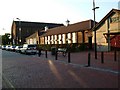
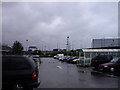
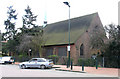
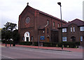
38 photos from this area
Area Information
Key information about the RM9 6NP including its size, population, and administrative classification.
- Area Type
- Postcode
- Area Size
- 2933 m²
- Population
- 1710
- Population Density
- 8201 people/km²
House Prices in RM9 6NP
12
Properties
£207,749
Average Sold Price
£44,000
Lowest Price
£325,000
Highest Price
Showing 12 properties
| Address | Type | Beds | Baths | Last Sale Price | Last Sale Date | |
|---|---|---|---|---|---|---|
| 51 Downing Road, Dagenham, RM9 6NP | Terraced | 2 | 1 | £310,000 | Feb 2020 | |
| 48 Downing Road, Dagenham, RM9 6NP | Terraced | 2 | 1 | £298,000 | Oct 2019 | |
| 52 Downing Road, Dagenham, RM9 6NP | house | 3 | 1 | £325,000 | Dec 2017 | |
| 50 Downing Road, Dagenham, RM9 6NP | Terraced | 2 | 1 | £285,000 | Nov 2017 | |
| 55 Downing Road, Dagenham, RM9 6NP | Terraced | 3 | 1 | £170,000 | Mar 2006 | |
| 46 Downing Road, Dagenham, RM9 6NP | house | 2 | 1 | £140,000 | Jan 2003 | |
| 53 Downing Road, Dagenham, RM9 6NP | house | - | - | £89,995 | Jan 2002 | |
| 44 Downing Road, Dagenham, RM9 6NP | Terraced | 3 | - | £44,000 | Nov 1997 | |
| 40 Downing Road, Dagenham, RM9 6NP | Terraced | - | - | - | - | |
| 47 Downing Road, Dagenham, RM9 6NP | Terraced | - | - | - | - |
Page 1 of 2
Energy Efficiency in RM9 6NP
Amenities
Schools
| Rank | School | Type | Entry gender | Ages |
|---|
Explore more schools in this area
Go to Schools tabDemographics
Household Size
Family (3-5 people)
most common
Accommodation Type
Houses
most common
Tenure
48
majority
Ethnic Group
White
most common
Religion
N/A
most common
Household Composition
N/A
most common
Age
47
median
Adults (30-64 years)
most common
Household Deprivation
N/A
with no deprivation
NS-SEC
20
in Lower managerial occupations
Explore more demographic insights in this area
Go to Demographics tabPlanning
Planning Constraints
- Flood RiskPremium
- Ramsar Wetland SitesPremium
- Area of Outstanding Natural BeautyPremium
- Protected Nature ReservePremium
- Protected WoodlandPremium