Area Overview for RM9 5XT
Photos of RM9 5XT


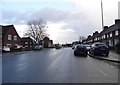


28 photos from this area
Area Information
Key information about the RM9 5XT including its size, population, and administrative classification.
- Area Type
- Postcode
- Area Size
- 1.2 hectares
- Population
- 1899
- Population Density
- 10802 people/km²
House Prices in RM9 5XT
46
Properties
£255,960
Average Sold Price
£50,000
Lowest Price
£406,000
Highest Price
Showing 46 properties
| Address | Type | Beds | Baths | Last Sale Price | Last Sale Date | |
|---|---|---|---|---|---|---|
| 30 Eliot Road, Dagenham, RM9 5XT | house | - | - | £360,000 | Mar 2025 | |
| 11 Eliot Road, Dagenham, RM9 5XT | Terraced | 2 | 1 | £345,000 | May 2023 | |
| 5 Eliot Road, Dagenham, RM9 5XT | Terraced | 2 | 1 | £345,000 | Jun 2022 | |
| 17 Eliot Road, Dagenham, RM9 5XT | house | - | - | £406,000 | Feb 2022 | |
| 20 Eliot Road, Dagenham, RM9 5XT | Terraced | 3 | 1 | £380,000 | Jul 2020 | |
| 55 Eliot Road, Dagenham, RM9 5XT | Retail | 2 | 1 | £327,800 | Nov 2019 | |
| 25 Eliot Road, Dagenham, RM9 5XT | Terraced | 3 | 1 | £310,000 | Sep 2019 | |
| 19 Eliot Road, Dagenham, RM9 5XT | house | 5 | 2 | £320,000 | Mar 2019 | |
| 24 Eliot Road, Dagenham, RM9 5XT | Terraced | 2 | 1 | £336,000 | Nov 2018 | |
| 26 Eliot Road, Dagenham, RM9 5XT | Terraced | 2 | 1 | £300,000 | Aug 2018 |
Page 1 of 5
Energy Efficiency in RM9 5XT
Amenities
Schools
| Rank | School | Type | Entry gender | Ages |
|---|
Explore more schools in this area
Go to Schools tabDemographics
Household Size
Family (3-5 people)
most common
Accommodation Type
Houses
most common
Tenure
45
majority
Ethnic Group
White
most common
Religion
N/A
most common
Household Composition
N/A
most common
Age
47
median
Adults (30-64 years)
most common
Household Deprivation
N/A
with no deprivation
NS-SEC
19
in Lower managerial occupations
Explore more demographic insights in this area
Go to Demographics tabPlanning
Planning Constraints
- Flood RiskPremium
- Ramsar Wetland SitesPremium
- Area of Outstanding Natural BeautyPremium
- Protected Nature ReservePremium
- Protected WoodlandPremium