Area Overview for RM9 5AF
Photos of RM9 5AF
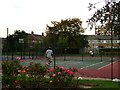
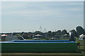
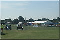
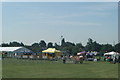

100 photos from this area
Area Information
Key information about the RM9 5AF including its size, population, and administrative classification.
- Area Type
- Postcode
- Area Size
- 3875 m²
- Population
- 1871
- Population Density
- 9004 people/km²
House Prices in RM9 5AF
14
Properties
£234,857
Average Sold Price
£137,500
Lowest Price
£362,500
Highest Price
Showing 14 properties
| Address | Type | Beds | Baths | Last Sale Price | Last Sale Date | |
|---|---|---|---|---|---|---|
| 337 Heathway, Dagenham, RM9 5AF | Terraced | 2 | 1 | £362,500 | Jun 2025 | |
| 317 Heathway, Dagenham, RM9 5AF | Terraced | 3 | 1 | £320,000 | Jul 2018 | |
| 311 Heathway, Dagenham, RM9 5AF | house | - | - | £270,000 | Dec 2016 | |
| 333 Heathway, Dagenham, RM9 5AF | house | - | - | £169,000 | Nov 2013 | |
| 331 Heathway, Dagenham, RM9 5AF | house | - | - | £137,500 | Feb 2010 | |
| 335 Heathway, Dagenham, RM9 5AF | house | - | - | £175,000 | Nov 2007 | |
| 319 Heathway, Dagenham, RM9 5AF | house | - | - | £210,000 | Oct 2005 | |
| 339A Heathway, Dagenham, RM9 5AF | Flat | 1 | 1 | - | - | |
| 339C Heathway, Dagenham, RM9 5AF | Flat | 3 | 1 | - | - | |
| 315 Heathway, Dagenham, RM9 5AF | Terraced | - | - | - | - |
Page 1 of 2
Energy Efficiency in RM9 5AF
Amenities
Schools
| Rank | School | Type | Entry gender | Ages |
|---|
Explore more schools in this area
Go to Schools tabDemographics
Household Size
Family (3-5 people)
most common
Accommodation Type
Houses
most common
Tenure
41
majority
Ethnic Group
White
most common
Religion
N/A
most common
Household Composition
N/A
most common
Age
47
median
Adults (30-64 years)
most common
Household Deprivation
N/A
with no deprivation
NS-SEC
20
in Lower managerial occupations
Explore more demographic insights in this area
Go to Demographics tabPlanning
Planning Constraints
- Flood RiskPremium
- Ramsar Wetland SitesPremium
- Area of Outstanding Natural BeautyPremium
- Protected Nature ReservePremium
- Protected WoodlandPremium