Area Overview for RM9 4WT
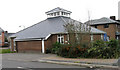
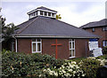
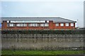
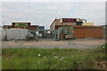
Photos of RM9 4WT


Area Information
Living in RM9 4WT offers a distinct experience within the Dagenham and Barking districts of East London. This specific postcode cluster serves a compact residential population of 1,705 people, creating a close-knit community atmosphere. Residents typically navigate a quiet neighbourhood lifestyle without the congestion of larger urban centres. The area functions as a practical base for those who need easy access to local train stations like Barking Riverside and Dagenham Dock, while maintaining a sense of privacy that larger cities often lack. Daily life here balances suburban tranquility with the connectivity of a major metropolitan region. You are not isolated from the wider world, yet you remain grounded in a defined locality where neighbours tend to know one another. The setting provides a stable environment for families and professionals alike who value a home with peace and quiet. Within this small but significant cluster, the land use is predominantly residential rather than a mix of commercial hubs or open spaces. The area feels focused on domestic comfort rather than urban density. You will find that the local character is shaped by its housing stock and the people who reside there. The proximity to London City Airport and major bus interchanges like Whipps Cross ensures that travel time to central London remains manageable. This postcode area represents a settled choice for buyers seeking a specific slice of East London living.
- Area Type
- Postcode
- Area Size
- Not available
- Population
- 1705
- Population Density
- 11678 people/km²
Homes in RM9 4WT form a market defined by traditional housing rather than modern blocks. The primary accommodation type is houses, which caters to buyers seeking semi-detached or detached properties rather than the flats common in central London. With home ownership standing at exactly 45%, the area maintains a strong base of owner-occupiers alongside an equal number of renters. This split suggests a healthy economy where many residents have the means to buy or are looking to eventually purchase within this small cluster. The market here does not cater to high-rise living or dense urban living. Instead, you encounter standard residential homes situated in a low-rise environment. This stock profile appeals to families requiring space and adults looking for a garden. Given that the area covers only a small postcode, supply is naturally limited, which can drive demand among those seeking these specific house types. Buyers looking at this location should note that the housing is integrated with the surrounding neighbourhood character. The 45% ownership rate indicates that the area is accessible enough for buyers but established enough to offer investment security for existing owners.
House Prices in RM9 4WT
No properties found in this postcode.
Energy Efficiency in RM9 4WT
Residents of RM9 4WT enjoy a convenient array of amenities within practical reach. For your daily shopping needs, you are close to five notable retailers including Spar, Morrisons Daily, and Budgens Learoyds. These shops cover essentials and groceries, keeping the cost and time of shopping low. Your commute flexibility extends considerably as you are near five metro stations such as Upney Station and Dagenham Heathway. This density of transport options means you rarely need to wait long for a train or bus. The area also benefits from five rail stations including Barking Station and Dagenham Dock Station, further expanding your journey destinations. If you prefer water travel, five ferry terminals like Woolwich Arsenal Pier and Barrier Gardens Pier are available nearby. For those who frequently travel to the airport, London City Airport sits just one station away. Additionally, the Whipps Cross Bus Interchange provides extensive bus coverage. This combination of retail, rail, metro, ferry, and air transport creates a lifestyle where you are never far from a connection. You can manage your day without leaving the district or make spontaneous trips with ease.
Amenities
Schools
Schools near RM9 4WT provide a solid foundation for local education. The James Cambell Primary School operates within the area and holds an Ofsted rating of good, offering a verified standard of education for younger children. You will also find the Cambell Junior School, which serves as a preparatory stage for primary education. Both institutions are key settings for children growing up near the postcodes covered in this cluster. The area also includes Mayesbrook Park School, which functions as another educational option for the local community. This mix of primary schools and other institutions gives families several choices when selecting where their children will attend classes. With two primary schools listed with specific names and types, parents have access to familiar local education settings rather than relying solely on transport links to distant academies. The presence of these schools supports the demographic profile of a neighbourhood with many older children and families. Education remains a central feature of the community infrastructure here.
| Rank | School | Type | Entry gender | Ages |
|---|
Explore more schools in this area
Go to Schools tabDemographics
The community profile of RM9 4WT reflects a mature and established neighbourhood. The median age stands at 47 years, with the most common age range falling between 30 and 64 years. This demographic skew indicates a population dominated by adults who are often raising families or nearing retirement. Home ownership levels sit at 45%, suggesting a balanced market where nearly half of all residents have purchased properties, while the other half likely reside through rental arrangements or shared ownership schemes. The predominant ethnic group in the area is White, which contributes to a relatively homogeneous community fabric compared to more diverse urban zones. Accommodation in this cluster consists primarily of houses, distinguishing it from areas where flats or apartments rule the skyline. This housing type aligns well with the older demographic, offering space and often a garden. You will find that the residents here have invested time in building their lives within this specific postcode. The stability created by a high proportion of homeowners often leads to lower turnover rates. This consistency can benefit businesses relying on a fixed local customer base and children attending nearby schools who benefit from settled peer groups. The data confirms a neighbourhood defined by stability rather than rapid change.
Household Size
Accommodation Type
Tenure
Ethnic Group
Religion
Household Composition
Age
Household Deprivation
NS-SEC
Explore more demographic insights in this area
Go to Demographics tabPlanning
Planning Constraints
- Flood RiskPremium
- Ramsar Wetland SitesPremium
- Area of Outstanding Natural BeautyPremium
- Protected Nature ReservePremium
- Protected WoodlandPremium