Area Overview for RM9 4SR
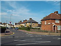
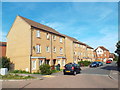
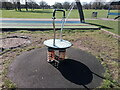
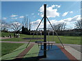
Photos of RM9 4SR


Area Information
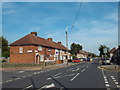
RM9 4SR is a specific postcode area covering a small residential cluster in England. It encompasses exactly 2,293 square metres of land, making it a very compact neighbourhood. Despite its small footprint, the area supports a population of 2,161 people. This results in an extremely high density of 942,565 people per square kilometre, which is unusually intense for a property search. Living here means navigating a tightly packed environment where residents share limited space with thousands of other individuals. The area functions as a dense hub where daily routines occur in close proximity to neighbours. Prospective homebuyers should note that the sheer concentration of people within such a limited geographic boundary shapes the character of daily life. The locality offers a high degree of connectivity due to this density, with immediate access to major transport links. Residents find themselves at the centre of a network connecting to London stations and piers. This location suits those who prioritise access over open space, acknowledging that the immediate physical surroundings are compact.
- Area Type
- Postcode
- Area Size
- 2293 m²
- Population
- 2161
- Population Density
- 11332 people/km²
Housing in RM9 4SR is dominated by houses, as indicated by the primary accommodation type data. Only 36 per cent of residents own their homes, meaning nearly two-thirds live in rental accommodation. This imbalance points to a market heavily weighted towards tenants renting from private landlords or housing associations. Buyers looking at homes in this small postcode should understand that new owner-occupancy rates grow slowly here due to the existing high rental population. The compact nature of the 2,293 square metre area limits the supply of new houses entering the market. Families seeking to buy may face competition from investors who maintain the high volume of rental units. Recent sales data would help clarify trends, but the current structural pressure heavily favours the private rental sector. Expect a market where purchase prices reflect the scarcity of owner-occupied inventories within this tiny residential patch.
House Prices in RM9 4SR
Showing 1 properties
| Address | Type | Beds | Baths | Last Sale Price | Last Sale Date | |
|---|---|---|---|---|---|---|
| London Borough Barking And Dagenham, Social Service Offices, Julia Engwell Clinic, Woodward Road, Dagenham, RM9 4SR | Office | - | - | - | - |
Energy Efficiency in RM9 4SR
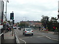
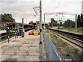
Residents of RM9 4SR benefit from immediate access to five local retailers, including Morrisons Daily, Budgens Learoyds, and Co-op Gale. These shops serve practical daily needs without requiring a journey elsewhere. For transport enthusiasts, the neighbourhood sits near five metro stops and five rail stations, including Dagenham Dock Station and Barking Station. Five ferry options, such as Woolwich Arsenal Pier and Barrier Gardens Pier, are nearby. Additionally, London City Airport lies within reach for aviation needs. You can catch a bus at the Whipps Cross Bus Interchange if required. The variety of retail outlets provides convenience for groceries and essentials. The density of transport hubs means you rarely need a car for local travel. This network of amenities and transit creates a lifestyle where most requirements are met minutes from your front door.
Amenities
Schools
Families living in RM9 4SR have Mayesbrook School available directly within their local area. This institution is designated as a primary school. The presence of a single named primary school suggests that early education is well-supported immediately around the neighbourhood. Parents of young children value having a recognised educational establishment nearby without needing long commutes to larger complexes. The specific designation of Mayesbrook School as the nearest provider indicates a focused option for infant and junior education. While secondary education data is not listed in this specific profile, residents rely on this primary provision for the foundational years of schooling. The proximity of Mayesbrook School makes it a central consideration for anyone evaluating homes in RM9 4SR. Families prioritising school catchment areas in this postcode will find this named institution as their primary choice.
| Rank | School | Type | Entry gender | Ages |
|---|
Explore more schools in this area
Go to Schools tabDemographics
The community in RM9 4SR is defined by a median age of 47 years. The most common age range consists of adults between 30 and 64 years old. This demographic profile suggests a neighbourhood populated by mid-life families and empty-nesters rather than young singles or teenagers. Only 36 per cent of households are owner-occupied, indicating that a large proportion of residents are renters. The area primarily consists of houses, though the high population density relative to the land size suggests compact living arrangements. The predominant ethnic group is White. With a median age and household composition focused on working-age adults, life in RM9 4SR centres around established family units and professional workers. The lower home ownership rate compared to the general national average implies a significant rental segment within the market. This demographic mix influences local demand, with families and dual-income households driving activity during school run times and commuting hours.
Household Size
Accommodation Type
Tenure
Ethnic Group
Religion
Household Composition
Age
Household Deprivation
NS-SEC
Explore more demographic insights in this area
Go to Demographics tabPlanning
Planning Constraints
- Flood RiskPremium
- Ramsar Wetland SitesPremium
- Area of Outstanding Natural BeautyPremium
- Protected Nature ReservePremium
- Protected WoodlandPremium