Area Overview for RM9 4PA
Photos of RM9 4PA
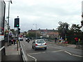
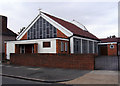
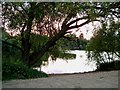
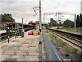
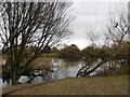
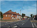
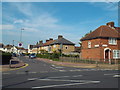
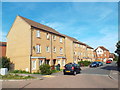
64 photos from this area
Area Information
Key information about the RM9 4PA including its size, population, and administrative classification.
- Area Type
- Postcode
- Area Size
- 7086 m²
- Population
- 2080
- Population Density
- 4020 people/km²
House Prices in RM9 4PA
15
Properties
£284,125
Average Sold Price
£210,000
Lowest Price
£375,000
Highest Price
Showing 15 properties
| Address | Type | Beds | Baths | Last Sale Price | Last Sale Date | |
|---|---|---|---|---|---|---|
| 64 Gale Street, Dagenham, RM9 4PA | house | - | - | £363,000 | Sep 2016 | |
| 56 Gale Street, Dagenham, RM9 4PA | Semi-detached | 3 | - | £375,000 | Aug 2016 | |
| 58 Gale Street, Dagenham, RM9 4PA | house | 3 | 1 | £315,000 | May 2016 | |
| 62 Gale Street, Dagenham, RM9 4PA | house | 3 | - | £320,000 | Dec 2015 | |
| 70 Gale Street, Dagenham, RM9 4PA | Semi-detached | 3 | 1 | £250,000 | Jul 2013 | |
| 48 Gale Street, Dagenham, RM9 4PA | Semi-detached | - | - | £210,000 | Nov 2008 | |
| 66 Gale Street, Dagenham, RM9 4PA | Terraced | 3 | 1 | £210,000 | Dec 2006 | |
| 52 Gale Street, Dagenham, RM9 4PA | house | - | - | £230,000 | Feb 2005 | |
| 72 Gale Street, Dagenham, RM9 4PA | Terraced | 3 | 1 | - | - | |
| Tennis 328M From 50 Gale Street 21M From Unnamed Road, Gale Street, Dagenham, RM9 4PA | Leisure | - | - | - | - |
Page 1 of 2
Energy Efficiency in RM9 4PA
Amenities
Schools
| Rank | School | Type | Entry gender | Ages |
|---|
Explore more schools in this area
Go to Schools tabDemographics
Household Size
Family (3-5 people)
most common
Accommodation Type
Houses
most common
Tenure
50
majority
Ethnic Group
White
most common
Religion
N/A
most common
Household Composition
N/A
most common
Age
47
median
Adults (30-64 years)
most common
Household Deprivation
N/A
with no deprivation
NS-SEC
22
in Lower managerial occupations
Explore more demographic insights in this area
Go to Demographics tabPlanning
Planning Constraints
- Flood RiskPremium
- Ramsar Wetland SitesPremium
- Area of Outstanding Natural BeautyPremium
- Protected Nature ReservePremium
- Protected WoodlandPremium