Area Overview for RM9 4DP
Photos of RM9 4DP
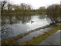

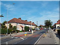


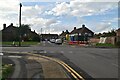
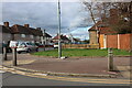
48 photos from this area
Area Information
Key information about the RM9 4DP including its size, population, and administrative classification.
- Area Type
- Postcode
- Area Size
- 6645 m²
- Population
- 1842
- Population Density
- 12071 people/km²
House Prices in RM9 4DP
32
Properties
£217,088
Average Sold Price
£46,500
Lowest Price
£405,000
Highest Price
Showing 32 properties
| Address | Type | Beds | Baths | Last Sale Price | Last Sale Date | |
|---|---|---|---|---|---|---|
| 97 Rosedale Road, Dagenham, RM9 4DP | house | 2 | 1 | £377,000 | May 2025 | |
| 49 Rosedale Road, Dagenham, RM9 4DP | house | - | - | £405,000 | Oct 2022 | |
| 81 Rosedale Road, Dagenham, RM9 4DP | house | - | - | £340,000 | Oct 2021 | |
| 47 Rosedale Road, Dagenham, RM9 4DP | house | 3 | 1 | £290,000 | Jul 2019 | |
| 79 Rosedale Road, Dagenham, RM9 4DP | Terraced | 2 | 1 | £310,000 | Dec 2018 | |
| 37 Rosedale Road, Dagenham, RM9 4DP | Detached | 2 | 1 | £325,000 | Nov 2018 | |
| 71 Rosedale Road, Dagenham, RM9 4DP | house | 3 | - | £242,000 | Nov 2015 | |
| 99 Rosedale Road, Dagenham, RM9 4DP | Terraced | 2 | 1 | £178,000 | Oct 2013 | |
| 55 Rosedale Road, Dagenham, RM9 4DP | house | 2 | - | £170,000 | Oct 2010 | |
| 57 Rosedale Road, Dagenham, RM9 4DP | Terraced | 3 | 1 | £174,995 | Mar 2007 |
Page 1 of 4
Energy Efficiency in RM9 4DP
Amenities
Schools
| Rank | School | Type | Entry gender | Ages |
|---|
Explore more schools in this area
Go to Schools tabDemographics
Household Size
Family (3-5 people)
most common
Accommodation Type
Houses
most common
Tenure
48
majority
Ethnic Group
White
most common
Religion
N/A
most common
Household Composition
N/A
most common
Age
47
median
Adults (30-64 years)
most common
Household Deprivation
N/A
with no deprivation
NS-SEC
19
in Lower managerial occupations
Explore more demographic insights in this area
Go to Demographics tabPlanning
Planning Constraints
- Flood RiskPremium
- Ramsar Wetland SitesPremium
- Area of Outstanding Natural BeautyPremium
- Protected Nature ReservePremium
- Protected WoodlandPremium