Area Overview for RM8 3NA
Photos of RM8 3NA


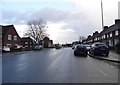


28 photos from this area
Area Information
Key information about the RM8 3NA including its size, population, and administrative classification.
- Area Type
- Postcode
- Area Size
- 9307 m²
- Population
- 1899
- Population Density
- 10802 people/km²
House Prices in RM8 3NA
29
Properties
£194,408
Average Sold Price
£41,000
Lowest Price
£380,000
Highest Price
Showing 29 properties
| Address | Type | Beds | Baths | Last Sale Price | Last Sale Date | |
|---|---|---|---|---|---|---|
| 135 Wood Lane, Dagenham, RM8 3NA | Semi-detached | 4 | 2 | £330,000 | Jan 2023 | |
| 107 Wood Lane, Dagenham, RM8 3NA | house | - | - | £183,000 | Jul 2022 | |
| 123 Wood Lane, Dagenham, RM8 3NA | house | - | - | £380,000 | Nov 2021 | |
| 81 Wood Lane, Dagenham, RM8 3NA | Terraced | 3 | 2 | £322,000 | Jul 2019 | |
| 131 Wood Lane, Dagenham, RM8 3NA | house | - | - | £164,900 | Jun 2011 | |
| 95 Wood Lane, Dagenham, RM8 3NA | house | 3 | - | £175,000 | Nov 2009 | |
| 115 Wood Lane, Dagenham, RM8 3NA | Terraced | - | - | £218,000 | Sep 2007 | |
| 105 Wood Lane, Dagenham, RM8 3NA | Terraced | - | - | £215,000 | Jun 2005 | |
| 129 Wood Lane, Dagenham, RM8 3NA | Terraced | - | - | £178,000 | May 2005 | |
| 113 Wood Lane, Dagenham, RM8 3NA | house | 3 | - | £81,000 | Feb 1999 |
Page 1 of 3
Energy Efficiency in RM8 3NA
Amenities
Schools
| Rank | School | Type | Entry gender | Ages |
|---|
Explore more schools in this area
Go to Schools tabDemographics
Household Size
Family (3-5 people)
most common
Accommodation Type
Houses
most common
Tenure
45
majority
Ethnic Group
White
most common
Religion
N/A
most common
Household Composition
N/A
most common
Age
47
median
Adults (30-64 years)
most common
Household Deprivation
N/A
with no deprivation
NS-SEC
19
in Lower managerial occupations
Explore more demographic insights in this area
Go to Demographics tabPlanning
Planning Constraints
- Flood RiskPremium
- Ramsar Wetland SitesPremium
- Area of Outstanding Natural BeautyPremium
- Protected Nature ReservePremium
- Protected WoodlandPremium