Area Overview for RM8 2YL
Photos of RM8 2YL

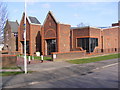
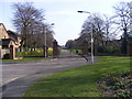


24 photos from this area
Area Information
Key information about the RM8 2YL including its size, population, and administrative classification.
- Area Type
- Postcode
- Area Size
- 1.0 hectares
- Population
- 1920
- Population Density
- 12516 people/km²
House Prices in RM8 2YL
36
Properties
£220,964
Average Sold Price
£49,995
Lowest Price
£504,100
Highest Price
Showing 36 properties
| Address | Type | Beds | Baths | Last Sale Price | Last Sale Date | |
|---|---|---|---|---|---|---|
| 72 Fitzstephen Road, Dagenham, RM8 2YL | Terraced | 3 | 2 | £504,100 | Jul 2025 | |
| 46A Fitzstephen Road, Dagenham, RM8 2YL | Maisonette | - | - | £208,000 | Jan 2023 | |
| 84 Fitzstephen Road, Dagenham, RM8 2YL | house | - | - | £297,000 | Apr 2021 | |
| 62 Fitzstephen Road, Dagenham, RM8 2YL | Terraced | 2 | - | £310,000 | Feb 2019 | |
| 106 Fitzstephen Road, Dagenham, RM8 2YL | Terraced | - | - | £348,500 | Oct 2018 | |
| 86 Fitzstephen Road, Dagenham, RM8 2YL | Terraced | 3 | 1 | £324,000 | Jun 2018 | |
| 52 Fitzstephen Road, Dagenham, RM8 2YL | house | - | - | £290,000 | Sep 2017 | |
| 96 Fitzstephen Road, Dagenham, RM8 2YL | Terraced | 2 | - | £300,000 | Jan 2017 | |
| 112 Fitzstephen Road, Dagenham, RM8 2YL | Terraced | 3 | - | £325,000 | Oct 2016 | |
| 108 Fitzstephen Road, Dagenham, RM8 2YL | house | - | - | £282,000 | Jun 2016 |
Page 1 of 4
Energy Efficiency in RM8 2YL
Amenities
Schools
| Rank | School | Type | Entry gender | Ages |
|---|
Explore more schools in this area
Go to Schools tabDemographics
Household Size
Family (3-5 people)
most common
Accommodation Type
Houses
most common
Tenure
41
majority
Ethnic Group
White
most common
Religion
N/A
most common
Household Composition
N/A
most common
Age
47
median
Adults (30-64 years)
most common
Household Deprivation
N/A
with no deprivation
NS-SEC
21
in Lower managerial occupations
Explore more demographic insights in this area
Go to Demographics tabPlanning
Planning Constraints
- Flood RiskPremium
- Ramsar Wetland SitesPremium
- Area of Outstanding Natural BeautyPremium
- Protected Nature ReservePremium
- Protected WoodlandPremium