Area Overview for RM8 2UJ
Photos of RM8 2UJ

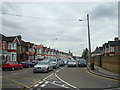
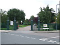
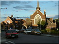

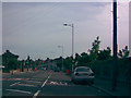
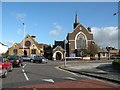
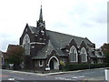


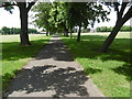
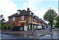
37 photos from this area
Area Information
Key information about the RM8 2UJ including its size, population, and administrative classification.
- Area Type
- Postcode
- Area Size
- 1.1 hectares
- Population
- 1693
- Population Density
- 9953 people/km²
House Prices in RM8 2UJ
35
Properties
£257,344
Average Sold Price
£80,200
Lowest Price
£405,000
Highest Price
Showing 35 properties
| Address | Type | Beds | Baths | Last Sale Price | Last Sale Date | |
|---|---|---|---|---|---|---|
| 99 Becontree Avenue, Dagenham, RM8 2UJ | Terraced | 3 | 1 | £405,000 | May 2025 | |
| 67 Becontree Avenue, Dagenham, RM8 2UJ | Terraced | 2 | 1 | £370,000 | Mar 2025 | |
| 117 Becontree Avenue, Dagenham, RM8 2UJ | house | - | - | £300,000 | Dec 2023 | |
| 71 Becontree Avenue, Dagenham, RM8 2UJ | Terraced | 2 | 1 | £360,000 | Feb 2023 | |
| 77 Becontree Avenue, Dagenham, RM8 2UJ | Terraced | 2 | 2 | £330,000 | Jul 2020 | |
| 105 Becontree Avenue, Dagenham, RM8 2UJ | Terraced | 3 | 1 | £330,000 | Nov 2019 | |
| 113 Becontree Avenue, Dagenham, RM8 2UJ | house | - | - | £228,000 | Sep 2019 | |
| 61 Becontree Avenue, Dagenham, RM8 2UJ | house | 2 | 1 | £308,500 | Jan 2019 | |
| 91 Becontree Avenue, Dagenham, RM8 2UJ | Terraced | 4 | 1 | £380,000 | Aug 2018 | |
| 109 Becontree Avenue, Dagenham, RM8 2UJ | Terraced | 3 | 2 | £312,000 | Dec 2017 |
Page 1 of 4
Energy Efficiency in RM8 2UJ
Amenities
Schools
| Rank | School | Type | Entry gender | Ages |
|---|
Explore more schools in this area
Go to Schools tabDemographics
Household Size
Family (3-5 people)
most common
Accommodation Type
Houses
most common
Tenure
36
majority
Ethnic Group
White
most common
Religion
N/A
most common
Household Composition
N/A
most common
Age
47
median
Adults (30-64 years)
most common
Household Deprivation
N/A
with no deprivation
NS-SEC
18
in Lower managerial occupations
Explore more demographic insights in this area
Go to Demographics tabPlanning
Planning Constraints
- Flood RiskPremium
- Ramsar Wetland SitesPremium
- Area of Outstanding Natural BeautyPremium
- Protected Nature ReservePremium
- Protected WoodlandPremium