Area Overview for RM8 2PT
Photos of RM8 2PT

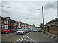
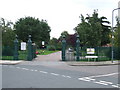
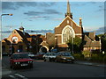

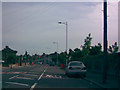
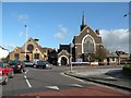
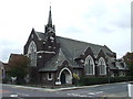


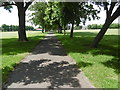
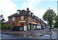
37 photos from this area
Area Information
Key information about the RM8 2PT including its size, population, and administrative classification.
- Area Type
- Postcode
- Area Size
- 2.0 hectares
- Population
- 1657
- Population Density
- 9045 people/km²
House Prices in RM8 2PT
40
Properties
£242,715
Average Sold Price
£39,500
Lowest Price
£549,000
Highest Price
Showing 40 properties
| Address | Type | Beds | Baths | Last Sale Price | Last Sale Date | |
|---|---|---|---|---|---|---|
| 72 Dunkeld Road, Dagenham, RM8 2PT | house | - | - | £549,000 | Feb 2022 | |
| 68 Dunkeld Road, Dagenham, RM8 2PT | house | - | - | £450,000 | Mar 2021 | |
| 63 Dunkeld Road, Dagenham, RM8 2PT | Terraced | 4 | 2 | £350,000 | Mar 2020 | |
| 82 Dunkeld Road, Dagenham, RM8 2PT | Terraced | 3 | 1 | £316,000 | Sep 2019 | |
| 62 Dunkeld Road, Dagenham, RM8 2PT | Semi-detached | 5 | 2 | £456,000 | Nov 2016 | |
| 84 Dunkeld Road, Dagenham, RM8 2PT | house | 3 | - | £285,000 | Dec 2015 | |
| 77 Dunkeld Road, Dagenham, RM8 2PT | house | - | - | £294,000 | Nov 2015 | |
| 76 Dunkeld Road, Dagenham, RM8 2PT | Terraced | 3 | - | £250,000 | Feb 2015 | |
| 71 Dunkeld Road, Dagenham, RM8 2PT | Terraced | 3 | 1 | £250,000 | Aug 2014 | |
| 79 Dunkeld Road, Dagenham, RM8 2PT | house | - | - | £230,000 | Jul 2014 |
Page 1 of 4
Energy Efficiency in RM8 2PT
Amenities
Schools
| Rank | School | Type | Entry gender | Ages |
|---|
Explore more schools in this area
Go to Schools tabDemographics
Household Size
Family (3-5 people)
most common
Accommodation Type
Houses
most common
Tenure
46
majority
Ethnic Group
White
most common
Religion
N/A
most common
Household Composition
N/A
most common
Age
47
median
Adults (30-64 years)
most common
Household Deprivation
N/A
with no deprivation
NS-SEC
20
in Lower managerial occupations
Explore more demographic insights in this area
Go to Demographics tabPlanning
Planning Constraints
- Flood RiskPremium
- Ramsar Wetland SitesPremium
- Area of Outstanding Natural BeautyPremium
- Protected Nature ReservePremium
- Protected WoodlandPremium