Area Overview for RM8 2ES
Photos of RM8 2ES


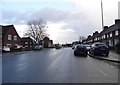


28 photos from this area
Area Information
Key information about the RM8 2ES including its size, population, and administrative classification.
- Area Type
- Postcode
- Area Size
- 5411 m²
- Population
- 1920
- Population Density
- 12516 people/km²
House Prices in RM8 2ES
23
Properties
£214,499
Average Sold Price
£74,500
Lowest Price
£360,000
Highest Price
Showing 23 properties
| Address | Type | Beds | Baths | Last Sale Price | Last Sale Date | |
|---|---|---|---|---|---|---|
| 70 Marlborough Road, Dagenham, RM8 2ES | house | - | - | £360,000 | May 2022 | |
| 123 Marlborough Road, Dagenham, RM8 2ES | Semi-detached | 3 | 1 | £350,000 | Dec 2017 | |
| 76 Marlborough Road, Dagenham, RM8 2ES | house | - | - | £210,000 | Oct 2017 | |
| 66 Marlborough Road, Dagenham, RM8 2ES | house | - | - | £287,000 | Apr 2017 | |
| 52 Marlborough Road, Dagenham, RM8 2ES | Terraced | 2 | - | £167,500 | Aug 2011 | |
| 74 Marlborough Road, Dagenham, RM8 2ES | Terraced | 3 | 1 | £230,000 | May 2008 | |
| 121 Marlborough Road, Dagenham, RM8 2ES | house | - | - | £219,995 | Aug 2007 | |
| 64 Marlborough Road, Dagenham, RM8 2ES | Terraced | - | - | £162,000 | Sep 2006 | |
| 60 Marlborough Road, Dagenham, RM8 2ES | Terraced | - | - | £162,000 | Mar 2006 | |
| 105 Marlborough Road, Dagenham, RM8 2ES | Terraced | - | - | £181,995 | Sep 2005 |
Page 1 of 3
Energy Efficiency in RM8 2ES
Amenities
Schools
| Rank | School | Type | Entry gender | Ages |
|---|
Explore more schools in this area
Go to Schools tabDemographics
Household Size
Family (3-5 people)
most common
Accommodation Type
Houses
most common
Tenure
41
majority
Ethnic Group
White
most common
Religion
N/A
most common
Household Composition
N/A
most common
Age
47
median
Adults (30-64 years)
most common
Household Deprivation
N/A
with no deprivation
NS-SEC
21
in Lower managerial occupations
Explore more demographic insights in this area
Go to Demographics tabPlanning
Planning Constraints
- Flood RiskPremium
- Ramsar Wetland SitesPremium
- Area of Outstanding Natural BeautyPremium
- Protected Nature ReservePremium
- Protected WoodlandPremium