Area Overview for RM8 2AH
Photos of RM8 2AH


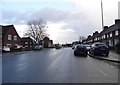


28 photos from this area
Area Information
Key information about the RM8 2AH including its size, population, and administrative classification.
- Area Type
- Postcode
- Area Size
- 8835 m²
- Population
- 1920
- Population Density
- 12516 people/km²
House Prices in RM8 2AH
43
Properties
£227,091
Average Sold Price
£133,500
Lowest Price
£362,500
Highest Price
Showing 43 properties
| Address | Type | Beds | Baths | Last Sale Price | Last Sale Date | |
|---|---|---|---|---|---|---|
| 732 Longbridge Road, Dagenham, RM8 2AH | Terraced | 2 | 1 | £362,500 | Feb 2025 | |
| 676 Longbridge Road, Dagenham, RM8 2AH | Terraced | 2 | 1 | £350,000 | Oct 2024 | |
| 668 Longbridge Road, Dagenham, RM8 2AH | house | 2 | - | £321,000 | Nov 2017 | |
| 678 Longbridge Road, Dagenham, RM8 2AH | Terraced | 3 | 1 | £220,000 | Mar 2015 | |
| 674 Longbridge Road, Dagenham, RM8 2AH | house | - | - | £158,000 | Jul 2013 | |
| 682 Longbridge Road, Dagenham, RM8 2AH | Terraced | 2 | - | £175,000 | Jan 2013 | |
| 736 Longbridge Road, Dagenham, RM8 2AH | house | - | - | £133,500 | Sep 2009 | |
| 684 Longbridge Road, Dagenham, RM8 2AH | Terraced | 3 | 1 | £217,000 | Aug 2007 | |
| 738 Longbridge Road, Dagenham, RM8 2AH | Terraced | 3 | - | £164,000 | Oct 2006 | |
| 742 Longbridge Road, Dagenham, RM8 2AH | house | - | - | £250,000 | Aug 2006 |
Page 1 of 5
Energy Efficiency in RM8 2AH
Amenities
Schools
| Rank | School | Type | Entry gender | Ages |
|---|
Explore more schools in this area
Go to Schools tabDemographics
Household Size
Family (3-5 people)
most common
Accommodation Type
Houses
most common
Tenure
41
majority
Ethnic Group
White
most common
Religion
N/A
most common
Household Composition
N/A
most common
Age
47
median
Adults (30-64 years)
most common
Household Deprivation
N/A
with no deprivation
NS-SEC
21
in Lower managerial occupations
Explore more demographic insights in this area
Go to Demographics tabPlanning
Planning Constraints
- Flood RiskPremium
- Ramsar Wetland SitesPremium
- Area of Outstanding Natural BeautyPremium
- Protected Nature ReservePremium
- Protected WoodlandPremium